Toppenish in Yakima County, Washington — The American West (Northwest)
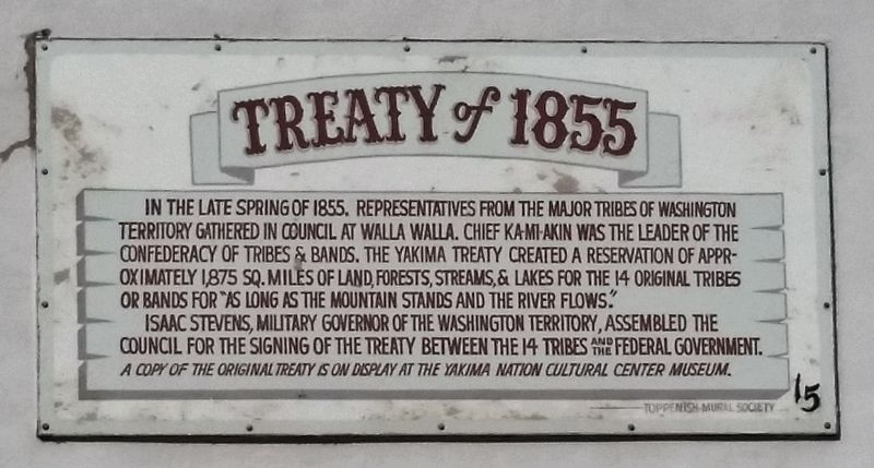
Treaty of 1855
In the late Spring of 1855, representatives from the major tribes of Washington Territory gathered in council at Walla Walla. Chief Ka-Mi-Akin was the leader of the Confederacy of Tribes & Bands. The Yakima Treaty created a reservation of approximately 1,875 sq. miles of land, forests, streams, & lakes for the 14 original tribes or bands for “as long as the mountain stands and the river flows.”
Isaac Stevens, Military Governor of the Washington Territory, assembled the council for the signing of the treaty between the 14 tribes and the Federal Government.
A copy of the original treaty is on display at the Yakima Nation Cultural Center Museum.
Erected by Toppenish Mural Society. (Marker Number 15.)
Topics. This historical marker is listed in these topic lists: Native Americans • Settlements & Settlers. A significant historical year for this entry is 1855.
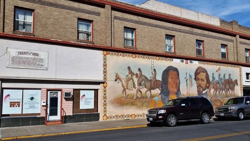
Location. 46° 22.521′ N, 120° 18.718′ W. Marker is in Toppenish, Washington, in Yakima County. Marker is at the intersection of Jefferson Avenue and West First Avenue, on the left when traveling south on Jefferson Avenue. This is a large, painted metal marker, mounted about 12-feet high on the southwest wall of the building at this address, facing Jefferson Avenue. Touch for map. Marker is at or near this postal address: 6 Jefferson Avenue, Toppenish WA 98948, United States of America. Touch for directions.
Other nearby markers. At least 8 other markers are within walking distance of this marker. Captain A. J. Hembree Monument (a few steps from this marker); The Blanket Traders (within shouting distance of this marker); Rodeo (within shouting distance of this marker); "Clearing the Land" (about 400 feet away, measured in a direct line); When Hops Were Picked by Hand (about 400 feet away); The Old Blacksmith Shop (about 500 feet away); Lou Shattuck (about 500 feet away); Indian Horse Races (about 500 feet away). Touch for a list and map of all markers in Toppenish.
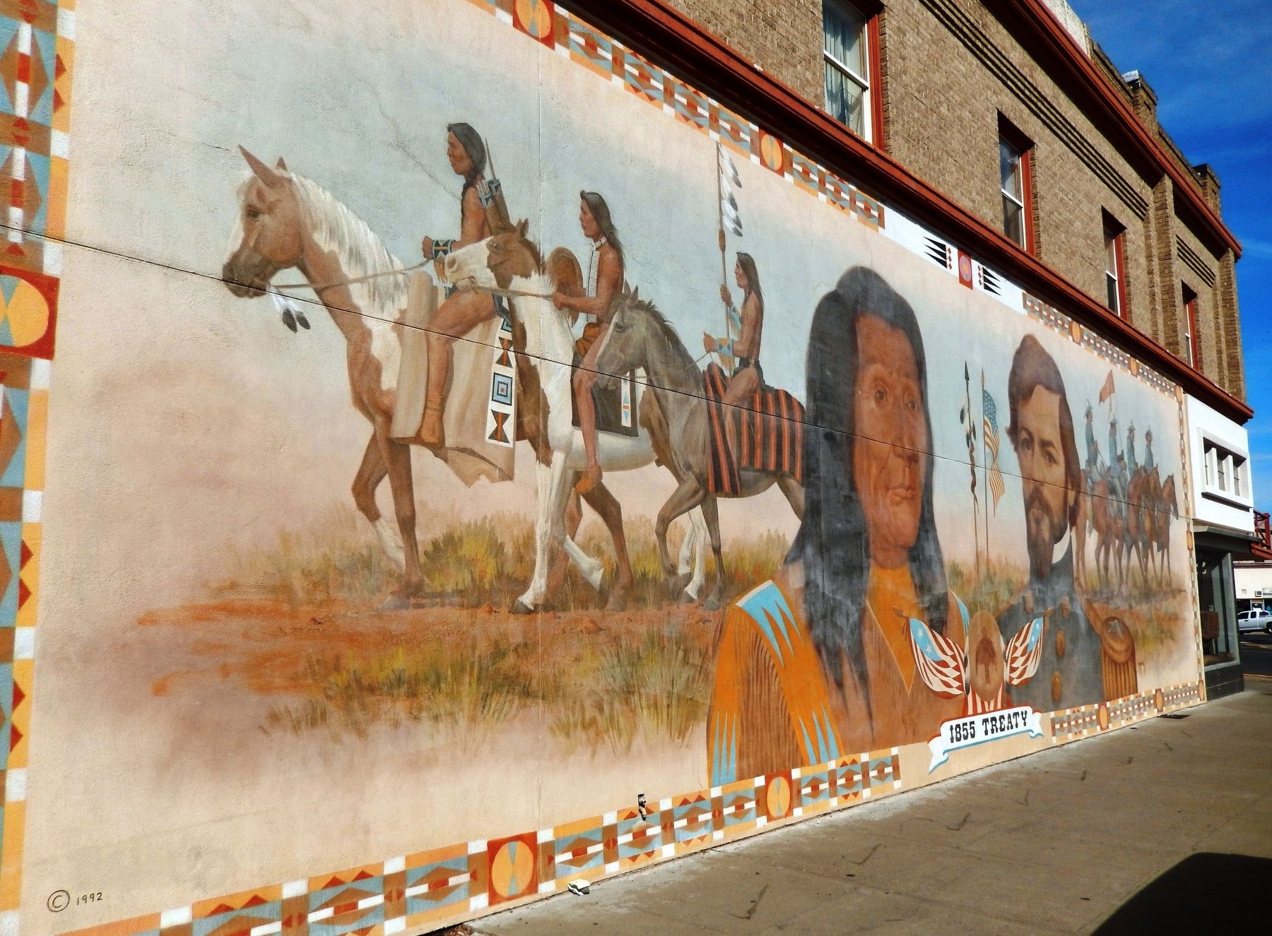
More about this marker. The majority of the southwest wall of the building at this address is covered by a giant mural symbolizing the Treaty of 1855 described by the marker.
Related markers. Click here for a list of markers that are related to this marker. Historical Murals of Toppenish, Washington
Also see . . .
1. Treaty with the Yakima, 1855. Original "Yakima" treaty of 1855, in PDF format (Submitted on February 8, 2019, by Cosmos Mariner of Cape Canaveral, Florida.)
2. Treaty of 1855 took land, created the Yakama Nation. Yakima Herald-Republic article, June 4, 2017:
Known as the Treaty of 1855, the agreement confederated 14 tribes and bands into the Yakama Nation, but took away most of the land they and their ancestors had lived on for thousands of years. But the document
also promised the Yakamas would have exclusive use of the 1.3-million-acre reservation — spanning from the eastern slopes of Mount Adams eastward to Granger, and stretching from just below Union Gap south to near Goldendale — with the authority to govern itself.
Prior to the treaty, the lands occupied by the tribes that formed the Yakama Nation ran from the Canadian border to south of the Columbia River, covering about a quarter of present-day Washington state. (Submitted on February 8, 2019, by Cosmos Mariner of Cape Canaveral, Florida.)
3. Toppenish Mural Guide. Visit Yakima website entry:
In 1989, the Toppenish Mural Society embarked on an ambitious plan to cover the town with murals depicting historical scenes. Each mural had to depict a Toppenish-area event from 1850 to 1920 and each had to be done by accomplished, professional Western artists. (Submitted on February 9, 2019, by Cosmos Mariner of Cape Canaveral, Florida.)
Credits. This page was last revised on March 26, 2022. It was originally submitted on February 8, 2019, by Cosmos Mariner of Cape Canaveral, Florida. This page has been viewed 265 times since then and 50 times this year. Photos: 1, 2, 3. submitted on February 8, 2019, by Cosmos Mariner of Cape Canaveral, Florida. • Bill Pfingsten was the editor who published this page.


