Estes Park in Larimer County, Colorado — The American Mountains (Southwest)
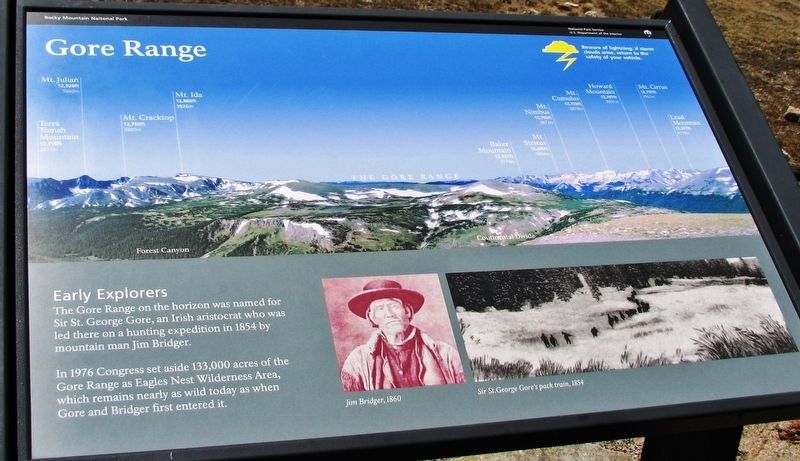
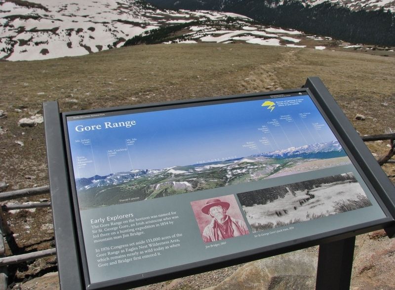
Gore Range
Terra Tomah Mountain 12,718ft (3877m)
Mt. Julian 12,928ft (3940m)
Mt. Cracktop 12,760ft (3889m)
Mt. Ida 12,880ft (3926m)
Baker Mountain 12,397ft (3779m)
Mt. Stratus 12,480ft (3804m)
Mt. Nimbus 12,706ft (3873m)
Mt. Cumulus 12,725ft (3878m)
Howard Mountain 12,797ft (3901m)
Mt. Cirrus 12,797ft (3901m)
Lead Mountain 12,474ft (3802m)
Early Explorers
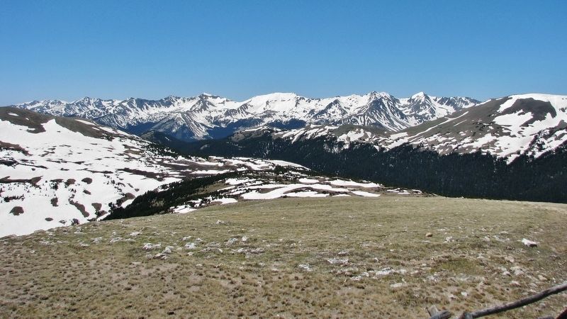
The Gore Range on the horizon was named for Sir St. George Gore, an Irish aristocrat who was led there on a hunting expedition in 1854 by mountain man Jim Bridger.
In 1976 Congress set aside 133,000 acres of the Gore Range as Eagles Nest Wilderness Area, which remains nearly as wild today as when Gore and Bridger first entered it.
(photo captions)
Jim Bridger, 1860
Sir St. George Gores pack train, 1854
Erected by National Park Service, U.S. Department of the Interior.
Topics. This historical marker is listed in this topic list: Notable Places. A significant historical year for this entry is 1854.
Location. 40° 25.958′ N, 105° 46.111′ W. Marker is in Estes Park, Colorado, in Larimer County. Marker is on Trail Ridge Road (U.S. 34), on the right when traveling east. Marker is located at the Gore Range Overlook, on the south side of Trail Ridge Road. Marker is beside the sidewalk, on the south side of the parking lot, at the center of the overlook. Touch for map. Marker is in this post office area: Estes Park CO 80517, United States of America. Touch for directions.
Other nearby markers. At least 8 other markers are within 7 miles of this marker, measured as the crow flies. Old Fall River Road (approx. one mile away); Trail Ridge Road at Rock Cut (approx. 2.4 miles away); Continental Divide (approx. 2.4 miles away); Roger Wolcott Toll (approx. 2.7 miles away); Horseshoe Park (approx. 5.9 miles away); People of Kawuneeche Valley (approx. 6.2 miles away); Never Summer Ranch (approx. 6.2 miles away); Moose (approx. 6.3 miles away). Touch for a list and map of all markers in Estes Park.
More about this marker. Marker is a rectangular, framed, composite panel, mounted horizontally on waist-high metal posts.
Also see . . . Gore Range History. The ridges of the range are prominently visible on clear days from the summit of Trail Ridge Road in Rocky Mountain National Park approximately 50 miles to the east. Lord St. George Gore, an Irish baronet, visited the area in the 1850s on a notorious hunting expedition throughout the American West which had him traversing what is today the Dakotas, Montana, Wyoming and Colorado. The figures are difficult to substantiate, but Gore himself claimed to have killed more than 2,000 buffalo, 1,600 elk and deer and 100 bears for mere sport. The carcasses were left to rot. (Submitted on February 14, 2019, by Cosmos Mariner of Cape Canaveral, Florida.)
Credits. This page was last revised on February 15, 2019. It was originally submitted on February 12, 2019, by Cosmos Mariner of Cape Canaveral, Florida. This page has been viewed 301 times since then and 18 times this year. Photos: 1, 2, 3, 4. submitted on February 14, 2019, by Cosmos Mariner of Cape Canaveral, Florida. • Bill Pfingsten was the editor who published this page.


