Mokelumne Hill in Calaveras County, California — The American West (Pacific Coastal)
Mokelumne Hill
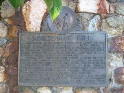
Corral Flat produced over thirty millions in gold. Sixteen feet square constituted a claim. The so-called 'French War' for possession of gold mines occurred in 1851.
'Calaveras Chronicle' was established in 1850. Fights between grizzly bears and bulls amused early residents. At one time headquarters of Joaquin Murieta . Town was destroyed by fires in 1854, 1864, and 1874.
County seat of Calaveras County from 1853 to 1866.
Erected 1937 by The Calaveras County Chamber of Commerce, and The Native Daughters of the Golden West. (Marker Number 269.)
Topics and series. This historical marker is listed in these topic lists: Industry & Commerce • Settlements & Settlers. In addition, it is included in the California Historical Landmarks, and the Native Sons/Daughters of the Golden West series lists. A significant historical year for this entry is 1848.
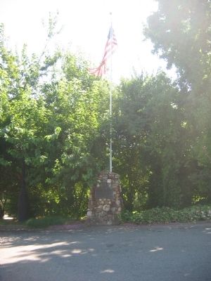
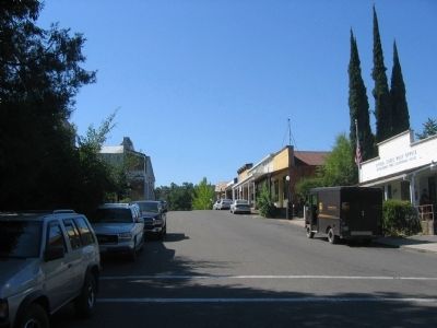
Location. 38° 18.115′ N, 120° 42.344′ W. Marker is in Mokelumne Hill , California, in Calaveras County. Marker is at the intersection of Main Street and Center Street, on the left when traveling south on Main Street. Touch for map. Marker is in this post office area: Mokelumne Hill CA 95245, United States of America. Touch for directions.
Other nearby markers. At least 8 other markers are within 5 miles of this marker, measured as the crow flies. Emily Peek's Saloon (within shouting distance of this marker); Calaveras County Courthouse and Leger Hotel (about 300 feet away, measured in a direct line); a different marker also named Mokelumne Hill (about 300 feet away); Butte Store (approx. 2.3 miles away); Moore Mine (approx. 3.9 miles away); Paloma (Fosteria) (approx. 4.2 miles away); Zeile Mine and Mine House (approx. 4˝ miles away); William J. Paugh House (approx. 4.8 miles away). Touch for a list and map of all markers in Mokelumne Hill.
Regarding Mokelumne Hill. In 1937 this was designated California Historical Landmark No. 269.
Also see . . .
1. Mokelumne Hill. (Submitted on October 26, 2008, by Syd Whittle of Mesa, Arizona.)
2. Mokelumne Hill. (Submitted on October 26, 2008, by Syd Whittle of Mesa, Arizona.)
3. Malakoff: Mokelumne Hill. (Submitted on October 26, 2008, by Syd Whittle of Mesa, Arizona.)
Additional keywords. Gold Rush
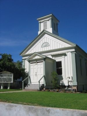
Photographed By Syd Whittle, September 20, 2006
5. Mokelumne Hill Congregational Church
The Congregational Church in Mokelumne Hill was organized August 28, 1853. The church building, erected in 1856, is the oldest Congregational Church building in the state. This site was designated as California Registered Historical Landmark No.261 on September 3, 1937. (There is no marker)
Click for more information.
Click for more information.
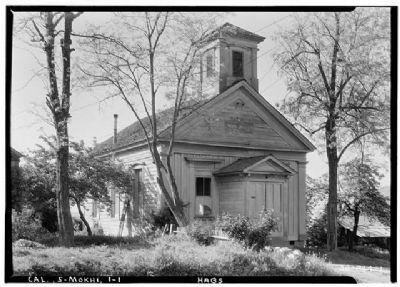
Photographed By Roger Sturtevant, Photographer, April 5, 1934
6. Congregational Church
Historic American Buildings Survey (Library of Congress)
HABS CAL,5-MOKHI,1-1
Click for more information.
HABS CAL,5-MOKHI,1-1
Click for more information.
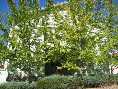
Photographed By Syd Whittle, September 20, 2006
8. Mokelumne Hill Town Hall
Attached link tells the history of the Town Hall Building
Click for more information.
Click for more information.
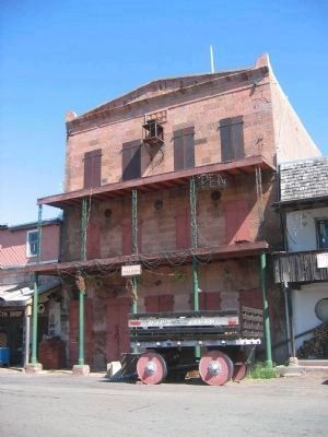
Photographed By Syd Whittle, August 21, 2006
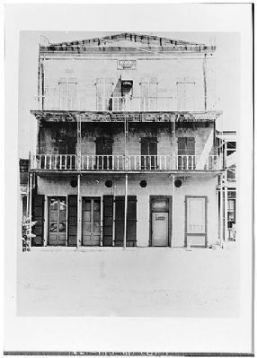
9. I.O.O.F. Hall
This is said to be California's first three-story building to be erected outside the coastal towns. The original building was erected in 1854 as a two-story building - a third story to be used for lodge purposes was added later. This site is California Registered Historical Landmark No.256 (There is no marker)
Click for more information.
Click for more information.
Wells Fargo Bank Historical Museum, San Francisco
10. I.O.O.F. Hall
Historic American Buildings Survey (Library of Congress)
HABS CAL,5-MOKHI,4-
Click for more information.
HABS CAL,5-MOKHI,4-
Click for more information.
Photographed By Syd Whittle, September 20, 2006
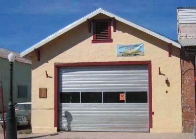
12. Fire House and "Fire Fighters" Marker
Marker Reads:
Volunteers served in the early 1850’s – Eagle Hook & Ladder Co. No. 1 formed 1861. Eureka Fire Co. No.2 with and constitution and by-laws 1862. Pennsylvania Engine Co. and Mokelumne Engine Co. No.1 all fought fires in the 1860’s
Volunteers served in the early 1850’s – Eagle Hook & Ladder Co. No. 1 formed 1861. Eureka Fire Co. No.2 with and constitution and by-laws 1862. Pennsylvania Engine Co. and Mokelumne Engine Co. No.1 all fought fires in the 1860’s
Credits. This page was last revised on January 23, 2024. It was originally submitted on October 26, 2008, by Syd Whittle of Mesa, Arizona. This page has been viewed 2,699 times since then and 44 times this year. Photos: 1, 2. submitted on October 26, 2008, by Syd Whittle of Mesa, Arizona. 3. submitted on December 8, 2008, by Syd Whittle of Mesa, Arizona. 4, 5. submitted on October 26, 2008, by Syd Whittle of Mesa, Arizona. 6. submitted on April 15, 2009, by Syd Whittle of Mesa, Arizona. 7, 8, 9. submitted on October 26, 2008, by Syd Whittle of Mesa, Arizona. 10. submitted on April 15, 2009, by Syd Whittle of Mesa, Arizona. 11. submitted on September 17, 2008, by Syd Whittle of Mesa, Arizona. 12, 13. submitted on February 5, 2009, by Syd Whittle of Mesa, Arizona. 14. submitted on October 26, 2008, by Syd Whittle of Mesa, Arizona.
