Rossville in Walker County, Georgia — The American South (South Atlantic)
Rossville, McFarland House & Spring
Chickamauga Campaign Heritage Trail
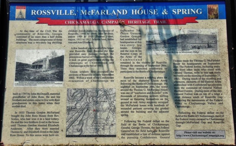
In 1835 Thomas Gordon McFarland bought the John Ross House from Rev. Scales, who had won it in a land lottery. He and his two brothers lived in the house until Thomas Gordon married Elizabeth Anderson. After they were married Thomas G. and Elizabeth lived in the John Ross House. To this union were born six children: Josiah Anderson. first mayor of Rossville, 1905 to 1909; John McNair, mayor 1909 to 1910; Thomas Foster, mayor, 1911 to 1912; Martha Jane, Sallie Ann and Ann Elizabeth.
A few hundred yards west of the house was Rossville Gap. Because the Gap provided easy passage through the precipitous barrier of Missionary Ridge, it took on great significance during the campaigns of Chickamauga and Chattanooga in the fall of 1863.
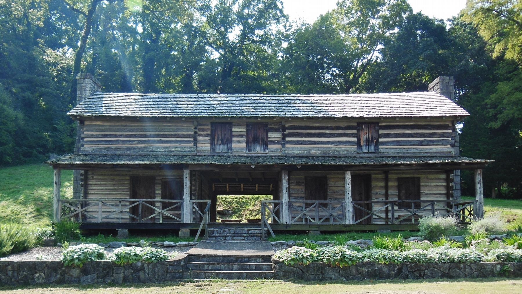
Union soldiers first occupied the environs of Rossville in early September 1863. Within a week of the Confederate evacuation of Chattanooga on September 7th, Union General Gordon Granger had established his headquarters at this two-story log house. Granger and the men in his Reserve Corps of the Army of the Cumberland remained in the vicinity of Rossville through the morning of September 20th. Then they marched southward to participate in the Battle of Chickamauga.
Rossville became a rallying place for most of the shattered Union Army following the Battle of Chickamauga. By nightfall on September 20th, the scene around the Thomas G. McFarland House was one of "confusion and disorder" with thousands of retreating soldiers milling around or throwing themselves on the ground to rest. Army surgeons occupied the McFarland house with hundreds of wounded patients covering the ground around the building and the adjacent spring.
Following the Federal defeat on the field at the Battle of Chickamauga, General George Thomas, the last Federal General on the field halted at Rossville and established a line of defense against the pursuing Confederates. General Thomas made the Thomas G. McFarland House his headquarters on September 21st. The Federal forces, including many men from other units who stood with General Thomas, were in line and ready for battle on the morning of September 21, 1863. During much of the morning and afternoon, elements of the Federal Army skirmished with Confederate cavalrymen from the command of General Nathan Bedford Forrest. During most of the day, General Forrest was
on top of a ridge a short distance south at Rossville Gap observing the movements of the Federal Army in Chattanooga Valley and Chattanooga.
Following the Federal defeat on the field at the Battle of Chickamauga, most of the Federal Army escaped to Chattanooga through McFarland Gap and Rossville Gap.
(photo captions)
• Wartime view of Thomas G. McFarland (John Ross) House
In 1962 the house was disassembled log by log and moved from the corner of Spring Street and Chickamauga Avenue to this location.
• From the map of Col. William E. Merrill, Chief Engineer, Army of the Cumberland
• Rossville Gap in Missionary Ridge
Erected by Chickamauga Campaign Heritage Trail. (Marker Number 31.)
Topics and series. This historical marker is listed in these topic lists: Settlements & Settlers • War, US Civil. In addition, it is included in the Chickamauga Campaign Heritage Trail series list. A significant historical date for this entry is September 21, 1863.
Location. 34° 58.866′ N, 85° 17.098′ W. Marker is in Rossville, Georgia, in Walker County. Marker is on Spring Street south of East Lake Avenue, on the right when traveling south. Marker is located in a small park across the street from the Chief John Ross House. Touch for map. Marker is at or near this postal address: 200 East Lake Avenue, Rossville GA 30741, United States of America. Touch for directions.
Other nearby markers.
At least 8 other markers are within walking distance of this marker. Home of John Ross (a few steps from this marker); Chief John Ross (a few steps from this marker); John Ross Home (a few steps from this marker); Ireland's Brigade (approx. 0.2 miles away); Geary's Division (approx. 0.2 miles away); Rossville Memorial Fountain (approx. 0.2 miles away); Rossville High Alumni Veteran's Memorial (approx. 0.2 miles away); Old Federal Road (approx. 0.2 miles away). Touch for a list and map of all markers in Rossville.
Related markers. Click here for a list of markers that are related to this marker. Chief John Ross Home
Also see . . . Chickamauga Campaign Heritage Trail. A major objective of the Confederate Army during the Chickamauga campaign was to block the Federal Army from Chattanooga. The Federal lifeline was dependent on control of at least one of two roads. One of these was the LaFayette Road, passing through Rossville Gap and roughly following the route of the modern Highway 27. The other was the Dry Valley Road that crossed West Chickamauga Creek at Owen's Ford, then ran northward through the foothills of Missionary Ridge, and eventually passed through the Ridge at McFarland's Gap before continuing through Rossville and ultimately on to Chattanooga. The Chickamauga Campaign Trail follows troop movements through these north-west Georgia regions. (Submitted on February 21, 2019, by Cosmos Mariner of Cape Canaveral, Florida.)
Credits. This page was last revised on February 22, 2019. It was originally submitted on February 21, 2019, by Cosmos Mariner of Cape Canaveral, Florida. This page has been viewed 517 times since then and 55 times this year. Photos: 1, 2, 3. submitted on February 21, 2019, by Cosmos Mariner of Cape Canaveral, Florida. • Bernard Fisher was the editor who published this page.


