Columbus in Colorado County, Texas — The American South (West South Central)
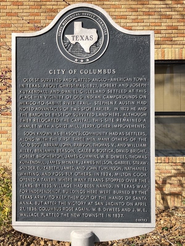
City of Columbus
Soon known as Beason's, community had as settlers, along with the first three men, many others of the "Old 300": Abram, John, Rawson, Thomas V., and William Alley; Benjamin Beason, Caleb R. Bostick, David Bright, Robert Brotherton, James Cummins, W. B. DeWees, Thomas Kuykendall, James McNair, James Nelson, Gabriel Strawn Snyder; Elizabeth, James, and John Tumlinson; Nathaniel Whiting, and possibly others. In 1824, Milton Cook opened a tavern where many Texans stopped over the years. By 1835, village had been named. In Texas War for Independence, buildings here were burned by the Texas Army, to keep them out of the hands of Santa Anna. But after the victory at San Jacinto on April 21, 1836, Columbus rose again. W. B. DeWees and J. W. E. Wallace platted the new townsite in 1837.
Erected 1973 by State Historical Survey Committee. (Marker Number 980.)
Topics. This historical marker is listed in this topic list: Settlements & Settlers. A significant historical year for this entry is 1821.
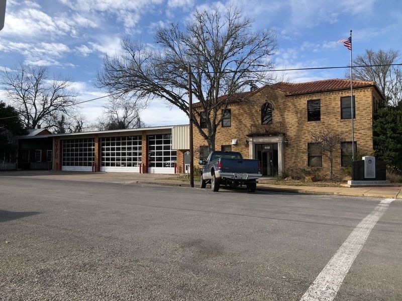
Location. 29° 42.329′ N, 96° 32.523′ W. Marker is in Columbus, Texas, in Colorado County. Marker is at the intersection of Spring Street and Bowie Street, on the right when traveling west on Spring Street. Marker is located in front of the Columbus Volunteer Fire Department. Touch for map. Marker is at or near this postal address: 602 Spring Street, Columbus TX 78934, United States of America. Touch for directions.
Other nearby markers. At least 8 other markers are within walking distance of this marker. Fiftieth Anniversary Celebration of the American Declaration of Independence (within shouting distance of this marker); Townsend-West House (within shouting distance of this marker); Site of Railway Hospital (about 300 feet away, measured in a direct line); Abram Alley and Texas' Struggle for Independence (about 300 feet away); Ilse-Rau House (about 300 feet away); Abram Alley Log Cabin (about 300 feet away); Texas and the Struggle for Independence (about 300 feet away); Dilue Rose Harris (about 400 feet away). Touch for a list and map of all markers in Columbus.
Also see . . . Columbus, TX - The Handbook of Texas Online. Texas State Historical Association (TSHA) (Submitted on February 26, 2019, by Brian Anderson of Humble, Texas.)
Credits. This page was last revised on November 2, 2020. It was originally submitted on February 26, 2019, by Brian Anderson of Humble, Texas. This page has been viewed 239 times since then and 26 times this year. Photos: 1, 2. submitted on February 26, 2019, by Brian Anderson of Humble, Texas.

