Galveston in Galveston County, Texas — The American South (West South Central)
Central Wharf
1840
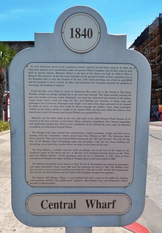
Until the flats were filled in, water in Galveston Bay came up to the Strand at 21st Street. Wooden tressels on pilings reached out to the nine foot channel. The ships actually entering the port were mostly coastwise vessels. Originally, two sand bars obstructed the entrance to the harbor. Large ocean vessels could not enter the bay, and lighting was necessary to bring cargo and passengers into Galveston. Passengers and freight were taken from ships anchored in the channel by skiffs or scows, or drays that could be driven through the shallow water. Some passengers walked on the rickety planks or waded to the Strand. When the flats were filled the wharves were moved out to meet the channel and Central Wharf was renamed Pier 21.
Menard's was the third wharf in the city, and came to be called Central Wharf because of its location at the foot of Center or 21st Street. Ships, schooners, steamboats, New Orleans steamships and small boats landed here. Prior to the completion of the railroad all town cargo for Houston steamboats was delivered at Central Wharf.
The Morgan Line ships docked here maintaining a regular passenger, freight and mail service starting with the "Columbia" which arrived from New Orleans in 1837. The Galveston Daily News reported "The rush at the Central Wharf during the late '60's and the early '70's with the big fleet of red Morgan ships discharging cargo and passengers, with the river boats loading and unloading, was so great that a police officer was kept on duty there all the time."
The Gem Saloon, a wooden structure built on pilings, was at the foot of the wharf on the southwest corner of 21st Street and Ave. A. Because of its location it became known as the "First and Last Chance Saloon". 41,670 passengers came by sea to Galveston in 1871, most of them coming in the Morgan line ships. Sailings of Morgan ships to Galveston ended in 1880.
The Mallory Steamship Lines docked at Piers 22 and 23 discharging and taking on passengers and cargo, principally cotton, from 1866 until fire destroyed the docks in 1923. The Mallory Line
then moved to a new terminal extending from Pier 23 to Pier 26, in 1927. At Pier 22, reconstructed after the fire, the Gulf Fisheries and the Liberty Fish Company occupied new quarters.
The famous 1877 Barque "Elissa" is now berthed here and is open to the public for touring, with maritime exhibits. The paddlewheel "Colonel" offers harbor tours, and Fisherman's Wharf provides a seafood market.
Topics. This historical marker is listed in these topic lists: Industry & Commerce • Settlements & Settlers • Waterways & Vessels. A significant historical year for this entry is 1840.
Location. 29° 18.495′ N, 94° 47.604′ W. Marker is in Galveston, Texas, in Galveston County. Marker is at the intersection of Kempner Street and Harborside Drive (State Highway 275), on the right when traveling north on Kempner Street. Touch for map. Marker is at or near this postal address: 102 Kempner Street, Galveston TX 77550, United States of America. Touch for directions.
Other nearby markers. At least 8 other markers are within walking distance of this marker. Battle of Galveston (about 300 feet away, measured in a direct line); Mallory-Produce Building (about 300 feet away); The First National Bank of Galveston (about 300 feet away); Middle Passage Galveston, Texas (about 300 feet away); The Strand (about 300 feet away); Juneteenth (about 300
feet away); Thompson Building (about 400 feet away); Old Galveston Square (about 400 feet away). Touch for a list and map of all markers in Galveston.
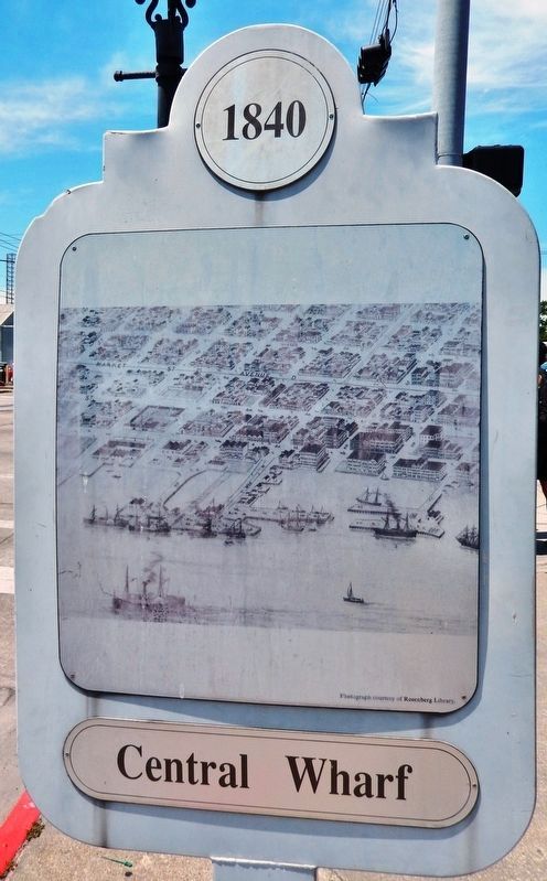
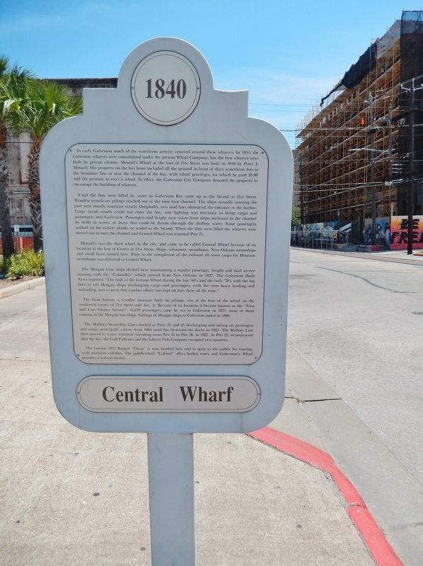
More about this marker. Marker consists of two large laser-printed metal plaques, one with text and one with an historic illustration of the wharf, mounted on either side of a five-foot tall post.
Also see . . . Galveston Wharves. The growing demand for wharf facilities prompted Galveston's founder and developer, Michel B. Menard, to organize his associates, Ebenezar B. Nichols, Henry Howell Williams, and others to form the Galveston Wharf and Cotton Compress Company in 1854 with three wharves. By 1859 the company had merged with seven other piers formerly known as the Palmetto, the Central, the Brick, the Western, the Labadie, the Commercial, and the Merchants (or Hutchings). In this manner the ownership of the wharf company was spread among many previously independent owners. (Submitted on February 28, 2019, by Cosmos Mariner of Cape Canaveral, Florida.)
Credits. This page was last revised on March 1, 2019. It was originally submitted on February 28, 2019, by Cosmos Mariner of Cape Canaveral, Florida. This page has been viewed 399 times since then and 41 times this year. Photos: 1, 2, 3, 4. submitted on February 28, 2019, by Cosmos Mariner of Cape Canaveral, Florida. • Bernard Fisher was the editor who published this page.


