Adams Morgan in Northwest Washington in Washington, District of Columbia — The American Northeast (Mid-Atlantic)
The Latino Community
Roads to Diversity
— Adams Morgan Heritage Trail —
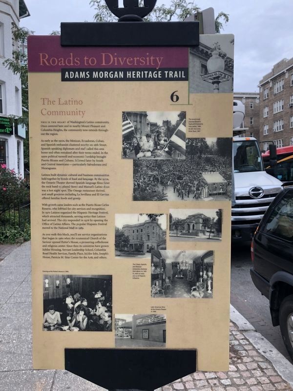
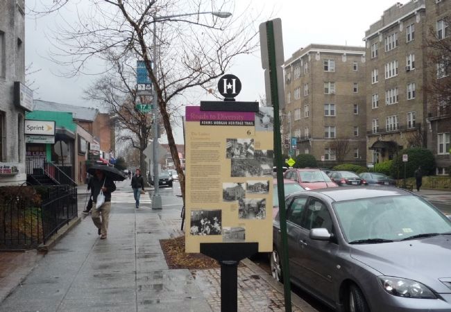
This is the heart of Washington’s Latino community. Once centered here and in nearby Mount Pleasant and Columbia Heights, the community now extends throughout the region.
As early as the 1910s, the Mexican, Ecuadoran, Cuban, and Spanish embassies clustered nearby on 16th Street. Spanish-speaking diplomats and staff called this area home and often remained after their terms ended. In the 1950s, political turmoil and economic hardship brought Puerto Ricans and Cubans, followed later by South and Central Americans–particularly Salvadorans and Nicaraguans.
Latinos built dynamic cultural and business communities held together by bonds of food and language. By the 1970s, the Ontario Theater showed Spanish-language films (later the rock band U2 played there) and Manuel’s Latino disco was a hot night spot. The Omega restaurant thrived and small groceries including La Sevillana and El Gavilan offered familiar foods and gossip.
With growth came leaders such as the Puerto Rican, Carlos Rosario, who lobbied for city services and recognition. In 1970, Latinos organized the Hispanic Heritage Festival, which attracted thousands, serving notice that Latinos had arrived. The city responded in 1976 by opening the Office of Latino Affairs. The popular Hispanic Festival moved to the National Mall in 1989.
As you walk this block, you’ll see service organizations that began in 1960 when the ecumenical Church of the Savior opened Potter’s House, a pioneering coffeehouse and religious center. Since then its ministries have grown: Jubilee Housing, Servant Leadership School, Columbia Road Health Services, Family Place, Jubilee Jobs, Joseph’s House, Patricia M. Sitar Center for the Arts, and others.
Erected 2005 by Cultural Tourism DC. (Marker Number 6.)
Topics and series. This historical marker is listed in these topic lists: Education • Entertainment • Hispanic Americans. In addition, it is included in the Adams Morgan Heritage Trail series list. A significant historical year for this entry is 1970.
Location. 38° 55.499′ N, 77° 2.333′ W. Marker is in Northwest Washington in Washington, District of Columbia. It is in Adams Morgan. Marker is on Columbia Road Northwest east of 17th Street Northwest, on the right when traveling east. Touch for map. Marker is at or near this postal address: 1664 Columbia Road Northwest, Washington DC 20009, United States of America. Touch for directions.
Other nearby markers. At least 8 other markers are within walking distance of this marker. un/fold (a few steps from this marker); Ontario 17 (within shouting distance of this marker); Lanier Heights (about 600 feet away, measured in a direct line); Polska (about 600 feet away); Jan Czochralski (about 600 feet away); Ernest Malinowski (about 600 feet away); Jacek Karpiński (about 600 feet away); Henryk Arctowski (about 600 feet away). Touch for a list and map of all markers in Northwest Washington.
More about this marker.
[Picture captions:]
The enormously popular Hispanic Festival in Kalorama Park, below, 1980. At left, the Costa Rican float, 1987.
The Cuban, Spanish, and Mexican embassies, clockwise from above, on 16th St., were an early source of Hispanic influence.
Evening at the Potter’s House in 1960.
Latin American films at the Ontario Theater in 1969.
Credits. This page was last revised on January 30, 2023. It was originally submitted on March 18, 2009, by Richard E. Miller of Oxon Hill, Maryland. This page has been viewed 1,904 times since then and 44 times this year. Last updated on March 7, 2019, by Devry Becker Jones of Washington, District of Columbia. Photos: 1. submitted on October 26, 2018, by Devry Becker Jones of Washington, District of Columbia. 2. submitted on July 21, 2021, by Ray Gurganus of Washington, District of Columbia. 3. submitted on March 18, 2009, by Richard E. Miller of Oxon Hill, Maryland. • Bill Pfingsten was the editor who published this page.


