Park View in Northwest Washington in Washington, District of Columbia — The American Northeast (Mid-Atlantic)
Urban Oasis
Lift Every Voice
— Georgia Ave./Pleasant Plains Heritage Trail —
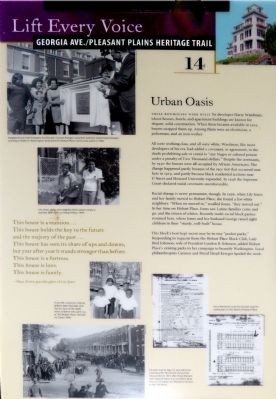
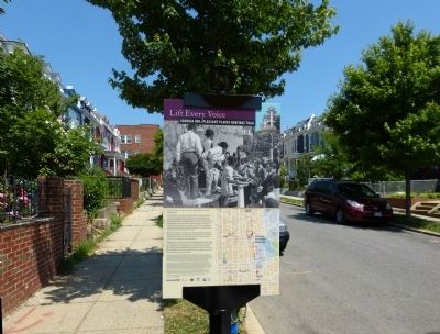
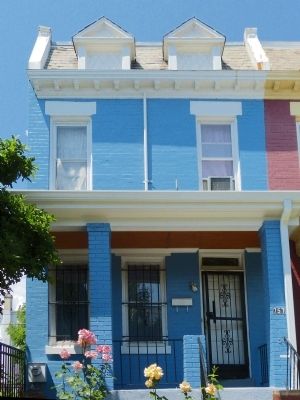
These Rowhouses Were Built by developer Harry Wardman, whose houses, hotels, and apartment buildings are known for elegant, solid construction. When these became available in 1912, buyers snapped them up. Among them were an electrician, a policeman, and an iron worker.
All were working class, and all were white. Wardman, like most developers of his era, had added a covenant, or agreement, to the deeds prohibiting sale or rental to “any Negro or colored person under a penalty of Two Thousand Dollars.” Despite the covenants, by 1930 the houses were all occupied by African Americans. The change happened partly because of the race riot that occurred near here in 1919, and partly because black residential sections near U Street and Howard University expanded. In 1948 the Supreme Court declared racial covenants unenforceable.
Racial change is never permanent, though. In 1956, when Lily Jones and her family moved to Hobart Place, she found a few white neighbors: “When We moved in, ” recalled Jones, “they moved out.” In her time on Hobart Place, Jones saw Latino families come and go, and the return of the whites. Recently multi-racial block parties resumed here, where Jones and her husband George raised eight children in their “study, well-built” house.
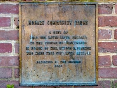
This block's best-kept secret may be its tiny “Pocket parks.” Responding to requests from Hobart Place Block Club, Lady Bird Johnson, wife of President Lyndon B. Johnson, added Hobart Place's existing parks to her campaign to beautify Washington. Local philanthropists Carmen and David Lloyd Kreeger funded the work.
This house is a mansion…
This house holds the key to the future
and the majesty of the past…
This house has seen its share of ups and downs,
but year after year it stands stronger than before.
This house is a fortress.
This house is love.
This house is family
-- Maya Alston, granddaughter of Lily Johnson.
Erected by Cultural Tourism DC. (Marker Number 14.)
Topics and series. This historical marker is listed in these topic lists: African Americans • Environment. In addition, it is included in the Georgia Avenue / Pleasant Plains Heritage Trail, and the Historically Black Colleges and Universities series lists. A significant historical year for this entry is 1912.
Location. 38° 55.65′ N, 77° 1.496′ W. Marker is in Northwest Washington in Washington, District of Columbia. It is in Park View. Marker is on Hobart Place Northwest east of Sherman Avenue Northwest, on the right when traveling west. Near Hobart Twins Park. Touch for map. Marker is at or near this postal address: 756 Hobart Place Northwest, Washington DC 20001, United States of America. Touch for directions.
Other nearby markers. At least 8 other markers are within walking distance of this marker. Hobart Community Parks (here, next to this marker); Rose Garden (a few steps from this marker); "Treat Me Refined" (about 300 feet away, measured in a direct line); 2728 Sherman Ave. N.W. (about 700 feet away); Girard Street Elites (approx. 0.2 miles away); Along the "Nile Valley" (approx. 0.2 miles away); "The Divine Nine Help Shape Black American History" (approx. 0.2 miles away); Nob Hill (approx. ¼ mile away). Touch for a list and map of all markers in Northwest Washington.
Credits. This page was last revised on January 30, 2023. It was originally submitted on July 12, 2015, by Allen C. Browne of Silver Spring, Maryland. This page has been viewed 501 times since then and 23 times this year. Last updated on March 7, 2019, by Devry Becker Jones of Washington, District of Columbia. Photos: 1, 2, 3, 4. submitted on July 12, 2015, by Allen C. Browne of Silver Spring, Maryland. • Bill Pfingsten was the editor who published this page.


