Waikiki in Honolulu in Honolulu County, Hawaii — Hawaiian Island Archipelago (Pacific Ocean)
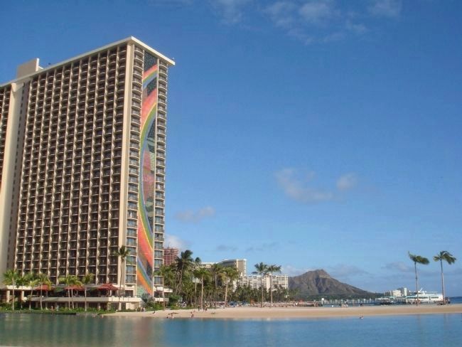
Rainbow Tower & Hilton Lagoon
— Waikīkī Historic Trail —
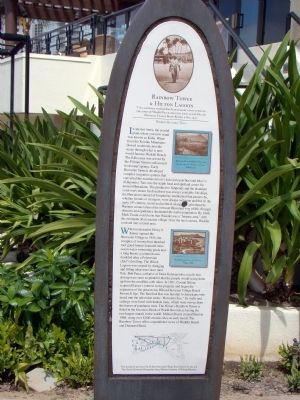
The legendary surfer Duke Kahanamoku often strolled the sands of Waikīkī Beach fronting what is now Hilton Hawaiian Village Beach Resort & Spa, 1959.
In ancient times, the coastal plain where you now stand was known as Kālia. Water from the Ko‘olau Mountains flowed in streams into the ocean through what is now world-famous Waikiki Beach. The Kālia area was served by the Pi‘inaio Stream and several freshwater springs. Early Hawaiian farmers developed complex irrigation systems that converted the marshes into lo‘i kalo (taro patches) and loko i‘a (fishponds). Taro was the staple food and spiritual center for ancient Hawaiians. The productive fishponds and the abundant coral reefs meant fresh seafood was always available. Ho‘okipa, the Hawaiian concept of hospitality, maintained that passers-by, whether friends or strangers, were always welcome and fed. In the early 19th century, social and political change brought about by Western contact altered the intricate Hawaiian way of life. Foreign diseases and epidemics decimated the native population. By 1866, Mark Twain would note that Waikīkī was a “historic area,” with the remnants of an ancient village. Over the next century, Waikīkī evolved into a resort area.
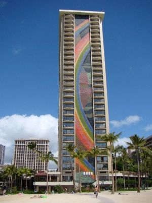
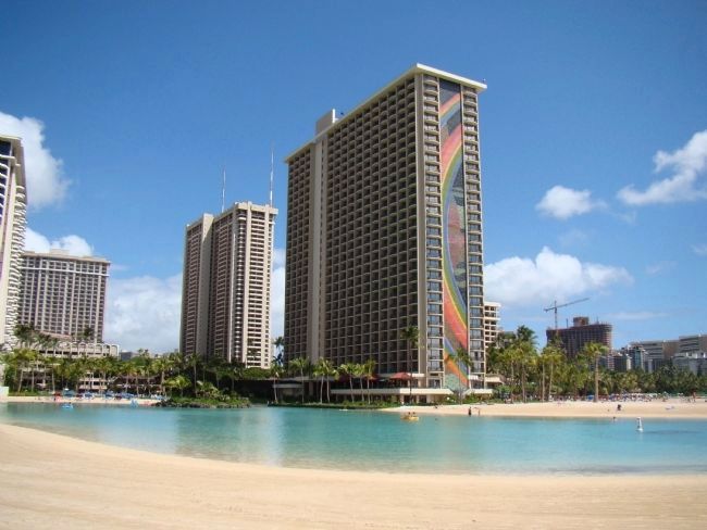
When industrialist Henry J. Kaiser opened the Hawaiian Village in 1955, the complex of twenty-four thatched roof guest houses featured three ocean water swimming pools and a long house, a common area modeled after a Polynesian chief’s dwelling. The Hilton Lagoon was created by dredging and filling what were once mud flats. Bob Paoa, a relative of Duke Kahanamoku, recalls that shrimp were once so plentiful that the people would scoop them up from the mudflats with rakes. In 1961, Conrad Hilton acquired Kaiser’s interest in the property and began the expansion of the present day Hilton Hawaiian Village Beach Resort & Spa. The Barefoot Bar was familiar to Americans who tuned into the television series “Hawaiian Eye.” Its walls and ceilings were lined with lauhala mats, which were woven from the leaves of pandanus trees. The Hilton’s Rainbow Tower is listed in the Guinness Book of World Records as having the two largest murals in the world. Millard Sheets created them in 1968, using over 8,000 ceramic tiles on each mural. The Rainbow Tower offers unparalleled views of Waikīkī Beach and Diamond Head.
Topics. This historical marker is listed in these topic lists: Anthropology & Archaeology • Asian Americans • Industry & Commerce • Sports. A significant historical year for this entry is 1959.
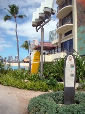
Location. 21° 16.917′ N, 157° 50.317′ W. Marker is in Honolulu, Hawaii, in Honolulu County. It is in Waikiki. Marker can be reached from Holomoana Street south of Ala Moana Boulevard. It is on the beach walk at the base of the Rainbow Tower. Touch for map. Marker is in this post office area: Honolulu HI 96815, United States of America. Touch for directions.
Other nearby markers. At least 8 other markers are within walking distance of this marker. Duke Kahanamoku (about 500 feet away, measured in a direct line); Rainbow Mural (about 600 feet away); Kālia Bay (about 600 feet away); The Story of Kālia (approx. ¼ mile away); Kaha ha ʻlo me nā Makani (approx. ¼ mile away); Kuroda Field (approx. 0.3 miles away); Kãlia Fishponds (approx. 0.3 miles away); U.S. Prefabricated Pill Box (approx. 0.4 miles away). Touch for a list and map of all markers in Honolulu.
More about this marker. A 1959 photo of Duke Kahanamoku walking the sands of Waikiki Beach near this spot is reproduced at the top of the marker. Two additional photos of the area, the first before hotels arrived, have the following captions: “The pi‘inaio Stream, the lifeblood of the people, flowed into the area, which is now the famous Waikīkī beach.” “Breathtaking aerial view of the Hawaiian Village in 1960.”
Regarding Rainbow Tower & Hilton Lagoon. The lagoon was recently rebuilt, with a liner. Umbrellas can no longer be staked in the sand for fear of puncturing the liner.
Additional keywords. Waikiki Beach, Kalia, Koolau, Native Hawaiians, Pacific Islanders
Credits. This page was last revised on February 10, 2023. It was originally submitted on October 28, 2008, by J. J. Prats of Powell, Ohio. This page has been viewed 4,381 times since then and 74 times this year. Photos: 1, 2, 3, 4, 5. submitted on October 28, 2008, by J. J. Prats of Powell, Ohio.
