Mount Pleasant in Northwest Washington in Washington, District of Columbia — The American Northeast (Mid-Atlantic)
Village Life
Village in the City
— Mount Pleasant Heritage Trail —
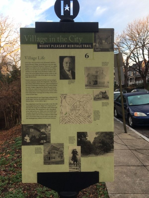
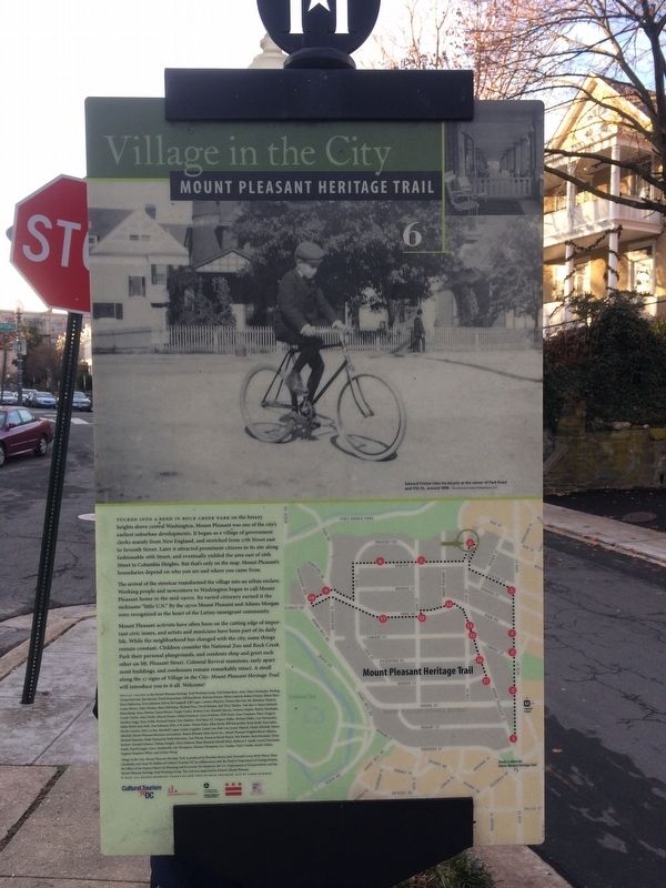
This was the western edge of Samuel P. Brown's Mount Pleasant Village. Across the street and a few steps ahead at 3423 Oakwood Terrace is "Oakwood," an original village house built in 1871 for city politician J.W. Buker. Brown reserved the land to your left for his family, and sold lots to your right, from 17th Street to today's 14th Street. You can recognize Brown's earliest streets on the trail map on the other side of this sign by the way they angle off 17th Street.
Brown's settlement attracted Civil War veterans and government employees, mostly New Englanders. They found these breezy hills healthier than the congested lowlands of the City of Washington (bounded on the north by Florida Avenue). Villagers organized the Mount Pleasant Assembly, which ran a horse-drawn coach from 14th Street and Park Road to the Treasury Department downtown. It also built Union Hall for meetings and worship services, and a school on Hiatt Place.
In 1883 Samuel Brown's son Chapin began subdividing the family estate. You'll see the subdivision's first house — 1701 Newton Street — as you walk to Sign 7.
Even before Rock Creek Park was set aside in 1890, the wild woodlands bordering the village were a happy part of daily life. The young sons of developer Luther Fristoe and his wife Caroline, who moved here in 1887, often played at the creek and the zoo. Others came from farther away: Theodore Roosevelt, president from 1901 to 1909, rode horseback, hiked, and even skinny-dipped in Rock Creek Park. He arrived so often via 17th Street, one street over, that Washingtonians dubbed it the Roosevelt Entrance.
Erected 2006 by Cultural Tourism DC. (Marker Number 6.)
Topics and series. This historical marker is listed in these topic lists: Architecture • Charity & Public Work • Railroads & Streetcars. In addition, it is included in the Former U.S. Presidents: #26 Theodore Roosevelt, and the Mount Pleasant Heritage Trail series lists. A significant historical year for this entry is 1883.
Location. 38° 56.073′ N, 77° 2.324′ W. Marker is in Northwest Washington in Washington, District of Columbia. It is in Mount Pleasant. Marker is at the intersection of Oakwood Terrace Northwest and 17th Street Northwest, on the left when traveling north on Oakwood Terrace Northwest. Touch for map. Marker is at or near this postal address: 3401 Oakwood Terrace Northwest, Washington DC 20010, United States of America. Touch for directions.
Other nearby markers. At least 8 other markers are within walking distance of this marker. Elder Spirit (about 700 feet away, measured in a direct line); Twenty-seven Little Flags (about 700 feet away); Nacotchtank Family at the Piney Branch Quarry, ca. 1600 (about 700 feet away);
More about this marker.
Image captions (clockwise from top center):
Chapin Brown continued his father's work developing Mount Pleasant.
Village children were educated in this four-room schoolhouse, seen here in 1876.
Villagers built Union Hall, above, for church services, parties, and public meetings.
This 1887 Hopkins map shows Mount Pleasant Village. Old 16th and 17th sts. are now Mt. Pleasant St., Piney Branch Rd. is now 17th St., and Park St. and Pierce Mill Rd. are today's Park Rd.
President Theodore Roosevelt, avid outdoorsman, often rode into Rock Creek Park on 17th St., at the center of this 1927 view, right.
The Fristoe family house once stood at 3309 17th St. The
Credits. This page was last revised on January 30, 2023. It was originally submitted on December 24, 2017, by Devry Becker Jones of Washington, District of Columbia. This page has been viewed 275 times since then and 23 times this year. Last updated on March 8, 2019, by Devry Becker Jones of Washington, District of Columbia. Photos: 1, 2, 3. submitted on December 24, 2017, by Devry Becker Jones of Washington, District of Columbia. • Bill Pfingsten was the editor who published this page.


