Wakefield in Northwest Washington in Washington, District of Columbia — The American Northeast (Mid-Atlantic)
Suburban Style
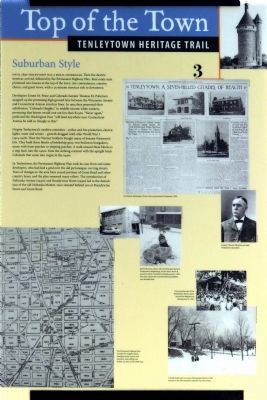
Top of the Town
— Tenleytown Heritage Trail —
Until 1890 Tenleytown was a rural crossroads. Then the electric streetcar arrived, followed by the Permanent Highway Plan. Real estate men promoted new houses at the top of the town: city conveniences, country charm, and great views, with a 25-minute streetcar ride to downtown.
Developers Ernest M. Pease and Colorado Senator Thomas M. Patterson snapped up the promising high ground here between the Wisconsin Avenue and Connecticut Avenue streetcar lines. In 1904 they promoted their subdivision, “Colorado Heights,” to middle-income white workers, promising that homes would cost not less than $2,500. “Never again,” predicted the Washington Post “ will land anywhere near Connecticut Avenue be sold so cheaply as this.”
Despite Tenleytown’s modern amenities – police and fire protection, electric lights, water and sewers – growth dragged until after World War I (1914-1918). Then the Warren brothers bought many of Senator Patterson’s lots. They built three blocks of battleship gray, two-bedroom bungalows, many with front porches or sleeping porches. A walk around these blocks is a step back into the 1920s. Note the striking contrast with the upright brick Colonials that came into vogue in the 1940s.
In Tenleytown the Permanent Highway Plan took its cues from real estate developers, who had laid a grid over the old picturesque, curving streets. Years of changes to the area have erased portions of Grant Road and other country lanes, and the plan renamed others. The introduction of Nebraska Avenue (1930s) and Brandywine Street (1950s) led to the demolition of the old Nebraska Market, once situated behind you at Brandywine Street and Grant Road.
Erected by Cultural Tourism DC. (Marker Number 3.)
Topics and series. This historical marker is listed in these topic lists: Railroads & Streetcars • Settlements & Settlers. In addition, it is included in the Tenleytown Heritage Trail series list. A significant historical year for this entry is 1890.
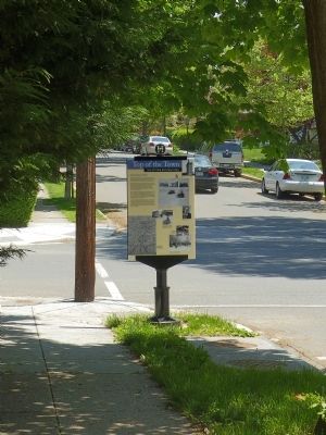
Location. 38° 56.987′ N, 77° 4.481′ W. Marker is in Northwest Washington in Washington, District of Columbia. It is in Wakefield. Marker is at the intersection of Brandywine Street Northwest and 38th Street Northwest, on the left when traveling east on Brandywine Street Northwest. Touch for map. Marker is in this post office area: Washington DC 20016, United States of America. Touch for directions.
Other nearby markers. At least 8 other markers are within walking distance of this marker. Schools (about 300 feet away, measured in a direct line); Three R's (about 400 feet away); Fort Reno (about 400 feet away); a different marker also named Fort Reno (about 800 feet away); Reservoir / Reno City (approx. 0.2 miles away); a different marker also named Fort Reno (approx. 0.2 miles away); a different marker also named Fort Reno (approx. 0.2 miles away); a different marker also named Fort Reno (approx. 0.2 miles away). Touch for a list and map of all markers in Northwest Washington.
Additional keywords. streetcar suburbs
Credits. This page was last revised on January 30, 2023. It was originally submitted on May 9, 2015, by Allen C. Browne of Silver Spring, Maryland. This page has been viewed 500 times since then and 13 times this year. Last updated on March 8, 2019, by Devry Becker Jones of Washington, District of Columbia. Photos: 1, 2. submitted on May 9, 2015, by Allen C. Browne of Silver Spring, Maryland. • Bill Pfingsten was the editor who published this page.
Editor’s want-list for this marker. Photo of the marker reverse • Can you help?

