Tenleytown in Northwest Washington in Washington, District of Columbia — The American Northeast (Mid-Atlantic)
Fort Reno
Top of the Town
— Tenleytown Heritage Trail —
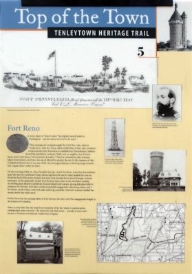
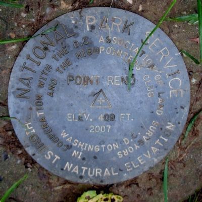
To your right is "Point Reno," the highest point in Washington — 409 feet above sea level, to be exact.
This unsurpassed vantage brought the Civil War (1861-1865) to Tenleytown. After the Union defeat at Bull Run in July 1861, northern troops took the Dyer farm here to establish Fort Pennsylvania. Soldiers cleared the farmhouse, orchards fields and, as neighbor Ann Forrest Green noted with alarm, "every particle of poultry." The fort, renamed in 1863 to honor Major General Jesse Lee Reno, was one of 68 built to protect the city. In the summer of 1864 Confederate forces knew it was one of the city's strongest defenses, with long-range cannons and a signal tower visible for miles.
On the morning of July 11, 1864, President Lincoln visited Fort Reno. Later that day, lookouts spied the dust of Confederate troops advancing from the north. Some headed this way on Rockville Road (Wisconsin Avenue), but most took the Seventh Street Road (Georgia Avenue), homing in on the apparently weaker Fort Stevens, three miles to the northeast. Luckily, the broiling heat delayed Confederate General Jubal Early's attack. giving defenders time to reinforce Fort Stevens. Fort Reno cavalry meanwhile engaged the advancing enemy only a few block north of here, with both sides suffering casualties. The fort's cannons shelled the enemy nearly four miles away.
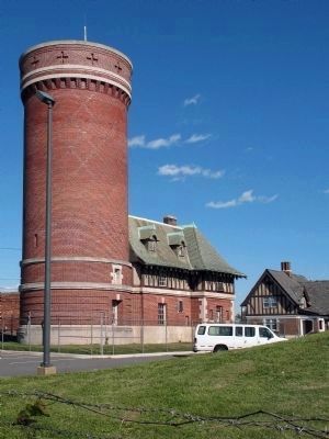
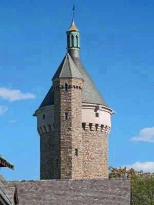
Early's forces lost the ensuing Battle of Fort Stevens, the only Civil War engagement fought in the District of Columbia. Some 30 years later the city erased any remnants of the fort when it constructed an underground water reservoir. The reservoir's red-brick tower — actually a water tank — became a Tenleytown landmark visible from Virginia.
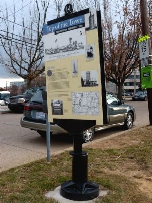
Erected by Cultural Tourism DC. (Marker Number 5.)
Topics and series. This historical marker is listed in these topic lists: Architecture • Forts and Castles • War, US Civil. In addition, it is included in the Defenses of Washington, the Former U.S. Presidents: #16 Abraham Lincoln, and the Tenleytown Heritage Trail series lists. A significant historical month for this entry is July 1861.
Location. 38° 57.048′ N, 77° 4.647′ W. Marker is in Northwest Washington in Washington, District of Columbia. It is in Tenleytown. Marker is on Chesapeake Street Northwest east of 40th Street Northwest, on the left when traveling east. The marker is along Chesapeake Street east of its intersection with 40th Street on the south edge of Fort Reno Park. Touch for map. Marker is at or near this postal address: 3815 Chesapeake Street Northwest, Washington DC 20016, United States of America. Touch for directions.
Other nearby markers. At least 8 other markers are within walking distance of this marker. The Civil War Defenses of Washington (here, next to this marker); Reservoir / Reno City (a few steps from this marker); a different marker also named Fort Reno (within shouting distance of this marker); Reno City (about 400 feet away, measured in a direct line); a different marker also named Fort Reno (about 400 feet away); a different marker also named Fort Reno (about 500 feet away); a different marker also named Fort Reno (about 700 feet away); Schools (about 700 feet away). Touch for a list and map of all markers in Northwest Washington.
Also see . . . Tenelytown Heritage Trail. (Submitted on March 24, 2013, by Allen C. Browne of Silver Spring, Maryland.)
Credits. This page was last revised on January 30, 2023. It was originally submitted on March 24, 2013, by Allen C. Browne of Silver Spring, Maryland. This page has been viewed 945 times since then and 22 times this year. Last updated on March 8, 2019, by Devry Becker Jones of Washington, District of Columbia. Photos: 1, 2, 3, 4, 5, 6. submitted on March 24, 2013, by Allen C. Browne of Silver Spring, Maryland. • Devry Becker Jones was the editor who published this page.
Editor’s want-list for this marker. A photo of the marker reverse. • Can you help?
