Financial District in Manhattan in New York County, New York — The American Northeast (Mid-Atlantic)
Broad Street History Path
Inscription.
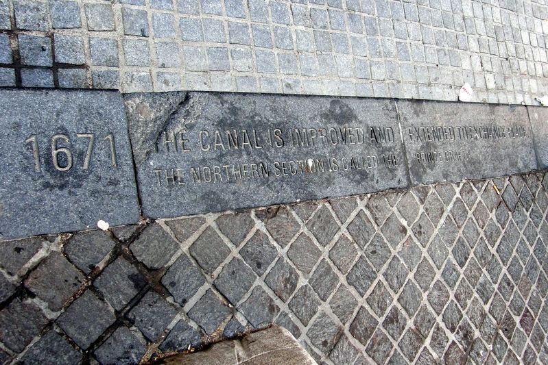
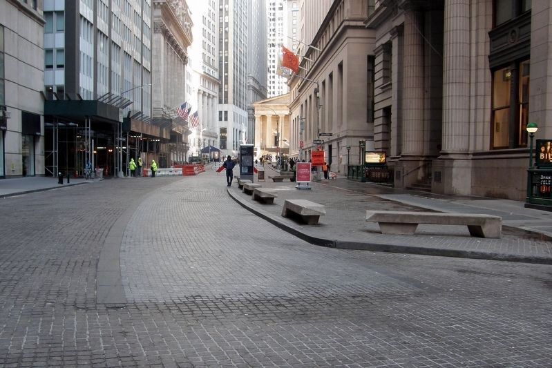
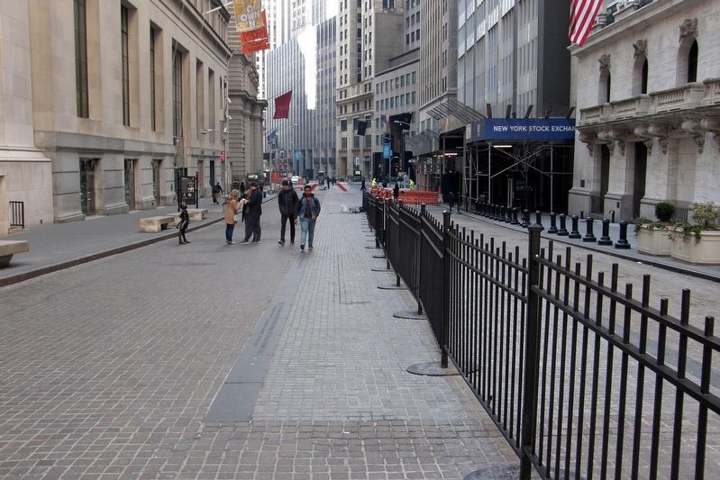
19 street panels along the path of the original Broad Street canal
1642: The Dutch create a canal south of Beaver Street by expanding a small rivulet known as “the ditch”. It is called the “Herre Graft”.
1642: Broad Street laid out with the canal down the middle. Sheriff later ordered to make sure no filth is cast into the canal.
1655: Broad Street is among the first streets paved in New Amsterdam. paving on either side of the canal is likely stone or bricks.
1660: About 28 houses now stand north of Beaver Street. The houses border the open ditch that persists in this area.
1661: Shoemakers and tanners join to erect a bark mill at Exchange Place. They also build homes north of Tuyne Street (Exchange Place).
1671: The canal is improved and extended to Exchange Place. The northern section is called the “Prinz Graft”.
1676: Broad Street residents are told to fill the canal. ordered to regrade the street and pitch it before their doors with stone.
1671: The canal is buried and becomes a common sewer. Tan pits above Beaver Street are filled.
1691: First Broad Street market is established at the south end of the Street. It is housed in a market building that stood until 1746.
1696: The canal is now a common sewer 1,158 feet long. It extends from the river to Exchange Place.
1711: Flatten Barrack market opens at Broad Street and Exchange Place. An informal, outdoor food market it functions for decades.
1791: A well in the north end of Broad Street is relocated on the street. It must be 7 feet deep for the city to pay for it.
1795: An English traveler writes that Broad Street “ is low but pleasant” and is “sufficiently wide”.
1833: Broad Street to be lit by gas.
1845: A fire burns out 177 Broad Street businesses and homes. The fire creates a favorable time to regrade and pave the street.
1846: New sewer to be built from Wall Street to the East River. An assessment list is drawn up to cover the cost.
1873: The raucous “Curb Market” gathers daily at Exchange Place. Unlisted securities are traded at this outdoor marker until 1921.
1899: Sewer between Beaver Street and Exchange Place must be repaired. The $1,000 cost is unanimously approved.
1903: Stock Exchange occupies its present building just north of Exchange Place. Its history begins in 1792 with daily gatherings under a buttonwood tree on Wall Street.
Topics. This historical marker is listed in these topic lists: Colonial Era • Roads & Vehicles. A significant historical year for this entry is 1642.
Location. 40° 42.347′ N, 74° 0.683′ W. Marker is
in Manhattan, New York, in New York County. It is in the Financial District. Marker can be reached from Broad Street, in the median. The markers are set into the street from between Beaver Street and Exchange Place to Wall Street. Touch for map. Marker is in this post office area: New York NY 10004, United States of America. Touch for directions.
Other nearby markers. At least 8 other markers are within walking distance of this marker. "Curbstone Brokers" (a few steps from this marker); Albert Sprague Bard (within shouting distance of this marker); Marinus Willett (within shouting distance of this marker); First Latin School of New Amsterdam (about 300 feet away, measured in a direct line); Fearless Girl (about 300 feet away); New York Stock Exchange (about 300 feet away); a different marker also named New York Stock Exchange (about 400 feet away); 75 Broad Street (about 400 feet away). Touch for a list and map of all markers in Manhattan.
Related marker. Click here for another marker that is related to this marker. A former nearby marker encompassed the canal's New Amsterdam history.
Also see . . . Broad Street, Manhattan. Wikipedia entry (Submitted on March 15, 2019, by Larry Gertner of New York, New York.)
Credits. This page was last revised on January 31, 2023. It was originally submitted on March 15, 2019, by Larry Gertner of New York, New York. This page has been viewed 462 times since then and 88 times this year. Photos: 1, 2, 3. submitted on March 15, 2019, by Larry Gertner of New York, New York. • Bill Pfingsten was the editor who published this page.


