Pachalúm, El Quiché, Guatemala — Central America
A Fortified City
Ciudad Fortaleza - Chuwa Nima’ Ab’äj
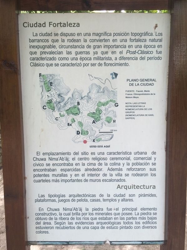
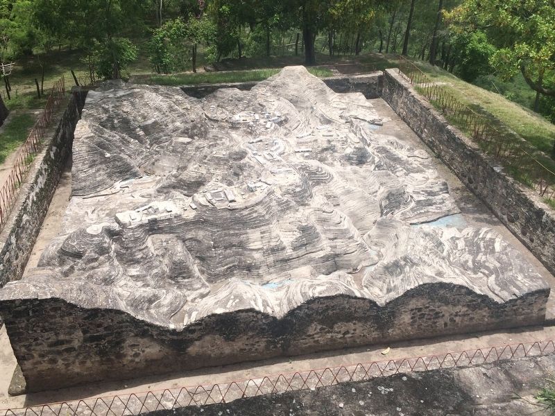
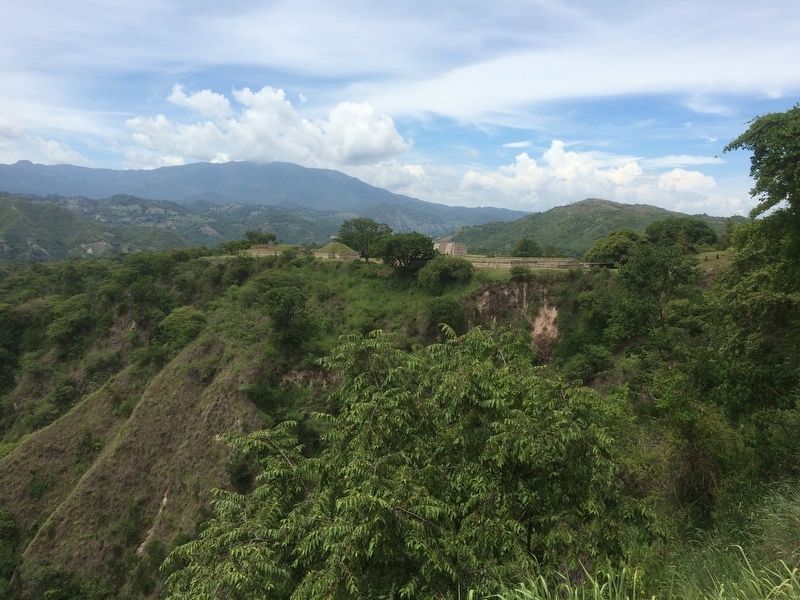
La ciudad se dispuso en una magnífica posición topográfica. Los barrancos que la rodean la convierten en una fortaleza natural inexpugnable, circunstancia de gran importancia en una época en que prevalecían las guerras ya que en el Post-Clásico fue caracterizado como una época militarista, a diferencia del período Clásico que se caracterizó por ser de florecimiento.
El emplazamiento del sitio es una característica urbana de Chuwa Nima'Ab'äj; el centro religioso ceremonial, comercial y cívico se encontraba en la cima de la colina y la población se encontraban esparcidas alrededor. Además reforzaron sus potentes murallas y en el interior de la villa se rodearon los cuarteles más importantes de muros escalonados.
Arquitectura
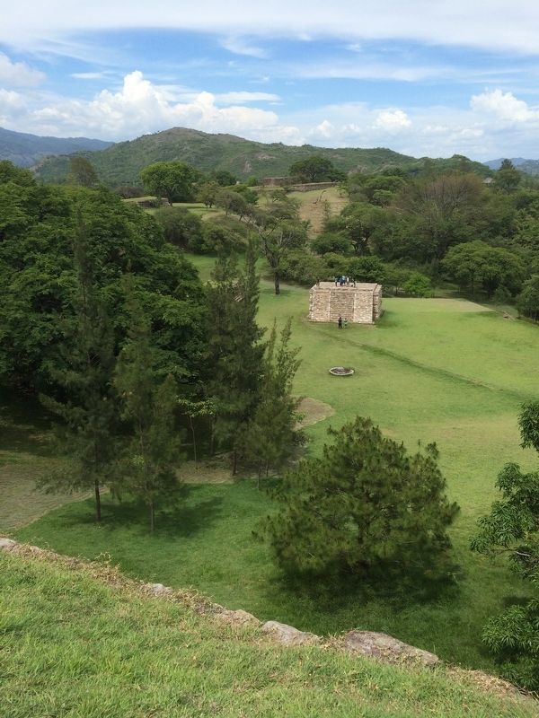
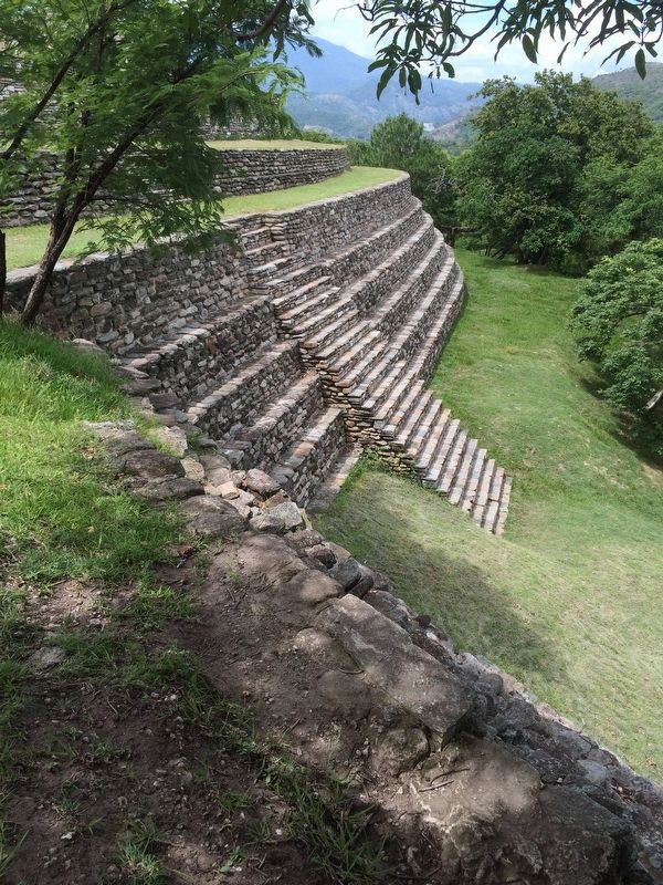
Las tipologías arquitectónicas de la ciudad son pirámides, plataformas, juegos de pelota, casas, templos y altares. En Chuwa Nima'Ab'äj la piedra fue el principal elemento constructivo, la cual brilla por los minerales que posee. La piedra se obtuvo de la ribera de los ríos que estaban en las partes más bajas del área. Según las evidencias arqueológicas todos los edificios estuvieron recubiertos de una capa de estuco pintado con diversos colores.
Pie de dibujo:
Plano General de la Ciudad
Fuente: Fauvet, Marie
France. Ethnoprehistoire de la Maison Maya.
Nota: Las letras representan la nomenclatura de los grupos (Nomenclatura de Karl Sapper)
A Fortified City
The city’s location gives it a magnificent topographical position. The ravines that surround it make it an impregnable natural fortress, a circumstance of great importance at a time when wars were common in the Post-Classic era characterized as a militaristic era, unlike the Classic period that was characterized as being more peaceful, with more development of trade and social activities.
The location of the site is an urban feature of Chuwa Nima'Ab'äj; the ceremonial, commercial and civic religious center was at the top of the hill and the population lived in surrounding suburban areas. In addition, they reinforced their powerful walls and in the interior of the town surrounded the most important barracks with stepped walls.
Architecture
The architectural features of the city include pyramids, platforms, ball game courts, houses, temples and altars. In Chuwa Nima'Ab'äj stone was the main construction element. They type of stone used here shines because of its minerals.
The stone was obtained from the banks of the rivers that were in the lower parts of the area. According to the archaeological evidence, all the buildings were covered with a layer of stucco painted with different colors.
Captions:
A General Map of the City
Source: Marie Fauvet, France. Ethnoprehistoire of the Maison Maya.
Note: The letters represent the nomenclature of the groups (Karl Sapper's Nomenclature)
Topics. This historical marker is listed in these topic lists: Man-Made Features • Native Americans • Settlements & Settlers.
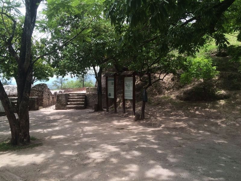
Location. 14° 52.305′ N, 90° 39.69′ W. Marker is in Pachalúm, El Quiché. The marker is near the entrance to the Archaeological Park of Chuwa Nima' Ab'aj, previously known as Mixco Viejo. Touch for map. Marker is in this post office area: Pachalúm, El Quiché 14022, Guatemala. Touch for directions.
Other nearby markers. At least 2 other markers are within 23 kilometers of this marker, measured as the crow flies. Archaeological Park Chuwa Nima’ Ab’äj (here, next to this marker); Parish of Santo Domingo Xenacoj (approx. 21.7 kilometers away in Sacatepéquez).
Credits. This page was last revised on March 26, 2019. It was originally submitted on March 26, 2019, by J. Makali Bruton of Accra, Ghana. This page has been viewed 206 times since then and 10 times this year. Photos: 1, 2, 3, 4, 5, 6. submitted on March 26, 2019, by J. Makali Bruton of Accra, Ghana.
