Sturgeon Bay in Door County, Wisconsin — The American Midwest (Great Lakes)
Sturgeon Bay's Waterfront History
Buoys and Beacons
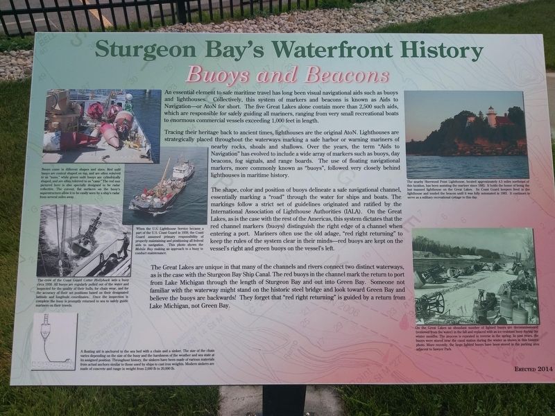
Tracing their heritage back to ancient times, lighthouses are the original AtoN. Lighthouses are strategically placed throughout the waterways marking a safe harbor or warning mariners of nearby rocks, shoals and shallows. Over the years, the term "Aids to Navigation" has evolved to include a wide array of markers such as buoys, day beacons, fog signals, and range boards. The use of floating navigational markers, more commonly known as "buoys," followed very closely behind lighthouses in maritime history.
The shape, color and position of buoys delineate a safe navigational channel, essentially marking a "road" through the water for ships and boats. The markings follow a strict set of guidelines originated and ratified by the International Association of Lighthouse Authorities (IALA). On the Great Lakes, as is the case with the rest of the Americas, this system dictates that the red channel markers (buoys) distinguish the right edge of a channel when entering a port. Mariners often use the old adage, "red right returning" to keep the rules of the system clear in their minds - red buoys are kept on the vessel's right and green buoys on the vessel's left.
The Great Lakes are unique in that many of the channels and rivers connect two distinct waterways, as is the case with the Sturgeon Bay Ship Canal. The red buoys in the channel mark the return to port from Lake Michigan through the length of Sturgeon Bay and out into Green Bay. Someone not familiar with the waterway might stand on the historic steel bridge and look toward Green Bay and believe the buoys are backwards! They forget that "red right returning" is guided by a return from Lake Michigan, not Green Bay.
Photo Captions (counter clockwise)
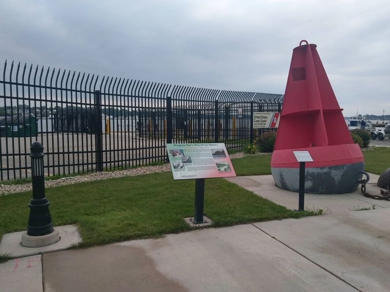
Buoys come in different shapes and sizes. Red unlit buoys are conical shaped on top, and are often referred to as "nuns," while green unlit buoys are cylindrically shaped, and are often referred to as "cans." The red nun pictured here is also specially designed to be radar reflective. The cut-out, flat surfaces on the buoy's superstructure allow it to be easily seen by a ship's radar from several miles away.
When the U.S. Lighthouse Service became a part of the U.S. Coast Guard in 1939, the Coast Guard assumed primary responsibility of properly maintaining and positioning all federal aids to navigation. This photo shows the Mobile Bay making an approach to a buoy to conduct maintenance.
The crew of the Coast Guard Cutter Hollyhock sets a buoy circa 1938. All buoys are regularly pulled out of the water and inspected for the quality of their hulls, for chain wear, and for the accuracy of their set positions based on their designated latitude and longitude coordinates. Once the inspection is complete the buoy is promptly returned to sea to safely guide mariners on their travels.
A floating aid is anchored to the sea bed with a chain and a sinker. The size of the chain varies depending on the size of the buoy and the harshness of the weather and sea state at its assigned position. Throughout history, the sinkers have been made of various materials from actual anchors similar to those used by ships to cast iron weights. Modern sinkers are made of concrete and range in weight from 2,000 lb to 20,000 lb.
On the Great Lakes an abundant number of lighted buoys are decommissioned (removed from the water) in the fall and replaced with an ice resistant buoy during the winter months. The process is repeated in reverse in the spring. In past years, the buoys were stored near the canal station during the winter as shown in this historic photo. More recently, the large lighted buoys have been stored in the parking area adjacent to Sawyer Park.
The nearby Sherwood Point Lighthouse, located approximately 4.5 miles northeast of this location, has been assisting the mariner since 1883. It holds the honor of being the last manned lighthouse on the Great Lakes. Its Coast Guard keepers lived in the lighthouse and tended the beacon until it was fully automated in 1983. It continues to serve as a military recreational cottage to this day.
Erected 2014.
Topics and series. This historical marker is listed in this topic list: Waterways & Vessels. In addition, it is included in the Lighthouses series list.
Location. 44° 49.72′ N, 87° 22.831′ W. Marker is in Sturgeon Bay, Wisconsin, in Door County. Marker can be reached from South Neenah Avenue. Touch for map. Marker is at or near this postal address: Sawyer Park, S Neenah Ave, Sturgeon Bay WI 54235, United States of America. Touch for directions.
Other nearby markers. At least 8 other markers are within walking distance of this marker. Buoy and Sinker (here, next to this marker); a different marker also named Sturgeon Bay's Waterfront History (within shouting distance of this marker); The Fluke Anchor (within shouting distance of this marker); a different marker also named Sturgeon Bay's Waterfront History (within shouting distance of this marker); a different marker also named Sturgeon Bay's Waterfront History (about 300 feet away, measured in a direct line); Ship Propellers (about 300 feet away); a different marker also named Sturgeon Bay's Waterfront History (about 300 feet away); a different marker also named Sturgeon Bay's Waterfront History (about 400 feet away). Touch for a list and map of all markers in Sturgeon Bay.
Credits. This page was last revised on March 29, 2019. It was originally submitted on March 27, 2019, by Devon Polzar of Port Washington, Wisconsin. This page has been viewed 144 times since then and 11 times this year. Photos: 1, 2. submitted on March 27, 2019, by Devon Polzar of Port Washington, Wisconsin. • Bill Pfingsten was the editor who published this page.

