Homestead in Miami-Dade County, Florida — The American South (South Atlantic)
The Edge of "Progress" / Al Margen del "Progreso"
Inscription.
The Edge of "Progress" (English)
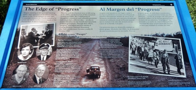
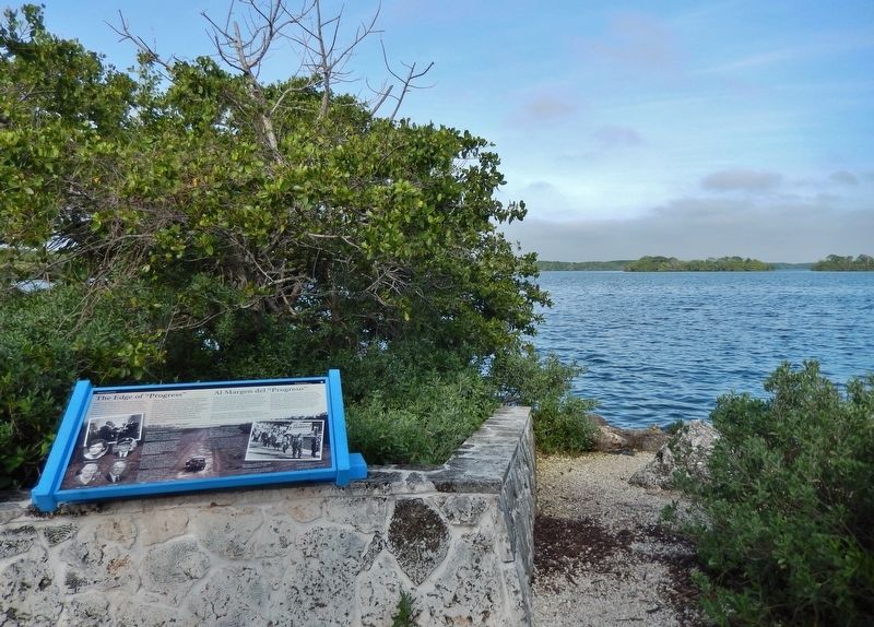
Imagine standing at this spot and watching tanker ships approach an oil refinery directly ahead of you. In the distance to your right, a causeway connects the Florida mainland to a new city on the northernmost islands of the Florida Keys. It almost happened.
Plans for such development were in full-swing in the 1960s, and destruction of this ecosystem seemed inevitable. But a small group of thoughtful, committed, and extremely persistent individuals had a different idea — an idea to protect this place for the benefit and enjoyment of future generations. Through their efforts, "progress" was halted and their dream of creating Biscayne National Monument (the Park's predecessor) became a reality in October 1968.
Al Margen del "Progreso” (Spanish)
Imagine estar parado en este lugar y mirar a los barcos petroleros acercarse a la refinería de petróleo directamente delante de usted. En la distancia a su derecha, una carretera elevada que conecta al continente desde la Florida hasta la nueva ciudad en las islas más al norte de los Cayos de la Florida. Casi pasó.
Los proyectos para ese desarrollo estaban en pleno apogeo alrededor del 1960, y la destrucción de este ecosistema parecía inevitable. Pero un pequeño grupo de individuos considerados, dedicados, y muy persistentes tenían una idea diferente — la idea de proteger este sitio para el beneficio y placer de las futuras generaciones. A través de sus esfuerzos, "el progreso" fue detenido y su sueño de crear el Monumento Nacional Biscayne (el precursor del Parque) se hizo una realidad en octubre de 1968.
A Rebó-a nan "Pwogré"
Ou ka jwenn tradiksyon an kreyól anwo-a, nan Sant pou Vizité-a [Visitor Center]
Signing Ceremony (English)
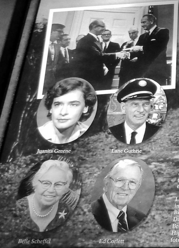
Lloyd Miller (left, with President Lyndon Johnson) was a driving force behind the Safe Progress Association's efforts to establish Biscayne National Monument.
Key players in the fight included Philip Wylie, Carl Karman, Bill Lazarus, Jim and Polly Redford, Dave Davenport, Arthur Marshall, Joe Browder, Dante Fascell, Herbert Hoover, Jr., the Izaak Walton League and those pictured to the left, among others.
Ceremonia de Firma (Spanish)
Lloyd Miller (a la izquierda, con el Presidente Lyndon Johnson) fue una fuerza impulsora detrás de los esfuerzos de la Asociación para un Progreso Seguro (Safe Progress Association) a establecer el Monumento Nacional de Biscayne.
Los jugadores claves en la lucha incluyeron a Philip Wylie, Carl Karman, Bill Lazarus, Jim y Polly Redford, Dave Davenport, Arthur Marshall, Joe Browder, Dante Fascell, Herbert Hoover, Hijo, la Liga de Izaak Walton y los fotografiados a la izquierda, entre otros.
(background image caption)
Determined developers bulldozed a road down the middle of Elliott Key in February, 1968. Its nickname, “Spite Highway," reflects the animosity that existed between developers and conservationists at the time.
Decididos a desarrolar urbanizadores arrasan una calle en el medio del Cayo Elliott. El apodo de "La Carretera del Despecho" refleja la animosidad que existía entonces entre los urbanizadores y los ecologistas, en febrero de 1968.
This project was made possible in part by a donation from the South Florida National Parks Trust.
Este proyecto fue posible en parte gracias a una donación del South Florida National Parks Trust.
Erected by National Park Service, U.S. Department of the Interior.
Topics and series. This historical marker is listed in these topic lists: Environment • Parks & Recreational Areas. In addition, it is included in the Former U.S. Presidents: #36 Lyndon B. Johnson series list. A significant historical month for this entry is October 1968.
Location. 25° 27.9′ N, 80° 20.07′ W. Marker is in Homestead, Florida, in Miami-Dade County. Marker can be reached from Southwest 328th Street, 2.8 miles east of Southwest
117th Avenue (Colonial Road) when traveling east. Marker is located along the Maritime Heritage Trail, near the Dante Fascell Visitor Center in Biscayne National Park. Touch for map. Marker is at or near this postal address: 9700 Southwest 328th Street, Homestead FL 33033, United States of America. Touch for directions.
Other nearby markers. At least 8 other markers are within 9 miles of this marker, measured as the crow flies. Hurricane Andrew (within shouting distance of this marker); The Edge of Discovery / Margen del Descubrimiento (approx. ¼ mile away); Coral Castle (approx. 7.3 miles away); Cooper Residence (approx. 7.3 miles away); The Hickson House (approx. 7.9 miles away); Redland District (approx. 8.8 miles away); The Hotel Redland (approx. 8.8 miles away); Redland Farm Life School (approx. 8.9 miles away). Touch for a list and map of all markers in Homestead.
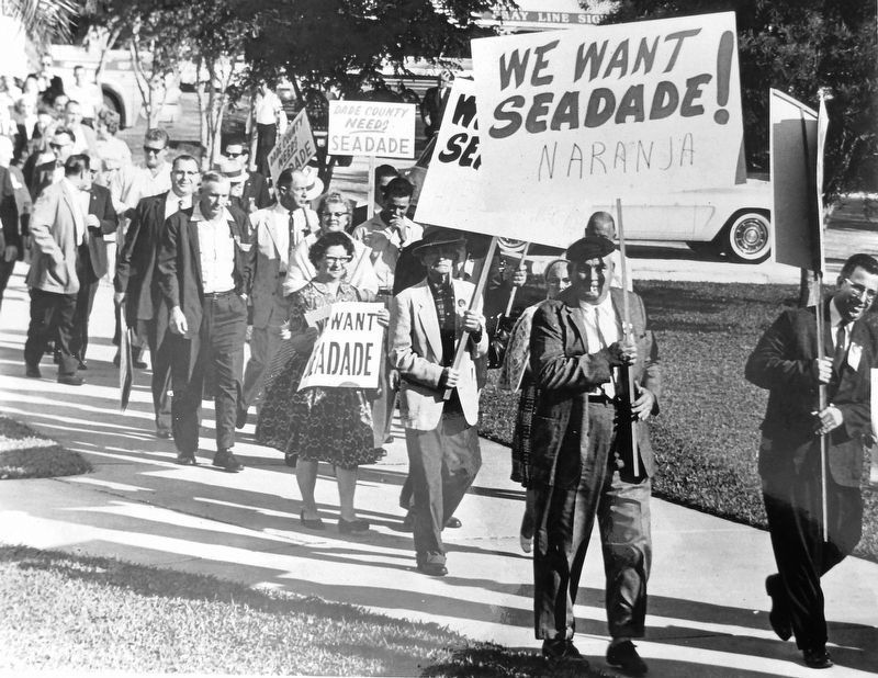
Also see . . . The Birth of Biscayne National Park. In 1961, 13 area landowners voted unanimously to create the City of Islandia. Plans for Seadade, a major industrial seaport, were announced in 1962. The proposal called for the dredging of a 40-foot deep channel through the Bay's clear, shallow waters. An initially small, but vocal, group of people had an entirely different vision for these islands; a national park unlike any other. The park would be covered by water, protecting not only the islands but the bay to the west and the reef to the east. It would provide a haven for wildlife and a respite for people tired of cramped city life. Facing a ground swell of public
support for the park idea, landowners in the city of Islandia brought in bulldozers in an attempt to spoil the area. Dubbed "spite highway," the swath was six lanes wide and seven miles long, right down the middle of Elliott Key. Park proponents were not deterred. Congress, led by longtime Representative Dante Fascell, created Biscayne National Monument to protect "a rare combination of terrestrial, marine and amphibious life in a tropical setting of great natural beauty." President Lyndon B. Johnson signed the bill on October 18, 1968. (Submitted on April 6, 2019, by Cosmos Mariner of Cape Canaveral, Florida.)
Credits. This page was last revised on April 6, 2019. It was originally submitted on April 6, 2019, by Cosmos Mariner of Cape Canaveral, Florida. This page has been viewed 189 times since then and 9 times this year. Photos: 1, 2, 3, 4. submitted on April 6, 2019, by Cosmos Mariner of Cape Canaveral, Florida.


