Blakeley in Baldwin County, Alabama — The American South (East South Central)
Fort Blakeley (Blakely*)
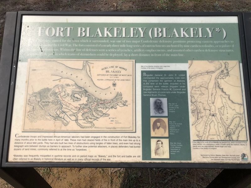
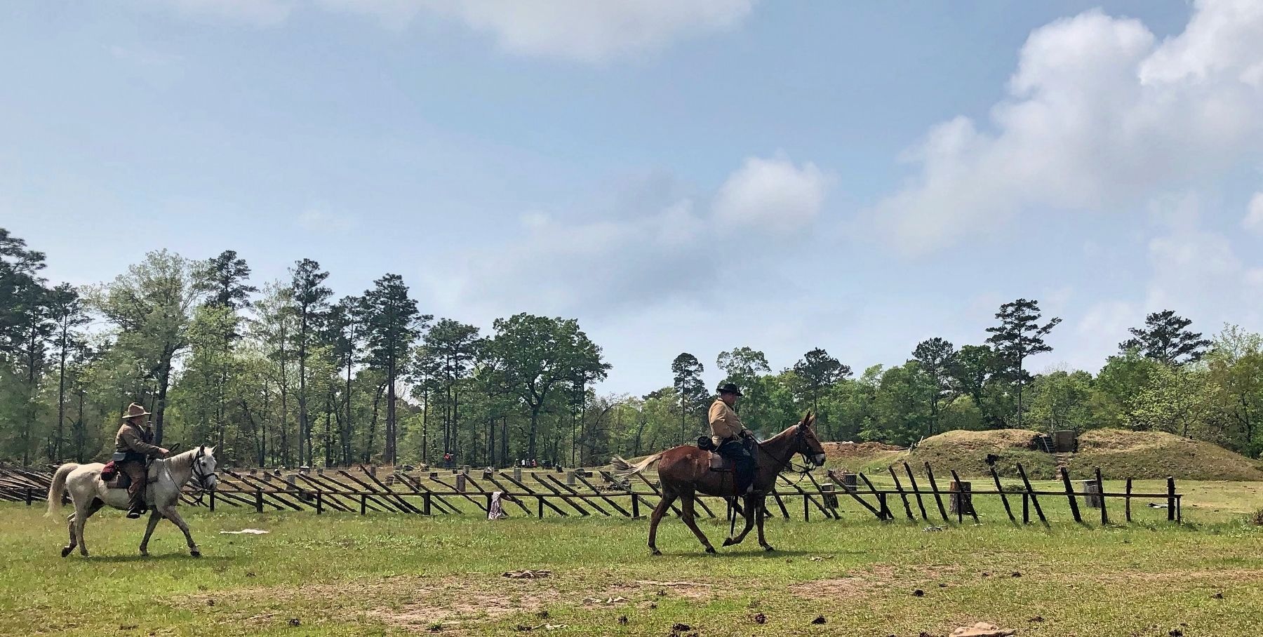
Confederate troops and impressed African-American laborers had been engaged in the construction of Fort Blakeley for many months prior to the battle here in April of 1865. These men had cleared fields of fire in front of the main line up to a distance of about 800 yards. They had also built two lines of obstructions using tangles of fallen trees, and even had strung telegraph wire between stumps as barriers to approach. To further slow potential attackers, in places defenders had buried dozens of land mines, commonly referred to at the time as "torpedoes.
*Blakeley was frequently misspelled in wartime records and on period maps as "Blakely," and the fort and battle are still often referred to as Blakely in historical literature as well as in many official records of the war.
Brigadier General St. John R. Liddell commanded the approximately 3,500 men that comprised the garrison at Blakeley at the time of the battle. Included in his command were veteran brigades under Brigadier General Francis M. Cockrell and raw regiments of conscripts under Brigadier General Bryan Thomas.
Photo captions:
Top left: Map of Fort Blakeley showing Union siege lines
Center portraits: Brig. Gen. St. John R. Liddell (top), Brig. Gen. Francis M. Cockrell (middle), Brig. Gen. Bryan Thomas (bottom)
Map on right: A few miles to the south of Fort Blakeley lay Spanish Fort, which consisted of three linked earthen forts overlooking a series of bluffs along the riverfront. Nearby on islands were two large batteries, named Huger and Tracy.
Erected 2017 by Historic Blakeley State Park, Auburn University College of Liberal Arts, the University of Alabama Center for Economic Development, and the Delaware Valley Civil War Roundtable.
Topics. This historical marker is listed in these topic lists: Forts and Castles • War, US Civil. A significant historical month for this entry is April 1865.
Location. 30° 44.964′ N, 87° 54.667′ W. Marker is in Blakeley, Alabama, in Baldwin County. Marker can be reached from Battlefield Road, 0.3 miles east of Green Street, on the right when traveling east. Located in Historic Blakeley Park at Redoubt #4. Touch for map. Marker is at or near this postal address: Battlefield Road, Spanish Fort AL 36527, United States of America. Touch for directions.
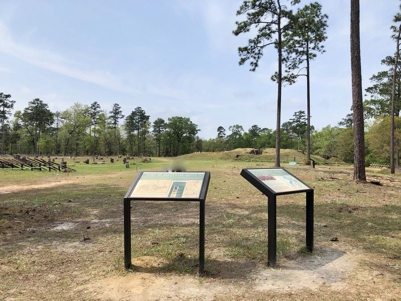
Other nearby markers. At least 8 other markers are within walking distance of this marker. The Battle of Fort Blakeley (here, next to this marker); The United States Colored Troops (USCT) at the Battle of Fort Blakeley (about 600 feet away, measured in a direct line); The Siege of Fort Blakeley (about 600 feet away); The Battle of Fort Blakely (approx. 0.3 miles away); Alabama (approx. half a mile away); Battle of Blakeley (approx. half a mile away); Redoubt Six (approx. half a mile away); The Bottle Creek Site (approx. ¾ mile away). Touch for a list and map of all markers in Blakeley.
Also see . . . Battle of Fort Blakeley - The War Ends and the Battle Begins. (Submitted on April 8, 2019, by Mark Hilton of Montgomery, Alabama.)
Credits. This page was last revised on May 11, 2023. It was originally submitted on April 8, 2019, by Mark Hilton of Montgomery, Alabama. This page has been viewed 903 times since then and 86 times this year. Photos: 1, 2, 3. submitted on April 8, 2019, by Mark Hilton of Montgomery, Alabama.


