Near Moore in Spartanburg County, South Carolina — The American South (South Atlantic)
Site of Fredonia
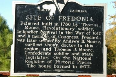
Believed built in 1786 by Thomas Moore, Revolutionary soldier, brigadier general in the War of 1812 and a member of Congress, Fredonia was later owned by Andrew B. Moore, earliest known doctor in this region, and Thomas J. Moore, Confederate soldier and state legislator. On the National Register of Historical Places. The house burned in 1977.
Erected 1979 by Spartanburg County Historical Association. (Marker Number 42-9.)
Topics. This historical marker is listed in these topic lists: Colonial Era • Notable Places • War of 1812 • War, US Civil • War, US Revolutionary. A significant historical year for this entry is 1786.
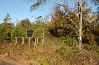
Location. 34° 50.066′ N, 81° 58.903′ W. Marker is near Moore, South Carolina, in Spartanburg County. Marker is on U.S. 221, 0.1 miles north of Moore-Duncan Highway (State Highway 290), on the left when traveling north. Touch for map. Marker is in this post office area: Moore SC 29369, United States of America. Touch for directions.
Other nearby markers. At least 10 other markers are within 7 miles of this marker, measured as the crow flies. “Kate Barry” (approx. 0.8 miles away); Walnut Grove Plantation (approx. 0.8 miles away); Emmanuel Baptist Church Veterans Monument (approx. 2.7 miles away); Crash Site of USA AF A20G Havoc (approx. 4.1 miles away); First Erosion Control Work in the Southeast (approx. 4.6 miles away); Nazareth Frame House (approx. 5.1 miles away); Nazareth Church Stone Marker (approx. 5.2 miles away); Nazareth Church (approx. 5˝ miles away); John B. White Sr., Blvd. (approx. 6.1 miles away); S.J. Workman Highway (approx. 6.2 miles away). Touch for a list and map of all markers in Moore.
Regarding Site of Fredonia. Fredonia was a large vernacular house that typified a family structure as it was modified by succeeding generations. It had evolved from a single log cabin built around 1786 to a two story Georgian house constructed around 1800. A Greek Revival portico was added to the front facade around 1840. The house had a Victorian appearance and doubled in size around 1900. Nothing remains of the structure after it burned in 1977. It was removed from the National Register in 1981.
Also see . . . Fredonia. Fredonia is a large vernacular house that typifies a family structure as it was modified by succeeding generations to suit changing needs and prevailing architectural fashions. (Submitted on November 4, 2008, by Brian Scott of Anderson, South Carolina.)
Credits. This page was last revised on June 16, 2016. It was originally submitted on November 1, 2008, by Michael Sean Nix of Spartanburg, South Carolina. This page has been viewed 1,711 times since then and 50 times this year. Photos: 1, 2. submitted on November 1, 2008, by Michael Sean Nix of Spartanburg, South Carolina. • Craig Swain was the editor who published this page.

