Santa María del Río, San Luis Potosí, Mexico — The Northeast (and Central Highlands)
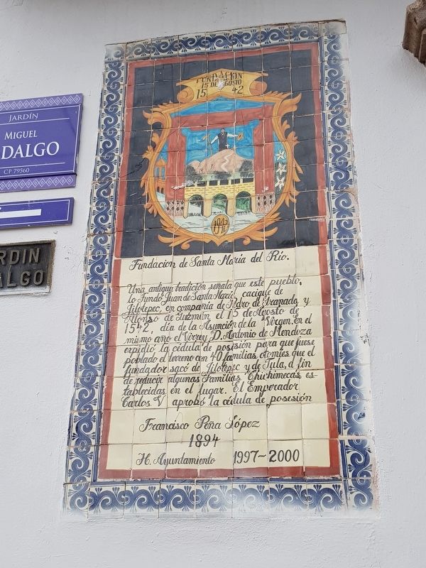
Foundation of Santa María del Río
Una antigua tradición señala que este pueblo, lo Fundó Juan de Santa María cacique de Jilotepec, en compañía de Pedro de Granada y Alonso de Gúzman el 15 de Agosto de 1542, día de la Asunción de la Virgen. En el mismo año el Virrey D. Antonio de Mendoza expidió la cédula de posesión para que fuese poblado el terreno con 40 familias otomíes que el fundador sacó de Jilotepec y de Tula, a fin de reducir algunas Familias Chichimecas establecidas en el lugar. El Emperador Carlos V aprobó la cédula de posesión
Francisco Peña López
1894
H. Ayuntamiento 1997-2000
Foundation of Santa María del Río
Tradition says that this town was founded by Juan de Santa María, cacique de Jilotepec, accompanied by Pedro de Granada and Alonso de Gúzman on August 15, 1542 , Day of the Assumption of the Virgin. In the same year the Viceroy Antonio de Mendoza issued a title so that the land could be populated with 40 Otomi families that the founder took from Jilotepec and Tula, in order to displace some Chichimeca families established here. The title was approved by Emperor Carlos V.
Francisco Peña López
1894
Honorable City Hall 1997-2000
Erected 1999.
Topics. This historical marker is listed in these topic lists: Colonial Era • Native Americans • Settlements & Settlers. A significant historical date for this entry is August 15, 1542.
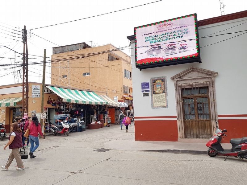
Location. 21° 48.014′ N, 100° 44.224′ W. Marker is in Santa María del Río, San Luis Potosí. Marker is at the intersection of Jardín Hidalgo and José María Morelos y Pavón, on the right when traveling south on Jardín Hidalgo. Touch for map. Marker is in this post office area: Santa María del Río SL 79560, Mexico. Touch for directions.
Other nearby markers. At least 8 other markers are within walking distance of this marker. City Hall (a few steps from this marker); Primo Feliciano Velázquez Rodríguez (within shouting distance of this marker); Purísima Chapel (within shouting distance of this marker); Otomíes and Guachichiles (within shouting distance of this marker); Hidalgo Garden (within shouting distance of this marker); The Parochial School of Music (within shouting distance of this marker); Tourism Office (within shouting distance of this marker); Former Franciscan Convent (about 90 meters away, measured in a direct line). Touch for a list and map of all markers in Santa María del Río.
Credits. This page was last revised on April 14, 2019. It was originally submitted on April 14, 2019, by J. Makali Bruton of Accra, Ghana. This page has been viewed 120 times since then and 9 times this year. Photos: 1, 2. submitted on April 14, 2019, by J. Makali Bruton of Accra, Ghana.

