Silver Springs in Marion County, Florida — The American South (South Atlantic)
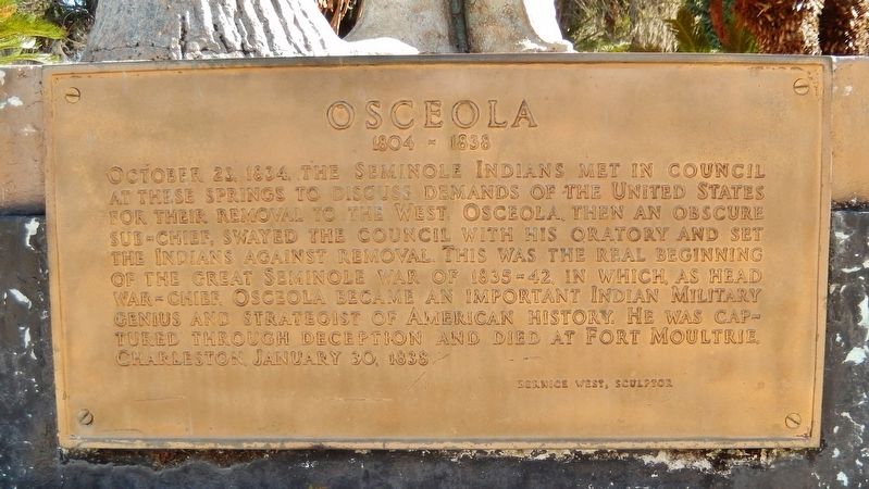
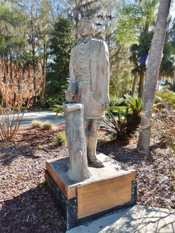
Osceola
1804-1838
October 23, 1834, the Seminole Indians met in council at these springs to discuss demands of the United States for their removal to the West. Osceola, then an obscure sub-chief, swayed the council with his oratory and set the Indians against removal. This was the real beginning of the Great Seminole War of 1835-42, in which, as head War-Chief, Osceola became an important Indian Military genius and strategist of American History. He was captured through deception and died at Fort Moultrie, Charleston, January 30, 1838.
Bernice West, Sculptor
Topics. This historical marker is listed in these topic lists: Native Americans • Wars, US Indian. A significant historical date for this entry is October 23, 1834.
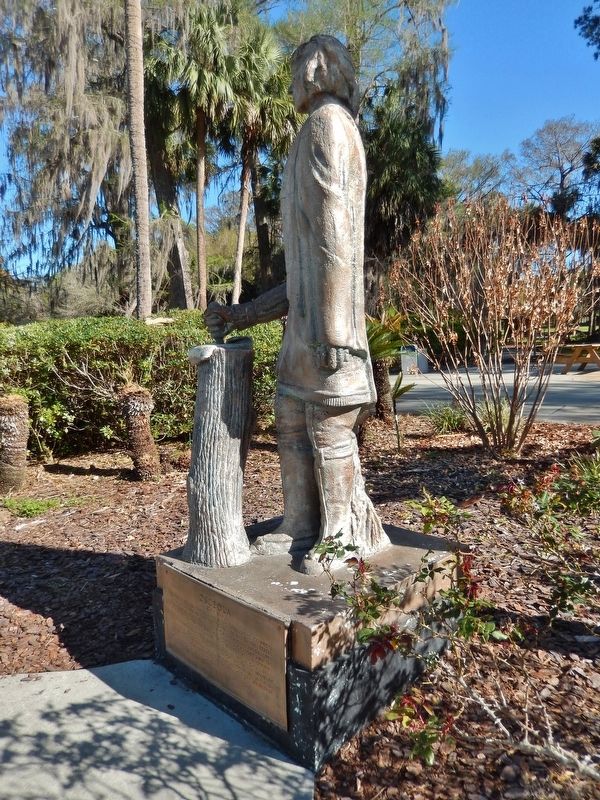
Location. 29° 12.941′ N, 82° 3.142′ W. Marker is in Silver Springs, Florida, in Marion County. Marker can be reached from Northeast 29th Place, half a mile south of East Silver Springs Boulevard (State Highway 40). Statue and marker are located along the River Trail in Silver Springs State Park, overlooking the springs, about 2/10 mile walk around the springs from the park entrance. Touch for map. Marker is at or near this postal address: 5656 East Silver Springs Boulevard, Silver Springs FL 34488, United States of America. Touch for directions.
Other nearby markers. At least 8 other markers are within walking distance of this marker. Silver Springs Paradise Park (within shouting distance of this marker); Florida’s Springs: Our Precious Resource (about 300 feet away, measured in a direct line); From Disaster to Award-Winning Design (about 400 feet away); Sea Hunt (about 400 feet away); Steamboats at the Spring (about 500 feet away); The Creature (about 500 feet away); Florida’s Roadside Attractions (about 500 feet away); Ross Allen (about 600 feet away). Touch for a list and map of all markers in Silver Springs.
Also see . . .
1. Osceola (Billy Powell), Medicine Man and War Chief. Native American Churches website entry:
Osceola is seen as a major figure in securing the rights of Seminoles and other native peoples during the colonial period—not through signing agreements and treaties with agents of the U.S. governments, as some tribal leaders had done, but through guerrilla warfare tactics that kept the U.S. military at bay for a long time, slowing the removal of Seminoles and the taking of Seminole lands. The United States Army captured Osceola, on October 20, 1837, under a white flag of truce, to talk peace. At the time of his capture, he was very ill. This event remains today, one of the blackest marks in American military history. (Submitted on April 15, 2019, by Cosmos Mariner of Cape Canaveral, Florida.)
2. Second Seminole War (1835–1842). Brittanica website entry:
In 1830 President Andrew Jackson signed the Indian Removal Act, authorizing the resettlement of all Native American peoples to lands west of the Mississippi. It called for the Seminoles to move within three years to the land assigned to Creek Indians west of the Mississippi. Osceola emerged as a leader among the Seminoles determined to resist resettlement. Throughout 1836 Seminoles attacked plantations, outposts, and supply lines, and they stymied several efforts by the United States to subdue them. Over the next four years, small engagements continued to take place, and increasing numbers of Seminoles were induced or forced to move west to the Creek reservation. (Submitted on April 15, 2019, by Cosmos Mariner of Cape Canaveral, Florida.)
Credits. This page was last revised on May 20, 2022. It was originally submitted on April 15, 2019, by Cosmos Mariner of Cape Canaveral, Florida. This page has been viewed 870 times since then and 82 times this year. Photos: 1, 2, 3. submitted on April 15, 2019, by Cosmos Mariner of Cape Canaveral, Florida.


