Waikiki in Honolulu in Honolulu County, Hawaii — Hawaiian Island Archipelago (Pacific Ocean)
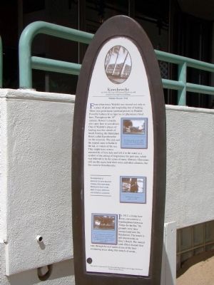
Kawehewehe
— Waikīkī Historic Trail —
From olden times Waikīkī was viewed not only as a place of peace and hospitality, but of healing. There was great mana (spiritual power) in Waikīkī. Powerful kahuna la‘au lapa‘au (or physicians) lived here. Throughout the 19th century, Hawai‘i’s royalty also came here to convalesce. One of Waikīkī’s places of healing was this stretch of beach fronting the Halekulani Hotel, called Kawehewehe (or the removal). The sick and the injured came to bathe in the kai, or waters of the sea. They might have worn a seaweed lei of limn kala and left it in the water as a symbol of the asking of forgiveness for past sins, which was believed to be the cause of many illnesses. Hawaiians still use the sea to heal their sores and other ailments, but few come to Kawehewehe.
Kawehewehe is believed to have healing powers. For centuries, Hawaiians have come here to heal spiritual and physical ailments.
In 1912, a home here was converted to a boardinghouse known as “Grays-by-the–Sea.” Its grounds were later incorporated into the Halekulani. The beach is still known today as Gray’s Beach. The natural sand—filled channel that runs through the reef makes it one of the best swimming areas along this stretch of ocean...
Erected by The Shore Bird Beach Broiler and Outrigger Reef Hotel. (Marker Number 13.)
Topics. This historical marker is listed in these topic lists: Anthropology & Archaeology • Asian Americans • Churches & Religion • Government & Politics. A significant historical year for this entry is 1912.
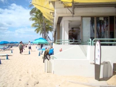
Location. 21° 16.65′ N, 157° 49.967′ W. Marker is in Honolulu, Hawaii, in Honolulu County. It is in Waikiki. Marker can be reached from Kalia Road west of Beachwalk Street. It is at the beach end of the public beach access walkway between the Outrigger Reef and the Halekulani hotels. Touch for map. Marker is in this post office area: Honolulu HI 96815, United States of America. Touch for directions.
Other nearby markers. At least 8 other markers are within walking distance of this marker. Afong Villa (about 300 feet away, measured in a direct line); Mahiole (about 600 feet away); Japanese Light Tank (about 600 feet away); U.S. 105mm Howitzer M3 (about 600 feet away); Japanese Type 1 (1941) (about 600 feet away); Monarchy Cannon (about 700 feet away); U.S. Prefabricated Pill Box (about 700 feet away); U.S. Light Tank, M24 (about 700 feet away). Touch for a list and map of all markers in Honolulu.
Additional keywords. Native Hawaiians, Pacific Islanders
Credits. This page was last revised on February 10, 2023. It was originally submitted on November 2, 2008, by J. J. Prats of Powell, Ohio. This page has been viewed 2,574 times since then and 113 times this year. Photos: 1, 2. submitted on November 2, 2008, by J. J. Prats of Powell, Ohio.

