Porterville in Tulare County, California — The American West (Pacific Coastal)
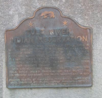
Tule River Indian Reservation
This location, not proving satisfactory, Tule River Indian Reservation was moved to its present location ten miles south-east in 1873.
Erected 1949 by The California Centennials Commission and base furnished by Tulare County Historical Society, October 16, 1949. (Marker Number 388.)
Topics and series. This historical marker is listed in these topic lists: Landmarks • Native Americans • Notable Events • Notable Places • Settlements & Settlers. In addition, it is included in the California Historical Landmarks series list. A significant historical year for this entry is 1857.
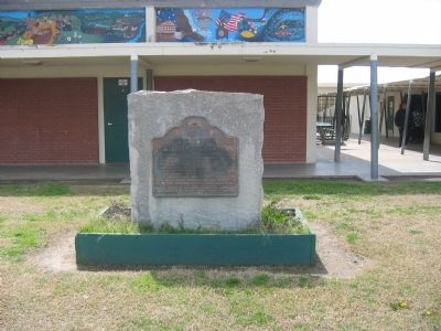
Location. 36° 3.497′ N, 118° 57.997′ W. Marker is in Porterville, California, in Tulare County. Marker is located on the grounds of the Alta Vista Elementary School. Touch for map. Marker is at or near this postal address: 2293 East Crabtree Avenue, Porterville CA 93257, United States of America. Touch for directions.
Other nearby markers. At least 8 other markers are within 3 miles of this marker, measured as the crow flies. The Tule River Stage Station (approx. 2.3 miles away); Gabriel Moraga (approx. 2.4 miles away); Vandalia (approx. 2.6 miles away); Dr. Samuel Gregg George (approx. 2.7 miles away); Nettie Smith's Place (approx. 2.7 miles away); Elisha Packwood (approx. 2.8 miles away); Porterville's Badman (approx. 2.9 miles away); Time Marches On (approx. 2.9 miles away). Touch for a list and map of all markers in Porterville.
Also see . . . Tule River Indian Tribe of the Tule River Reservation. Wikipedia entry. (Submitted on October 2, 2020, by Larry Gertner of New York, New York.)
Credits. This page was last revised on October 2, 2020. It was originally submitted on November 2, 2008, by Syd Whittle of Mesa, Arizona. This page has been viewed 2,276 times since then and 20 times this year. Photos: 1, 2. submitted on November 2, 2008, by Syd Whittle of Mesa, Arizona. 3. submitted on October 2, 2020, by Larry Gertner of New York, New York.


