Manassas, Virginia — The American South (Mid-Atlantic)
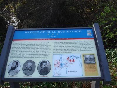
Battle of Bull Run Bridge
Liberia
— Second Manassas Campaign —
In Aug. 1862, Confederate Gen. Robert E. Lee ordered Gen. Thomas J. “Stonewall” Jackson from the Rappahannock River to keep Gen. John Pope’s and Gen. George B. McClellan’s armies from uniting. Jackson marched on Aug. 25, and Lee followed the next day with the rest of the Army of Northern Virginia. Jackson captured Bristoe Station and Manassas Junction late on Aug. 26. When reports reached Pope, he thought it was one of J.E.B. Stuart’s raids and ordered Gen. George W. Taylor’s reinforced infantry brigade to drive the imagined cavalrymen away.
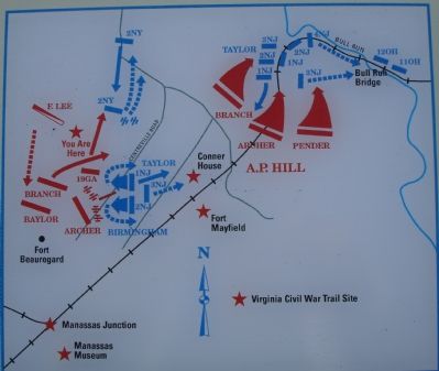
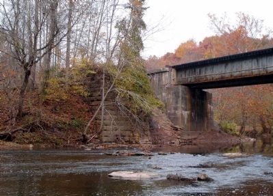
Meanwhile, about 6 a.m. on Aug. 27, Col. Gustav Waagner led the 2nd New York Heavy Artillery from nearby Bull Run to engage Jackson northeast of Liberia. Jackson quickly counterattacked and sent the New Yorkers retreating to Centreville. When Taylor’s command arrived about 8:30 as Waagner began withdrawing, Jackson’s men, entrenched here in a line between Liberia and Fort Mayfield, prepared to greet it with a “storm of lead.” The Federals advanced within 300 yards of Fort Beauregard, and Jackson rode forward waving a white handkerchief to suggest they surrender. When a Union bullet flew past Jackson’s head, he ordered his troops to open fire. Taylor fell mortally wounded, and his force retreated to the Orange and Alexandria Railroad and the Bull Run Bridge.
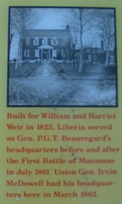
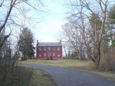
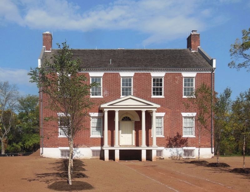
Built for William and Harriet Weir in 1825, Liberia served as Gen. P.G.T. Beauregard’s headquarters before and after the First Battle of Manassas in July 1861. Union Gen. Irvin McDowell had his headquarters here in March 1862.
Erected by Virginia Civil War Trails.
Topics and series. This historical marker is listed in this topic list: War, US Civil. In addition, it is included in the Virginia Civil War Trails series list. A significant historical month for this entry is March 1862.
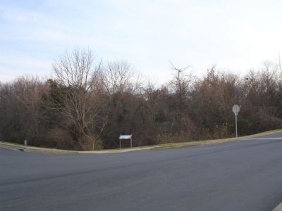
Location. Marker has been reported missing. It was located near 38° 46.11′ N, 77° 27.615′ W. Marker was in Manassas, Virginia. Marker was at the intersection of Breeden Avenue and Portner Avenue, on the left when traveling west on Breeden Avenue. Touch for map. Marker was in this post office area: Manassas VA 20110, United States of America. Touch for directions.
Other nearby markers. At least 8 other markers are within walking distance of this location. Weir Family Cemetery (about 500 feet away, measured in a direct line); Enslaved of Liberia (about 600 feet away); Turberville Memorial Garden (about 600 feet away); Liberia (about 700 feet away); a different marker also named Liberia (about 700 feet away); Liberia and the Weirs (about 700 feet away); Manassas 1825 (approx. ¼ mile away); Conner House (approx. 0.8 miles away). Touch for a list and map of all markers in Manassas.
Regarding Battle of Bull Run Bridge. Liberia House is currently undergoing restoration. The house is open for special events, school tours, group tours by appointment, and special behind the scenes restoration programs.
Related markers. Click here for a list of markers that are related to this marker. To better understand the relationship, study each marker in the order shown.
Also see . . .
1. Liberia Plantation House. (Submitted on December 17, 2006.)
2. Liberia House: Survivor of the War. Two-part article by Eileen Murphy. (Submitted on December 17, 2006.)
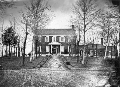
Courtesy of the Manassas Museum, circa 1862
7. The Liberia Plantation House
As of March 2009, the Museum was nearing completion of the first phase of its restoration work on the house, which aimed to stabilize the structure. Bricks have been repointed, and the roof and windows have been replaced as part of this phase.
Credits. This page was last revised on May 15, 2021. It was originally submitted on December 17, 2006. This page has been viewed 6,673 times since then and 96 times this year. Last updated on November 3, 2008. Photos: 1, 2, 3. submitted on December 17, 2006. 4. submitted on September 10, 2007, by Craig Swain of Leesburg, Virginia. 5. submitted on December 17, 2006. 6. submitted on August 26, 2020, by Bradley Owen of Morgantown, West Virginia. 7. submitted on March 31, 2009, by Kevin W. of Stafford, Virginia. 8. submitted on November 3, 2008. • Craig Swain was the editor who published this page.
