Front Royal in Warren County, Virginia — The American South (Mid-Atlantic)
Battle of Manassas Gap
Wapping Heights
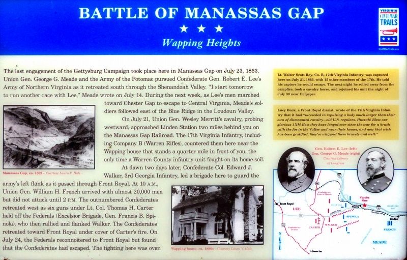
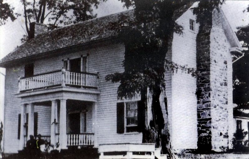
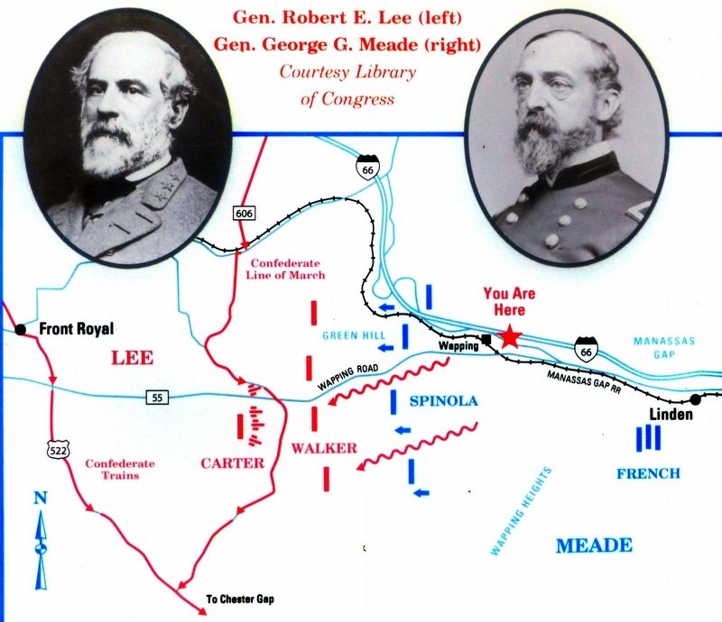
On July 21, Union Gen. Wesley Merritt's cavalry, probing westward, approached Linden Station two miles behind you on the Manassas Gap Railroad. The 17th Virginia Infantry, including Company B (Warren Rifles), countered them here near the Wapping house that stands a quarter mile in front of you, the only time a Warren County infantry unit fought on its home soil.
At dawn two days later, Confederate Col. Edward J. Walker, 3rd Georgia Infantry, led a brigade here to guard the army's left flank as it passed through Front Royal. At 10 A.M., Union Gen. Wil1iam H. French arrived with almost 20,000 men but did not attack until 2 P.M. The outnumbered Confederates retreated west as six guns under Lt. Col. Thomas H. Carter held off the Federals (Excelsior Brigade, Gen. Francis B. Spinola), who rallied and flanked Walker. The Confederates retreated toward Front Royal under cover of Carter's fire. On July 24, the Federals reconnoitered to Front Royal but found that the Confederates had escaped. The fight here was over.
(sidebar)
Lt. Walter Scott Roy, Co. B, 17th Virginia Infantry, was captured here on July 21, 1888, with 15 other members of the 17th. He told his captors he would escape. The next night he rolled away from the campfire, took a cavalry horse, and rejoined his unit the night of July 30 near Culpeper.
Lucy Buck, a Front Royal diarist, wrote of the 17th Virginia Infantry that it had “succeeded in repulsing a body much larger than their own of dismounted Cavalry—old U.S. regulars. Huzzah! Bless our glorious 17th! How they have longed ever since the war for a brush with the foe in the Valley and near their homes, and now that wish has been gratified, they've whipped them bravely and well.”
Erected by Virginia Civil War Trails.
Topics and series. This historical marker is listed in this topic list: War, US Civil. In addition, it is included in the Virginia Civil War Trails series list. A significant historical date for this entry is July 23, 1863.
Location. 38° 54.966′ N, 78° 6.547′ W. Marker is in Front Royal, Virginia, in Warren County. Marker can be reached from Dismal Hollow Road (Virginia Route 647) 0.4 miles north of John Marshall Highway (Virginia Route 55), on the right when traveling west. Marker is in the Linden Park & Ride near Linden, VA. Touch for map. Marker is at or near this postal address: 2611 Dismal Hollow Rd, Front Royal VA 22630, United States of America. Touch for directions.
Other nearby markers. At least 8 other markers are within 5 miles of this marker, measured as the crow flies. Camp Dismal Hollow (approx. 0.9 miles away); Warren County / Fauquier County (approx. 1.9 miles away); Discovery Shenandoah Valley (approx. 1.9 miles away); Chester Gap (approx. 3.9 miles away); Minding the Gaps (approx. 3.9 miles away); Warren County / Rappahannock County (approx. 4 miles away); Gettysburg Campaign (approx. 4 miles away); Site of Lane's Tavern (approx. 4.3 miles away). Touch for a list and map of all markers in Front Royal.
Also see . . . Battle of Manassas Gap/Wapping Heights. NPS Video, Cedar Creek Belle Grove, Published on July 23, 2013. (Submitted on May 9, 2019, by Allen C. Browne of Silver Spring, Maryland.)
Credits. This page was last revised on May 9, 2019. It was originally submitted on May 8, 2019, by Allen C. Browne of Silver Spring, Maryland. This page has been viewed 917 times since then and 75 times this year. Photos: 1. submitted on May 8, 2019, by Allen C. Browne of Silver Spring, Maryland. 2. submitted on May 9, 2019, by Allen C. Browne of Silver Spring, Maryland. 3, 4, 5, 6, 7. submitted on May 8, 2019, by Allen C. Browne of Silver Spring, Maryland. • Bernard Fisher was the editor who published this page.
