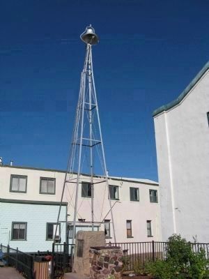
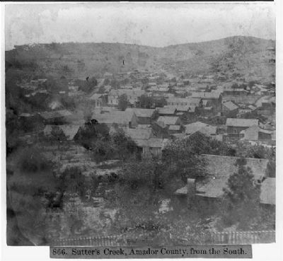
Sutter Creek in Amador County, California — The American West (Pacific Coastal)
General John A. Sutter
Sutter Creek
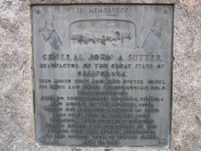
In Memory of General John A. Sutter, benefactor of the Great State of California, who mined here and gave Sutter Creek its name and under whose regime gold was discovered.
Also to those pioneer mothers, fathers and miners of the Mother Lode, which has produced millions in gold.
This rock used in Mother Lode Champion hand drilling contests.
Erected 1942 by The Native Sons and Native Daughters of the Golden West of Sutter Creek. (Marker Number 322.)
Topics and series. This historical marker is listed in this topic list: Industry & Commerce. In addition, it is included in the California Historical Landmarks, and the Native Sons/Daughters of the Golden West series lists.
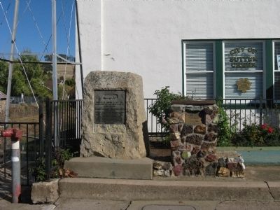
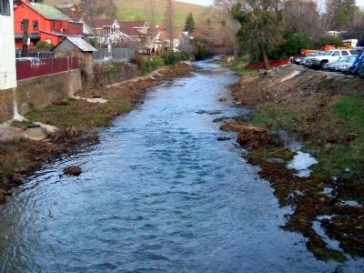
Location. 38° 23.541′ N, 120° 48.159′ W. Marker is in Sutter Creek, California, in Amador County. Marker is on Main Street (State Highway 49), on the right when traveling north. Marker is located in front of the Sutter Creek Town Hall and Police Department, next to the creek. Touch for map. Marker is at or near this postal address: 18 Main Street, Sutter Creek CA 95685, United States of America. Touch for directions.
Other nearby markers. At least 8 other markers are within walking distance of this marker. Sutter Creek United Methodist Church (within shouting distance of this marker); Robert Carlton Downs (within shouting distance of this marker); William Barker Hubbell (within shouting distance of this marker); Bellotti Inn (within shouting distance of this marker); To Remember the Men of Amador County Who Died in The World War (about 300 feet away, measured in a direct line); Knight Foundry (about 400 feet away); Native Sons Hall (about 400 feet away); Pine Woods (about 400 feet away). Touch for a list and map of all markers in Sutter Creek.
Regarding General John A. Sutter. In 1939 this site was designated California Historical Landmark No. 322, Sutter Creek - This town was named after John A. Sutter, who came to the region in 1846, and was the first to mine the locality in 1848. There was little activity at Sutter Creek until 1851, when quartz gold was discovered. In 1932 the Central Eureka mine, discovered in 1869, had reached the 2,300-foot level. By 1939, it was the best-paying mine at Sutter Creek.
Also see . . . Sutter Creek History. (Submitted on November 7, 2008, by Syd Whittle of Mesa, Arizona.)
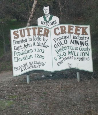
Photographed By Syd Whittle, January 10, 2006
6. Sign at Entrance to Town
Welcome - Sutter Creek - founded in 1846 by Capt. John A. Sutter. Population - 2303. Elevation - 1200. Recreation, Relaxation & Retirement. Principal Industry - Gold Mining. Production in County - $350 Million. Good Fishing and Hunting.
Credits. This page was last revised on June 17, 2023. It was originally submitted on November 7, 2008, by Syd Whittle of Mesa, Arizona. This page has been viewed 2,169 times since then and 21 times this year. Photos: 1, 2, 3, 4, 5, 6. submitted on November 7, 2008, by Syd Whittle of Mesa, Arizona. 7. submitted on April 5, 2009, by Syd Whittle of Mesa, Arizona.
