Near Tybee Island in Chatham County, Georgia — The American South (South Atlantic)
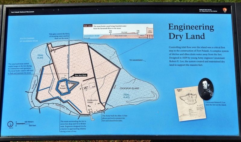
Engineering Dry Land
Fort Pulaski National Monument
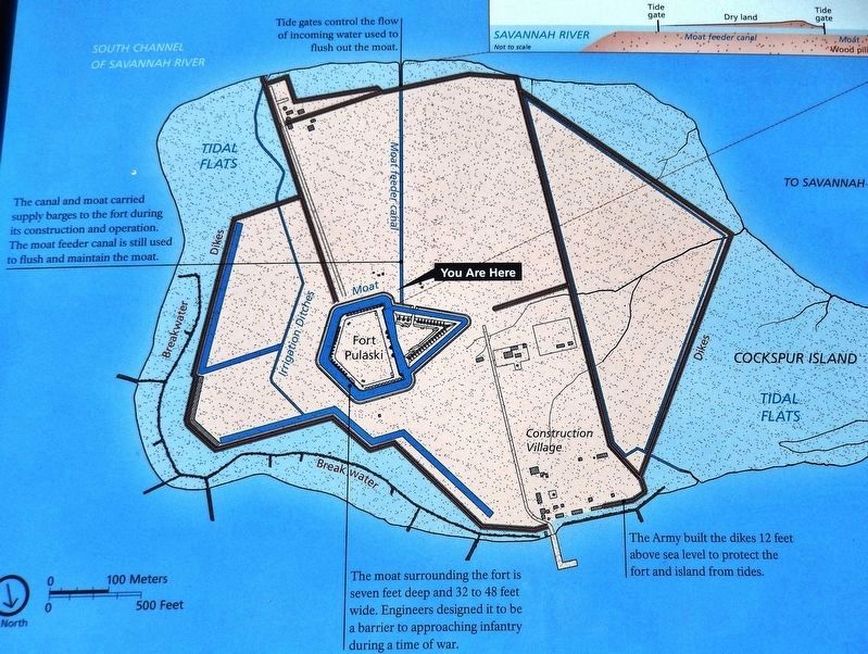
(diagram captions • counterclockwise from top)
• Tide gates control the flow of incoming water used to flush out the moat.
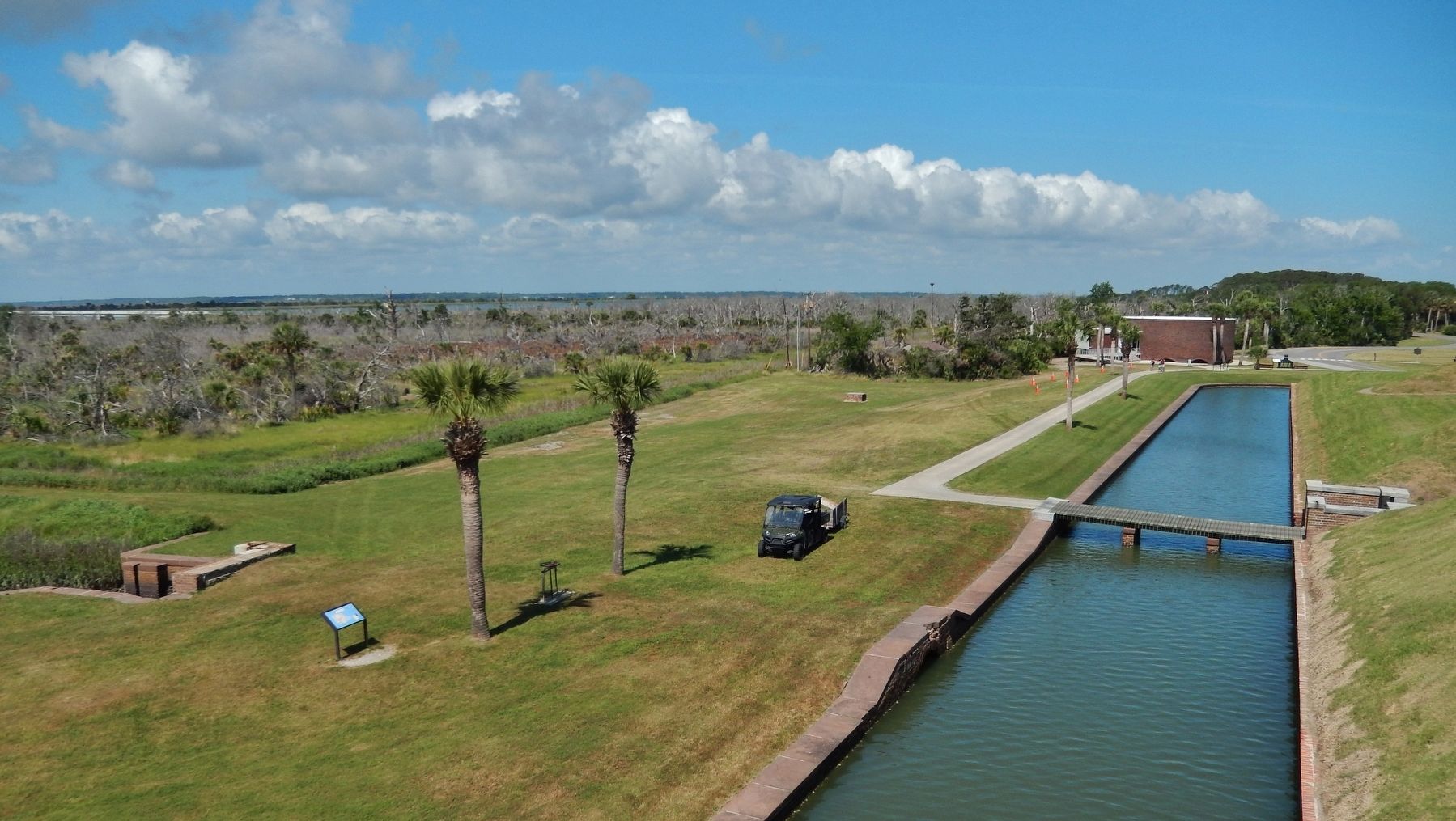
• The canal and moat carried supply barges to the fort during its construction and operation. The moat feeder canal is still used to flush and maintain the moat.
• The moat surrounding the fort is seven feet deep and 32 to 48 feet wide. Engineers designed it to be a barrier to approaching infantry during a time of war.
• The Army built the dikes 12 feet above sea level to protect the fort and island from tides.
Erected by National Park Service, U.S. Department of the Interior.
Topics. This historical marker is listed in this topic list: Forts and Castles. A significant historical year for this entry is 1829.
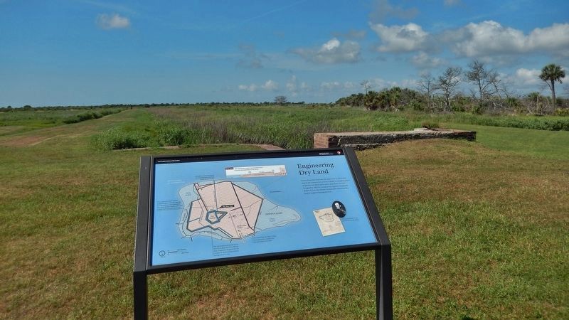
Location. 32° 1.587′ N, 80° 53.472′ W. Marker is near Tybee Island, Georgia, in Chatham County. Marker can be reached from Fort Pulaski Road, one mile north of U.S. 80. Marker is located at Fort Pulaski National Monument, overlooking the moat feeder canal, near the southwest corner of the fort. Touch for map. Marker is in this post office area: Tybee Island GA 31328, United States of America. Touch for directions.
Other nearby markers. At least 8 other markers are within walking distance of this marker. Southwest Magazine (within shouting distance of this marker); Parrott Rifle (within shouting distance of this marker); Southwest Bastion (within shouting distance of this marker); The Demilune (within shouting distance of this marker); German Volunteers (within shouting distance of this marker); Store House (within shouting distance of this marker); Fort at Play (within shouting distance of this marker); Through the Thick Brick Wall (about 300 feet away, measured in a direct line). Touch for a list and map of all markers in Tybee Island.
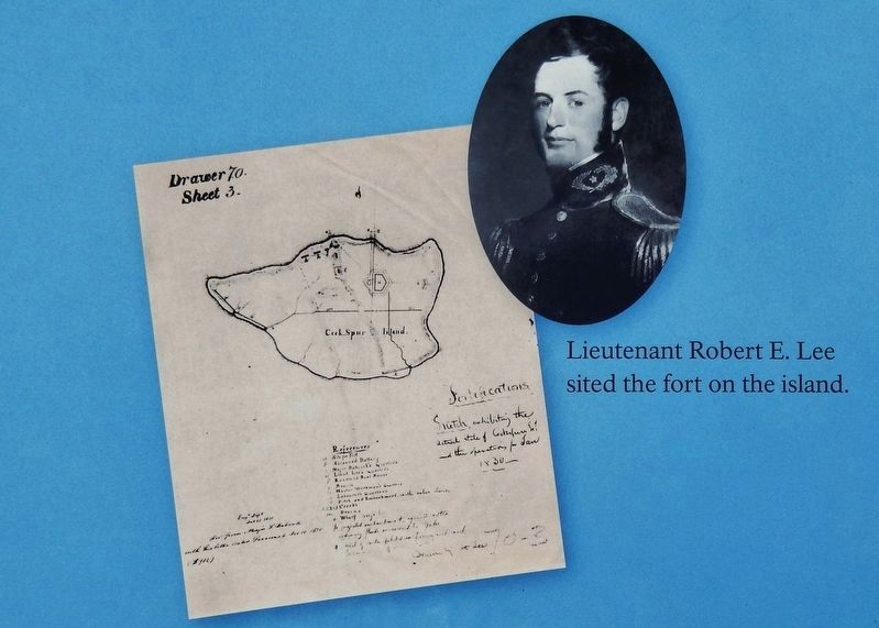
Also see . . . Robert E. Lee. Cockspur Island did not then, nor does it today, present an easy area for engineering operations. Essentially a mud and marsh island, containing a few low sand ridges, Cockspur demanded patience, skill, and strength from new Lieutenant Robert E. Lee. The stalwart young officer had a physique and mind equal to the task, however, and apparently trampled with little perturbation through the mud and marsh of Cockspur. These trying months on Cockspur must certainly have aided in the maturing of young Robert E. Lee to that calmness of purpose and quiet ability which characterized him in later life. (Submitted on May 21, 2019, by Cosmos Mariner of Cape Canaveral, Florida.)
Credits. This page was last revised on August 20, 2020. It was originally submitted on May 21, 2019, by Cosmos Mariner of Cape Canaveral, Florida. This page has been viewed 180 times since then and 19 times this year. Photos: 1, 2, 3, 4, 5, 6. submitted on May 21, 2019, by Cosmos Mariner of Cape Canaveral, Florida.
