Burlington in Boone County, Kentucky — The American South (East South Central)
Historic Burlington, KY
Settling In and Getting Around
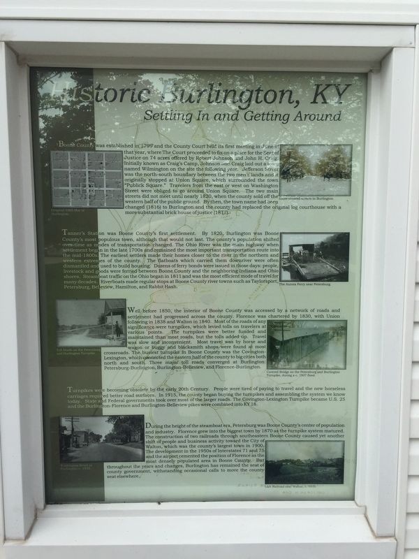
Boone County was established in 1799 and the County Court held its first meeting in June of that year, where The Court proceeded to fix on a place for the Seat of Justice on 74 acres offered by Robert Johnson and John H. Craig. Initially known as Craig’s Camp, Johnson and Craig laid out a town named Wilmington on the site the following year. Jefferson Street was the north-south boundary between the two men’s land and it originally stopped at Union Square, which surrounded the town “Publick Square.” Travelers from east or west on Washington were obliged to go around Union Square. The two main streets did not meet until nearly 1820, when the county sold off the western half of the public ground. By then, the town name had been changed to Burlington and the county had replaced the original log courthouse with a more substantial brick house of justice (1817).
Tanner’s Station was Boone County’s first settlement. By 1820, Burlington was Boone County’s most populous town, although that would not last. The county’s population shifted over time as modes of transportation changed. The Ohio River was the main highway when settlement began in the late 1700’s and remained the most important transportation mode into the mid-1800’s. The earliest settlers made their homes closer to the river in the northern and western extremes of the county. The flatboats which carried them downriver were often dismantled and used to build housing. Dozens of ferry bonds were issued in those days: people, livestock, and goods were ferried between Boone County and neighboring Indiana and Ohio shores. Steamboat traffic on the Ohio began in 1811, and was the most efficient mode of travel for many decades. Riverboats made regular stops at Boone County river towns such as Taylorsport, Petersburg, Belview, Hamilton, and Rabbit Hash.
Well before 1850, the interior of Boone County was accessed by a network of roads and settlement had progressed across the county. Florence was chartered by 1830, with Union following in 1838 and Walton in 1840. Most of the roads of any significance were turnpikes, which leveled tolls on travelers at various points. The turnpikes were better funded and maintained than most roads, but the tolls added up. Travel was slow and inconvenient. Most travel was by horse and wagon or buggy and blacksmith shops were found at most crossroads. The busiest turnpike in Boone County was the Covington-Lexington which connected the eastern half of the county to big cities north and south. Three major toll roads converged at Burlington: Petersburg-Burlington, Burlington-Belview, and Florence-Burlington.
Turnpikes were becoming obsolete by the early 20th century. People were tired of paying to travel and new horseless carriages required better road surfaces. In 1915, the county began buying turnpikes and assembling the system we know today. State and Federal governments took over most of the larger roads. The Covington-Lexington Turnpike became U.S. 25, and the Burlington-Florence and Burlington-Belview pikes were combined into KY 18.
During the height of the steamboat era, Petersburg was Boone County’s center of population and industry. Florence grew into the biggest town by 1870 as the turnpike system matured. The construction of two railroads through southwestern Boone County caused yet another shift of people and business activity toward the City of Walton, which was the county’s largest town until 1900. The development in the 1950’ of Interstates 71 and 75 and the airport cemented the population of Florence as the most densely populated area in Boone County. But throughout the years and changes, Burlington has remained the seat of county government, withstanding occasional calls to move the county seat elsewhere.
Phots, from top left and going counterclockwise:
Original 1803 Plat of Burlington
Toll Booth on Petersburg and Burlington Turnpike
Washington
Street in Burlington c. 1930
L&N Railroad near Walton, c. 1910
Covered Bridge on the Petersburg and Burlington Turnpike during c. 1907 flood
The Aurora Ferry near Petersburg
Snow-covered Streets in Burlington
Topics. This historical marker is listed in these topic lists: Roads & Vehicles • Settlements & Settlers • Waterways & Vessels. A significant historical year for this entry is 1799.
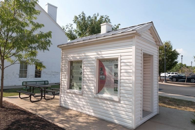
Location. 39° 1.689′ N, 84° 43.407′ W. Marker is in Burlington, Kentucky, in Boone County. Marker can be reached from Washington Street (Kentucky Route 18) near Jefferson Street (Kentucky Route 338). Located in Justice Square by new courthouse. Touch for map. Marker is in this post office area: Burlington KY 41005, United States of America. Touch for directions.
Other nearby markers. At least 8 other markers are within walking distance of this marker. A different marker also named Historic Burlington, KY (here, next to this marker); Renaker House (a few steps from this marker); a different marker also named Historic Burlington, KY (within shouting distance of this marker); Old Boone County Courthouse (within shouting distance of this marker); Foster-Sandford House (within shouting distance of this marker); From Craig’s Camp / To Burlington (within shouting distance of this marker); Burlington Presbyterian Church (within shouting distance of this marker); Stephens-Yelton House (within shouting distance of this marker). Touch for a list and map of all markers in Burlington.
Credits. This page was last revised on August 31, 2021. It was originally submitted on May 24, 2019, by Steve Stoessel of Niskayuna, New York. This page has been viewed 425 times since then and 65 times this year. Photos: 1. submitted on May 24, 2019, by Steve Stoessel of Niskayuna, New York. 2. submitted on August 31, 2021, by J. J. Prats of Powell, Ohio. • Andrew Ruppenstein was the editor who published this page.

