St. Simons Island in Glynn County, Georgia — The American South (South Atlantic)
The First Lighthouse ~ 1810
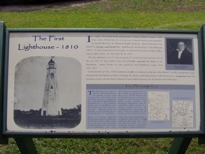
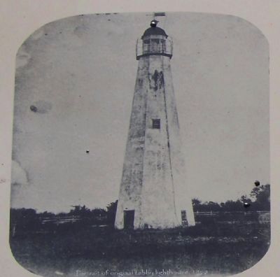
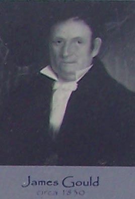
In 1804, Scottish-born plantation owner John Couper sold four acres of land for $1 to the new United States government to build the first St. Simons Light Station. James Gould was hired to design and build the lighthouse and keeper's dwelling in 1807. It was constructed of tabby - a mixture of oyster shells, lime, sand, and water. It was first lit in 1811.
The first lighthouse was 75' tall, octagonal, 25' at the base and tapered to 10' at the top. The 10' iron lantern room had oil lamps suspended by chains as the illuminant. James Gould was also appointed head lighthouse keeper from 1811-1837.
In the summer of 1861, 1500 Confederate troops were stationed on this site at Fort Brown. In 1862, Confederate troops destroyed the first lighthouse before evacuating the island so that Federal Forces could not use it as a navigational aid. The occupying troops were the African American Union soldiers known as the 1st South Carolina Volunteers.
The Plantation Era
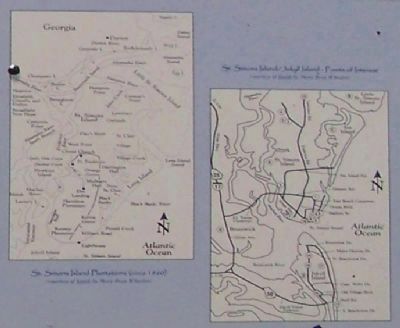
The Plantation Era began in the late 1700's and thrived on the growing of long staple cotton, known as "sea island cotton" and other crops such as indigo and rice. Cotton grew bigger and more plentifully here on the Georgia sea islands, and soon plantations were located from one tip of St. Simons to the other. Although slavery was outlawed in early Colonial days, it became legal by 1757 in Georgia.
There is a strong connection between the Coastal sea islands and the Windward Coast of West Africa due to the slave trade that played such an important role in the success of area plantations. Slaves from West Africa were highly prized for their ability to cultivate rice, and then cotton. The War Between the States brought on the virtual demise of this era. The loss of slave labor made cotton growing and harvesting unproductive and not profitable. What remains is a cultural linkage between the "Gullah/Geechee" descendants of slaves of the sea islands and the countries of their ancestors.
A few tabby ruins remain of this era at Hampton Point, Cannon's Point and Retreat Plantation. Most of the old plantation lands have been covered by growth or converted to residential or commercial properties.
Erected by Coastal Georgia Historical Society.
Topics and series. This historical marker is listed in these topic lists: Landmarks • Notable Buildings • Waterways & Vessels. In addition, it is included in the Lighthouses series list. A significant historical year for this entry is 1804.
Location. 31° 8.036′ N, 81° 23.618′ W.
Marker is on St. Simons Island, Georgia, in Glynn County. Marker is on 12th Street, on the right when traveling south. Touch for map. Marker is at or near this postal address: 101 12th Street, Saint Simons Island GA 31522, United States of America. Touch for directions.
Other nearby markers. At least 8 other markers are within walking distance of this marker. The Historic St. Simons Light Station (here, next to this marker); Early History of St. Simons Island (here, next to this marker); Historic St. Simons Lighthouse (a few steps from this marker); Fort St. Simons (a few steps from this marker); Couper's Point (within shouting distance of this marker); a different marker also named Fort St. Simons (within shouting distance of this marker); Keepers of the Light (within shouting distance of this marker); a different marker also named Fort St. Simons (within shouting distance of this marker). Touch for a list and map of all markers in St. Simons Island.
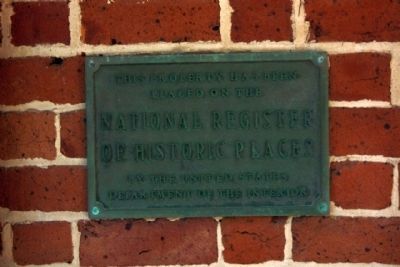
Regarding The First Lighthouse ~ 1810. National Register of Historic Places :
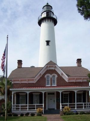
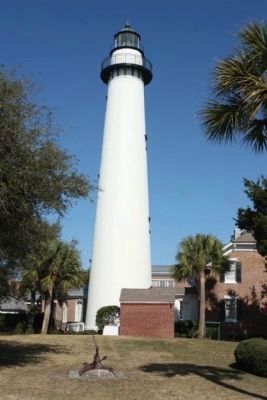
St. Simons Lighthouse and Lighthouse Keepers' Building ** (added 1972 - - #72000386)
600 Beachview Dr. , St. Simons Island
♦ Historic Significance: Information Potential, Event, Architecture/Engineering
♦ Architect, builder, or engineer: Cluskey,C.B., Poe,Bvt. Gen. O.M.
♦ Architectural Style: Other, Gothic
♦ Area of Significance: Historic - Non-Aboriginal,
Transportation, Architecture
♦ Cultural Affiliation: 19th C. coastal American
♦ Period of Significance: 1850-1874
♦ Owner: Federal , Local
♦ Historic Function: Domestic, Transportation
Credits. This page was last revised on November 25, 2020. It was originally submitted on November 10, 2008, by Mike Stroud of Bluffton, South Carolina. This page has been viewed 1,486 times since then and 35 times this year. Photos: 1, 2, 3, 4, 5. submitted on November 10, 2008, by Mike Stroud of Bluffton, South Carolina. 6, 7. submitted on January 30, 2012, by Mike Stroud of Bluffton, South Carolina. • Bill Pfingsten was the editor who published this page.
