Middleburg in Loudoun County, Virginia — The American South (Mid-Atlantic)
Phase Two of the Battle: Fighting Along the Turnpike
Battle of Middleburg/Mt. Defiance
Inscription.
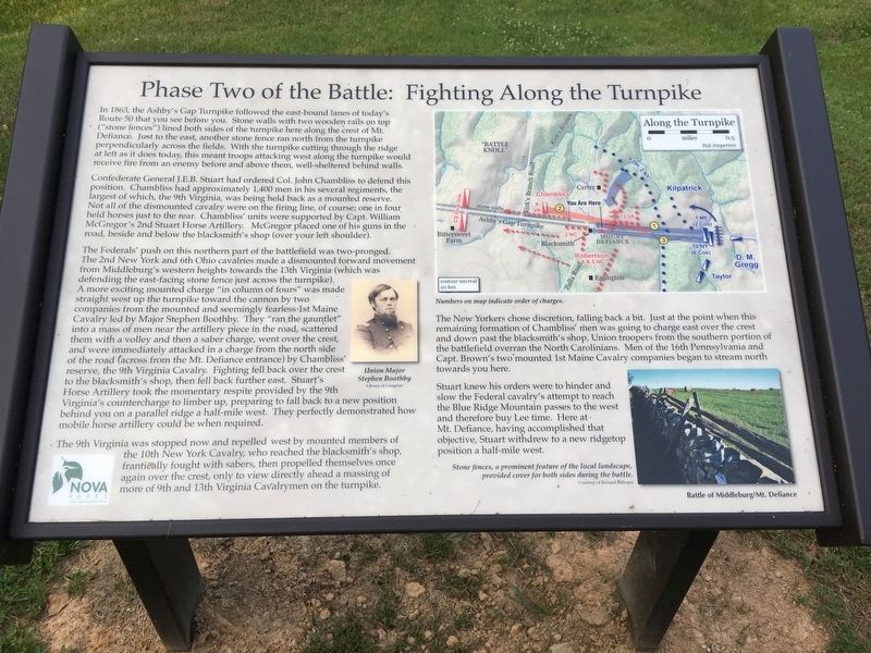
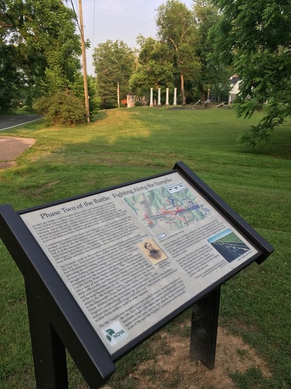
In 1863, the Ashby’s Gap Turnpike followed the east-bound lanes of today’s Route 50 that you see before you. Stone walls with two wooden rails on top (“stone fences”) lined both sides of the turnpike here along the crest of Mt. Defiance. Just to the east, another stone fence ran north from the turnpike perpendicularly across the fields. With the turnpike cutting through the ridge at left as it does today, this meant troops attacking west along the turnpike would receive fire from an enemy before and above them, well-sheltered behind walls.
Confederate General J.E.B. Stuart had ordered Col. John Chambliss to defend this position. Chambliss had approximately 1,400 men in his several regiments, the largest of which, the 9th Virginia, was being held back as a mounted reserve. Not all of the dismounted cavalry were on the firing line, of course; one in four held horses just to the rear. Chambliss’ units were supported by Capt. William McGregor’s 2nd Stuart Horse Artillery. McGregor placed one of his guns in the road, beside and below the blacksmith’s shop (over your left shoulder).
The Federals’ push on this northern part of the battlefield was two-pronged. The 2nd New York and 6th Ohio cavalries made a dismounted forward movement from Middleburg’s western heights towards the 13th Virginia (which was defending the east-facing stone fence just across the turnpike). A more exciting mounted charge “in column of fours” was made straight west up the turnpike toward the cannon by two companies from the mounted and seemingly fearless 1st Maine Cavalry led by Major Stephen Boothby. They “ran the gauntlet” into a mass of men near the artillery piece in the road, scattered them with a volley and then a saber charge, went over the crest, and were immediately attacked in a charge from the north side of the road (across from the Mt. Defiance entrance) by Chambliss’ reserve, the 9th Virginia Cavalry. Fighting fell back over the crest to the blacksmith’s shop, then fell back further east. Stuart’s Horse Artillery took the momentary respite provided by the 9th Virginia’s countercharge to limber up, preparing to fall back to a new position behind you on a parallel ridge a half-mile west. They perfectly demonstrated how mobile horse artillery could be when required.
The 9th Virginia was stopped now and repelled west by mounted members of the 10th New York Cavalry, who reached the blacksmith’s shop, frantically fought with sabers, then propelled themselves once again over the crest, only to view directly ahead a massing of more of 9th and 13th Virginia Cavalrymen on the turnpike.
The New Yorkers chose discretion, falling back a bit. Just at the point when this
remaining formation of Chambliss’ men was going to charge east over the crest and down past the blacksmith’s shop, Union troopers from the southern portion of the battlefield overran the North Carolinians. Men of the 16th Pennsylvania and Capt. Brown’s two mounted 1st Maine Cavalry companies began to stream north towards you here.
Stuart knew his orders were to hinder and slow the Federal cavalry’s attempt to reach the Blue Ridge Mountain passes to the west and therefore buy Lee time. Here at Mt. Defiance, having accomplished that objective, Stuart withdrew to a new ridgetop position a half-mile west.
Erected 2019 by NOVA Parks. (Marker Number 5.)
Topics and series. This historical marker is listed in this topic list: War, US Civil. In addition, it is included in the NOVA Parks series list. A significant historical date for this entry is June 19, 1863.
Location. 38° 58.072′ N, 77° 45.713′ W. Marker is in Middleburg, Virginia, in Loudoun County. Marker can be reached from John Mosby Highway (U.S. 50) west of Zulla Road (Virginia Route 709), on the left when traveling west. Touch for map. Marker is at or near this postal address: 35945 John Mosby Highway, Middleburg VA 20117, United States of America. Touch for directions.
Other nearby markers. At least 8 other markers are within walking distance of this marker. Mt. Defiance, the Turnpike, and Middleburg (within shouting distance of this marker); Horse Artillery at Mt. Defiance (within shouting distance of this marker); Mount Defiance (within shouting distance of this marker); The Battle Begins: Fighting East and Southeast of Mt. Defiance (about 300 feet away, measured in a direct line); The Prussian Warrior Heros Von Borcke Goes Down (about 300 feet away); a different marker also named Mount Defiance (about 300 feet away); The Battle Concludes: Buford's Flanking Movement & Stuart's Withdrawal (about 500 feet away); Battle of Middleburg (approx. 0.3 miles away). Touch for a list and map of all markers in Middleburg.
More about this marker.
(captions)
Union Major Stephen Boothby Library of Congress
Stone fences, a prominent feature of the local landscape, provided cover for both sides during the battle. Courtesy of Richard Gillespie
Along the Turnpike - number on map indicates charges.
Also see . . . Battle of Middleburg: Mt. Defiance Historic Park. NOVA Parks (Submitted on June 3, 2019.)
Credits. This page was last revised on June 14, 2020. It was originally submitted on June 2, 2019, by T. Elizabeth Renich of Winchester, Virginia. This page has been viewed 321 times since then and 29 times this year. Photos: 1, 2, 3. submitted on June 2, 2019, by T. Elizabeth Renich of Winchester, Virginia. • Bernard Fisher was the editor who published this page.


