Near Rouseville in Venango County, Pennsylvania — The American Northeast (Mid-Atlantic)
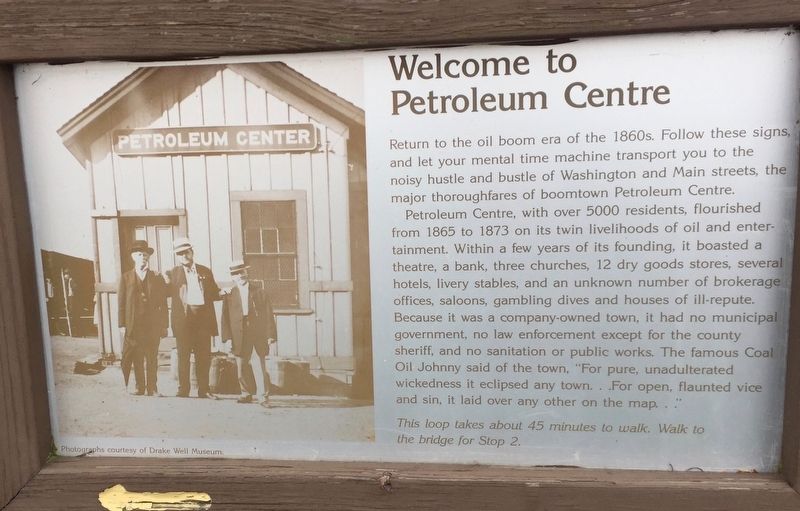
Welcome to Petroleum Centre
Return to the oil boom era of the 1860s. Follow these signs, and let your mental time machine transport you to the noisy hustle and bustle of Washington and Main streets, the major thoroughfares of boomtown Petroleum Centre.
Petroleum Centre, with over 5000 residents, flourished from 1865 to 1873 on its twin livelihoods of oil and entertainment. Within a few years of its founding, it boasted a theatre, a bank, three churches, 12 dry goods stores, several hotels, livery stables, and an unknown number of brokerage offices, saloons, gambling dives and houses of ill-repute. Because it was a company-owned town, it had no municipal government, no law enforcement except for the county sheriff, and no sanitation or public works. The famous Coal Oil Johnny said of the town, "For pure, unadulterated wickedness it eclipsed any town. . . For open, flaunted vice and sin, it laid over any other on the map..."
This loop takes about 45 minutes to walk. Walk to the bridge for Stop 2.
Topics. This historical marker is listed in these topic lists: Industry & Commerce • Parks & Recreational Areas.
Location. 41° 31.064′ N, 79° 41.03′ W. Marker is near Rouseville, Pennsylvania, in Venango County. Marker can be reached from the intersection of State Park Road and Petroleum Centre Road. In the parking lot for Park Visitors Center. Touch for map. Marker is in this post office area: Rouseville PA 16344, United States of America. Touch for directions.
Other nearby markers. At least 8 other markers are within 4 miles of this marker, measured as the crow flies. Wildcat Hollow (within shouting distance of this marker); Toll Bridge (about 700 feet away, measured in a direct line); Hyde & Egbert Farm, and the McCray Tract (approx. 0.2 miles away); Coy Coquette Locates Gusher (approx. ¼ mile away); McClintock-Steele-Waitz House (approx. 2½ miles away); Rynd Farm (approx. 2½ miles away); Humboldt Refinery (approx. 2.8 miles away); Pithole (approx. 3.4 miles away). Touch for a list and map of all markers in Rouseville.
Also see . . . Petroleum Center, PA. (Submitted on June 3, 2019, by Steve Stoessel of Niskayuna, New York.)
Credits. This page was last revised on June 5, 2019. It was originally submitted on June 3, 2019, by Steve Stoessel of Niskayuna, New York. This page has been viewed 612 times since then and 52 times this year. Photos: 1, 2. submitted on June 3, 2019, by Steve Stoessel of Niskayuna, New York. • Andrew Ruppenstein was the editor who published this page.

