Crystal City in Arlington in Arlington County, Virginia — The American South (Mid-Atlantic)
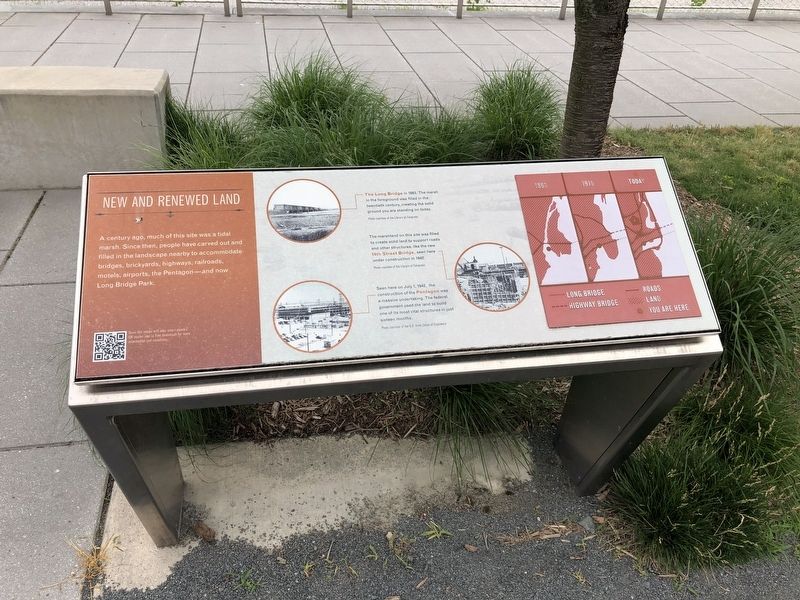
New and Renewed Land
A century ago, much of this site was a tidal marsh. Since then, people have carved out and filled in the landscape nearby to accommodate bridges, brickyards, highways, railroads, motels, airports, the Pentagon—and now Long Bridge Park.
The Long Bridge in 1863. The marsh in the foreground was filled in the twentieth century, creating the solid ground you are standing on today.
The marshland on this site was filled to create solid land to support roads and other structures, like the new 14th Street Bridge, seen here under construction in 1942.
Seen here on July 1, 1942, the construction of the Pentagon was a massive undertaking. The federal government used the land to build one of its most vital structures in just sixteen months.
Topics. This historical marker is listed in these topic lists: Bridges & Viaducts • Industry & Commerce • Railroads & Streetcars • Roads & Vehicles. A significant historical date for this entry is July 1, 1942.
Location. 38° 51.801′ N, 77° 2.881′ W. Marker is in Arlington, Virginia, in Arlington County. It is in Crystal City. Marker can be reached from 10th Street South east of South Ball Street, on the left when traveling east. Touch for map. Marker is at or near this postal address: 305 10th Street South, Arlington VA 22202, United States of America. Touch for directions.
Other nearby markers. At least 8 other markers are within walking distance of this marker. A Historic Junction (within shouting distance of this marker); Fort Runyon after the Civil War (approx. 0.2 miles away); Known Units Garrisoned at Fort Runyon (approx. 0.2 miles away); The Union Soldier (approx. 0.2 miles away); Arlington Transformed by War (approx. 0.2 miles away); The Defenses of Washington (approx. 0.2 miles away); The March Across the Long Bridge (approx. 0.2 miles away); Fort Runyon: Defending the Capital (approx. 0.2 miles away). Touch for a list and map of all markers in Arlington.
Credits. This page was last revised on February 1, 2023. It was originally submitted on June 7, 2019, by Devry Becker Jones of Washington, District of Columbia. This page has been viewed 138 times since then and 8 times this year. Photo 1. submitted on June 7, 2019, by Devry Becker Jones of Washington, District of Columbia.
Editor’s want-list for this marker. A wide-view shot of the marker in context. • Can you help?
