Tehachapi in Kern County, California — The American West (Pacific Coastal)
Importance of Water and Creation of Brite Lake
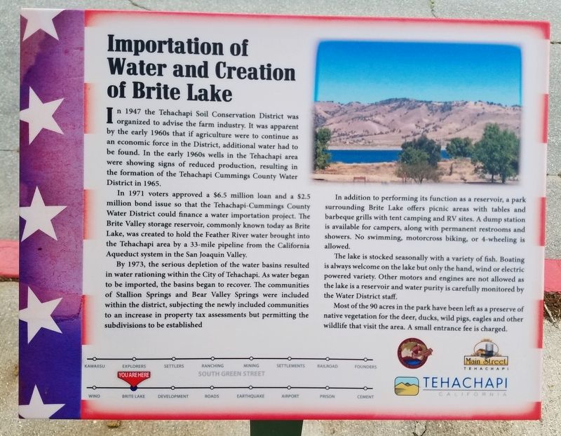
In 1947 the Tehachapi Soil Conservation District was organized to advise the farm industry. It was apparent by the early 1960s that if agriculture were to continue as economic force in the District, additional water had to be found. In the early 1960s wells in the Tehachapi area were showing signs of reduced production, resulting in the formation of the Tehachapi Cummings County Water District in 1965.
In 1971 voters approved a $6.5 million loan and a $2.5 million bond issue so that the Tehachapi-Cummings County Water District could finance a water importation project. The Brite Valley storage reservoir, commonly known today as Brite Lake, was created to hold the Feather River water brought into the Tehachapi are by a 33 mile pipeline from the California aqueduct system in the San Joaquin Valley.
By 1973, the serious depletion of the water basins resulted in water rationing within the City of Tehachapi. As water began to be imported, the basins began to recover. The communities of Stallion Springs and Bear Valley Springs were included within the district, subjecting the newly included communities to an increase in property tax assessments but permitting the subdivisions to be established.
In addition to performing its function as a reservoir, a park surrounding Brite Lake offers picnic areas with tables and barbeque grills with tent camping and RV sites. A dump station is available for campers, along with permanent restrooms and showers. No swimming, motorcross biking, or 4-wheeling is allowed.
The lake is stocked seasonally with a variety of fish. Boating is always welcome on the lake but only the hand, wind or electric powered variety. Other motors and engines are not allowed as the lake is reservoir and water purity is carefully monitored by the Water District staff.
Most of the 90 acres in the park have been left as a reserve of native vegetation for the deer, ducks, wild pigs, eagles and other wildlife that visit the area. A small entrance fee is charged.
Erected by Main Street Tehachapi, Tehachapi Heritage League, City of Tehachapi.
Topics. This historical marker is listed in these topic lists: Agriculture • Environment • Industry & Commerce • Waterways & Vessels. A significant historical year for this entry is 1947.
Location. 35° 7.785′ N, 118° 26.872′ W. Marker is in Tehachapi, California, in Kern County. Marker is at the intersection of Green Street and E Street, on the right when traveling north on Green Street. Located in front of the Church. Touch for map. Marker is at or near this postal address: 100 East E Street, Tehachapi CA 93561, United States of America. Touch for directions.
Other nearby markers. At least 8 other markers are within walking distance of this marker. Early Explorers in the Tehachapi Area (a few steps from this marker); Tehachapi Museum (within shouting distance of this marker); a different marker also named The Tehachapi Museum (within shouting distance of this marker); Real Estate Development Since The 1960s (within shouting distance of this marker); Wind Energy Industry (within shouting distance of this marker); Errea House (within shouting distance of this marker); The Kawaiisu (within shouting distance of this marker); Former Post Office (within shouting distance of this marker). Touch for a list and map of all markers in Tehachapi.
Credits. This page was last revised on July 3, 2023. It was originally submitted on June 8, 2019, by Denise Boose of Tehachapi, California. This page has been viewed 405 times since then and 47 times this year. Photos: 1, 2. submitted on June 8, 2019, by Denise Boose of Tehachapi, California. • Andrew Ruppenstein was the editor who published this page.

