Bridgetown, Saint Michael, Barbados — Caribbean Region of the Americas (Lesser Antilles of the West Indies)
Commissariat for the British Commission
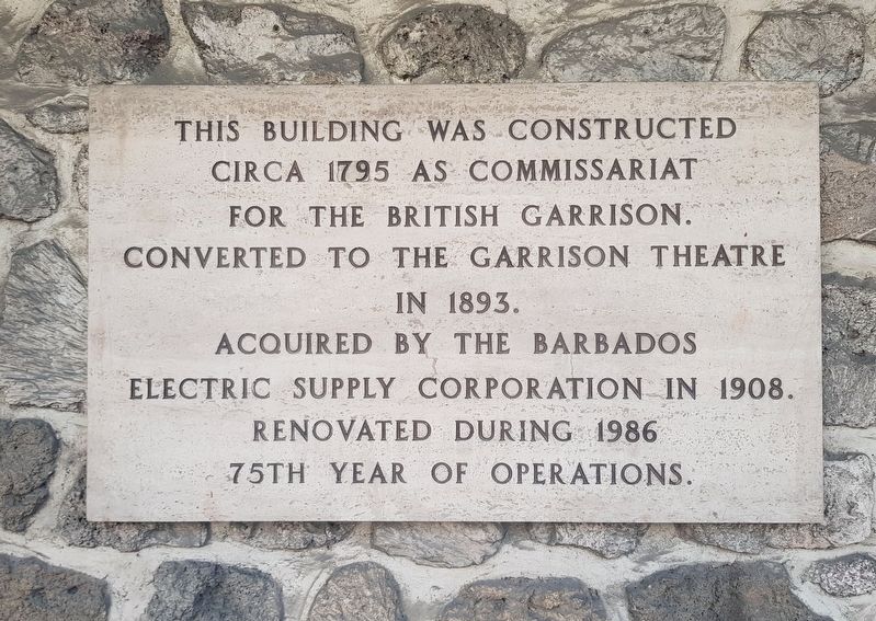
This building was constructed circa 1795 as Commissariat for the British Commission. Converted to the Garrison Theatre in 1893. Acquired by the Barbados Electric Supply Corporation in 1908. Renovated during 1986
75th year of operations.
Additional marker:
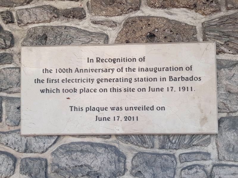
In Recognition of the 100th Anniversary of the inauguration of the first electricity generating station in Barbados which took place on this site on June 17, 1911.
This plaque was unveiled on June 17, 2011.
Erected 2011.
Topics. This historical marker is listed in these topic lists: Arts, Letters, Music • Government & Politics • Industry & Commerce • Man-Made Features. A significant historical date for this entry is June 17, 1911.
Location. 13° 4.883′ N, 59° 36.467′ W. Marker is in Bridgetown, Saint Michael. Marker is at the intersection of Hastings Main Road (Route H7) and Bush Hill Road, on the left when traveling north on Hastings Main Road. Touch for map. Marker is in this post office area: Bridgetown, Saint Michael BB14038, Barbados. Touch for directions.
Other nearby markers. At least 8 other markers are within walking distance of this marker. Monument to Those Lost in the 1831 Hurricane (about 120 meters away, measured in a direct line); Royal Artillery Barracks (about 150 meters away); The Main Guard (about 150 meters away); Engineer’s Office & Quarters (about 180 meters away); Errol Walton Barrow (about 180 meters away); Commonwealth War Graves (approx. 0.3 kilometers away); Barbados Independence Monument (approx. 0.3 kilometers away); The Barbados Military Cemetery (approx. 0.3 kilometers away). Touch for a list and map of all markers in Bridgetown.
Credits. This page was last revised on June 10, 2019. It was originally submitted on June 10, 2019, by J. Makali Bruton of Accra, Ghana. This page has been viewed 154 times since then and 8 times this year. Photos: 1, 2, 3. submitted on June 10, 2019, by J. Makali Bruton of Accra, Ghana.


