Cumberland Township near Gettysburg in Adams County, Pennsylvania — The American Northeast (Mid-Atlantic)
Culp's Hill
"The barb of the hook"
Topics. This historical marker is listed in this topic list: War, US Civil. A significant historical month for this entry is July 1961.
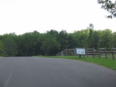
Location. 39° 49.553′ N, 77° 13.439′ W. Marker is near Gettysburg, Pennsylvania, in Adams County. It is in Cumberland Township. Marker is on East Confederate Avenue, on the right when traveling south. Located adjacent to the Gettysburg Middle School, in the Gettysburg National Military Park. Touch for map. Marker is in this post office area: Gettysburg PA 17325, United States of America. Touch for directions.
Other nearby markers. At least 8 other markers are within walking distance of this marker. Hoke's Brigade (approx. 0.2 miles away); Gordon's Brigade (approx. 0.2 miles away); Hays's Brigade (approx. ¼ mile away); Early's Division (approx. ¼ mile away); Henry Culp Farm (approx. ¼ mile away); 25th and 75th Ohio Infantry Regiments (approx. 0.3 miles away); 17th Connecticut Volunteers (approx. 0.3 miles away); Jones's Brigade (approx. 0.3 miles away). Touch for a list and map of all markers in Gettysburg.
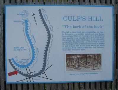
More about this marker. On the left side of the marker is a map of the respective army positions. On the lower right is a Sketch of action on Culp's Hill, by Edwin Forbes.
Related markers. Click here for a list of markers that are related to this marker. East Confederate Avenue Markers and Monuments.
Credits. This page was last revised on February 7, 2023. It was originally submitted on November 12, 2008, by Craig Swain of Leesburg, Virginia. This page has been viewed 1,255 times since then and 21 times this year. Photos: 1, 2. submitted on November 12, 2008, by Craig Swain of Leesburg, Virginia.

