Roseau, Saint George, Dominica — Caribbean Region of the Americas (Lesser Antilles of the West Indies)
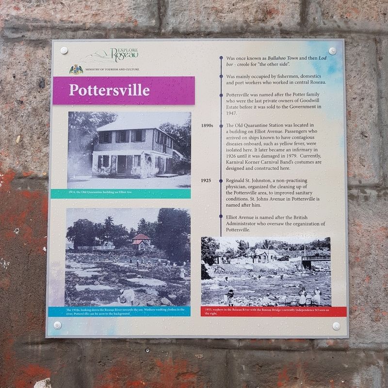
Pottersville
Explore Roseau
Pottersville
Was once known as Ballahoo Town and then Lod bor – creole for “the other side”.
Was mainly occupied by fishermen, domestics and port workers who worked in Roseau.
Pottersville was named after the Potter family who were the last private owners of Goodwill Estate before it was sold to the Government in 1947.
1890s The Old Quarantine Station was located in a building on Elliot Avenue. Passengers who arrived on ships known to have contagious diseases onboard, such as yellow fever, were isolated here. It later became an infirmary in 1926 until it was damaged in 1979. Currently, Karnival Korner Carnival Band’s costumes are designed and constructed here.
1925 Reginald St. Johnston, a non-practising physician, organized the cleaning up of the Pottersville area, to improved sanitary conditions. St. Johns Avenue in Pottersville is named after him.
Elliot Avenue is named after the British Administrator who oversaw the organization of Pottersville.
Captions: 1924, the Old Quarantine building on Elliot Ave.
The 1910s, looking down the Roseau River towards the sea. Washers washing clothes in the river, Pottersville can be seen in the background.
1955, washers in the Roseau River with the Roseau Bridge (currently Independence St) seen on the right.
Erected by Ministry of Tourism and Culture.
Topics. This historical marker is listed in these topic lists: Colonial Era • Settlements & Settlers. A significant historical year for this entry is 1947.
Location. 15° 18.028′ N, 61° 23.415′ W. Marker is in Roseau, Saint George. Marker is at the intersection of Elliot Avenue and St. John's Avenue, on the left when traveling north on Elliot Avenue. Touch for map. Touch for directions.
Other nearby markers. At least 8 other markers are within walking distance of this marker. Roseau Bayfront (approx. 0.3 kilometers away); a different marker also named Pottersville (approx. half a kilometer away); a different marker also named Roseau Bayfront (approx. half a kilometer away); Methodist Church (approx. 0.6 kilometers away); Roseau Cathedral (approx. 0.6 kilometers away); Glory to the French from Dominica (approx. 0.6 kilometers away); World Wars Memorial (approx. 0.6 kilometers away); Simon Bolivar (approx. 0.6 kilometers away). Touch for a list and map of all markers in Roseau.
Credits. This page was last revised on June 15, 2019. It was originally submitted on June 15, 2019, by J. Makali Bruton of Accra, Ghana. This page has been viewed 273 times since then and 22 times this year. Photos: 1, 2. submitted on June 15, 2019, by J. Makali Bruton of Accra, Ghana.

