Roseau, Saint George, Dominica — Caribbean Region of the Americas (Lesser Antilles of the West Indies)
Roseau Bayfront
Ferry Terminal
— Explore Roseau —
Ferry Terminal
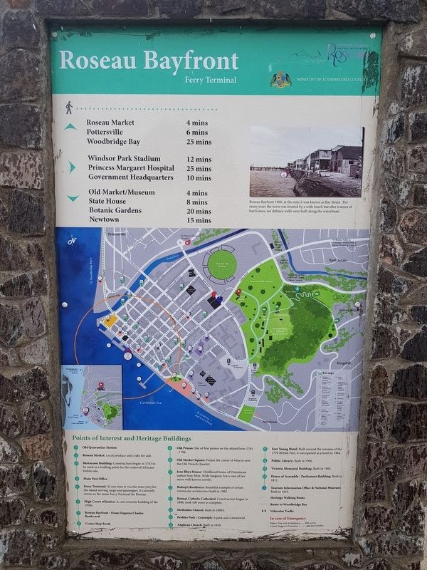
Roseau Bayfront 1900, at the time it was known as Bay Street. For many years the town was fronted by a wide beach but after a series of hurricanes, sea defence walls were built along the waterfront.
Walking distances to various historic sites and landmarks
Points of Interest and Historic Buildings
1 Old Quarantine Station
2 Roseau Market: Local produce and crafts for sale.
3 Barracoon Building: Construction began in 1763 to be used as a holding point for the enslaved Africas before sale.
4 Main Post Office
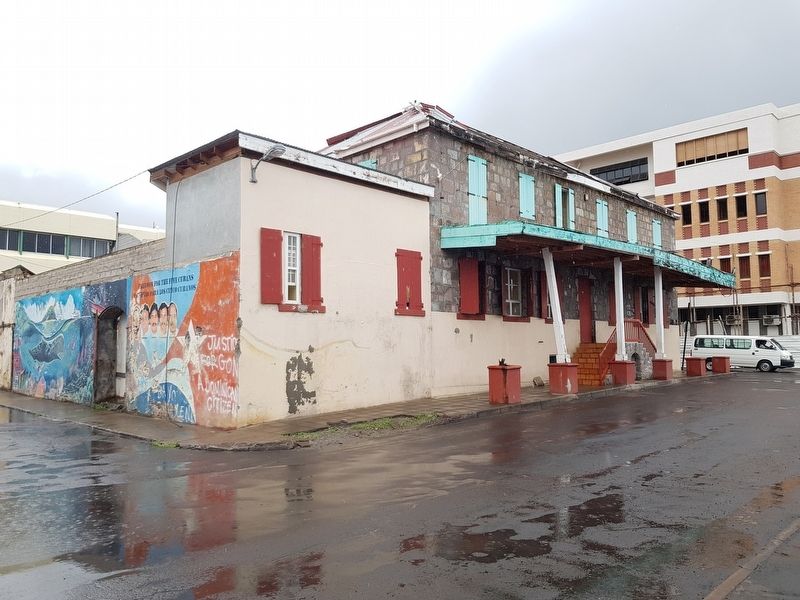
5 Ferry Terminal: At one time it was the main jetty for the island serving cargo and passengers. It current serves as the main Ferry Terminal for Roseau.
6 High Court of Justice: A cast concrete building of the 1920s.
7 Roseau Bayfront/Dame Eugenia Charles Boulevard.
8 Cruise Ship Berth
9 Old Prison: Site of the first prison on the island from 1761-1784.
10 Old Market Square: Forms the centre of what is now the Old French Quarter.
11 Jean Rhys House: Childhood home of Dominican author Jean Ryhs. Wide Sargasso Sea is one of her more well-known novels.
12 Bishop’s Residence: Beautiful example of ornate vernacular architecture built in 1902.
13 Roman Catholic Cathedral: Construction began in 1800, took 100 years to complete.
14 Methodist Church: Built in the 1800’s.
15 Peebles Park/Cenotaph: A park and a memorial.
16 Anglican Church: Built in 1820.
17 Fort Young Hotel: Built around the remains of the 1770 British Fort, it was opened as a hotel in 1964.
18 Public Library: Built in 1906.
19 Victoria Memorial Building: Built in 1902.
20 House of Assembly/Parliament Building: Built in 1811.
i Tourism Information Office & National Museum: Built in 1810.
Map key and emergency information
French:
Terminal Des Ferries
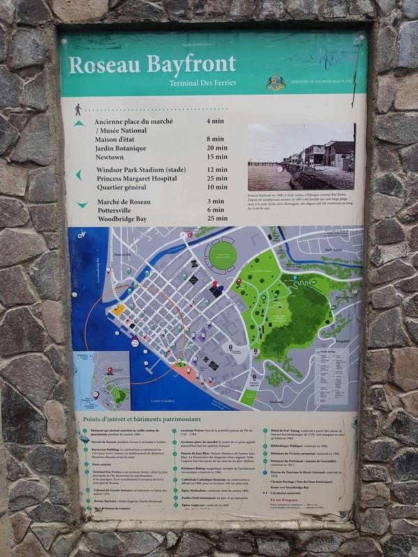
Roseau Bayfront en 1900, il était connu, à l’époque comme Bay Street. Depuis de nombreuses années, la ville a été bordée par une large plage, mais à la suite d’une série d’ouragans, des digues ont été construits au long du front de mer.
Durée de la marche vers divers sites et monuments historiques
Points d'intérêt et bâtiments patrimoniaux
1 Bâtiment qui abritait autrefois la vielle station de quarantaine pendant les années 1890
2 Marché de Roseau: produits locaux et artisanat à vendre.
3 Barracoon Building: la construction a commencé en 1763 pour servir comme un établissemente de détention d’esclaves africaines avant la vente.
4 Poste centrale
5 Terminal Des Ferries: à un moment donné, c’était la jetée principale de l'île desservant les marchandises et les passagers. Il est actuellement le terminal de ferry principal de Roseau.
6 Terminal de Grande Instance: un bâtiment en béton des années 1920.
7 Roseau Bayfront / Dame Eugenia Charles Boulivard.
8 Quai de bateau de croisière
9 Ancienne prison: lieu de la première prison de l'île de 1761-1784.
10 Ancienne place du marché: le centre de ce qu’on appellee aujourd’hui l’ancien quartier français.
11 Maison Jean Rhys: Maison d'enfance de l'auteur Jean Ryhs. La Prisionnière des Sargasses (titre original: Wide Sargasso Sea ait partie de se œuvres les plus célèbres.
12 Résidence Bishop: manifique exemple d’architecture vernaculaire construit en 1902.
13 Cathédrale Catholique Romaine: sa construction a débuté en 1800, pour se terminer 100 ans plus tard.
14 Église Méthodiste: construite dans le années 1800.
15 Peebles Park / monument: un parc et un mémorial.
16 Église Anglicane: construit en 1820.
17 Hôtel de Fort Young: construit à partir des ruines de l’ancien fort
britannique de 1770, c’est inauguré en tant qu'hôtel en 1964.
18 Bibliothèque Publique: construit en 1906.
19 Bâtiment du Victoria mémorial: construit en 1902.
20 Bâtiment du Parlement / maison de l’assemblée: construit en 1811.
i Bureau du Tourisme & Musée National: construit en 1810.
Clef de la carte et informations d’urgence
Erected by Ministry of Tourism and Culture.
Topics. This historical marker is listed in these topic lists: Colonial Era • Man-Made Features • Waterways & Vessels. A significant historical year for this entry is 1900.
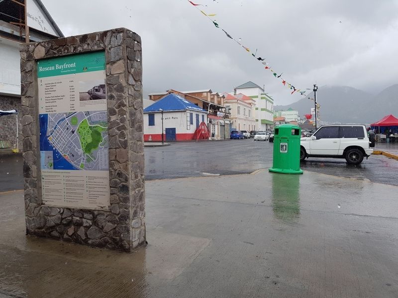
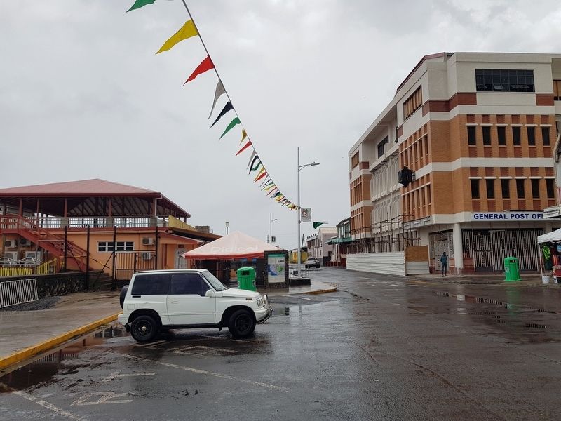
Location. 15° 17.871′ N, 61° 23.361′ W. Marker is in Roseau, Saint George. Marker is at the intersection of Dame Mary Eugenia Charles Boulevard and Drury Lane, on the left when traveling west on Dame Mary Eugenia Charles Boulevard. Touch for map. Touch for directions.
Other nearby markers. At least 8 other markers are within walking distance of this marker. A different marker also named Roseau Bayfront (approx. 0.2 kilometers away); Pottersville (approx. 0.3 kilometers away); Glory to the French from Dominica (approx. 0.3 kilometers away); World Wars Memorial (approx. 0.4 kilometers away); Methodist Church (approx. 0.4 kilometers away); Roseau Cathedral (approx. 0.4 kilometers away); Anglican Church
(approx. 0.4 kilometers away); Carnegie Library of Roseau (approx. half a kilometer away). Touch for a list and map of all markers in Roseau.
Credits. This page was last revised on June 16, 2019. It was originally submitted on June 16, 2019, by J. Makali Bruton of Accra, Ghana. This page has been viewed 322 times since then and 53 times this year. Photos: 1, 2, 3, 4, 5. submitted on June 16, 2019, by J. Makali Bruton of Accra, Ghana.
