Gate City in Scott County, Virginia — The American South (Mid-Atlantic)
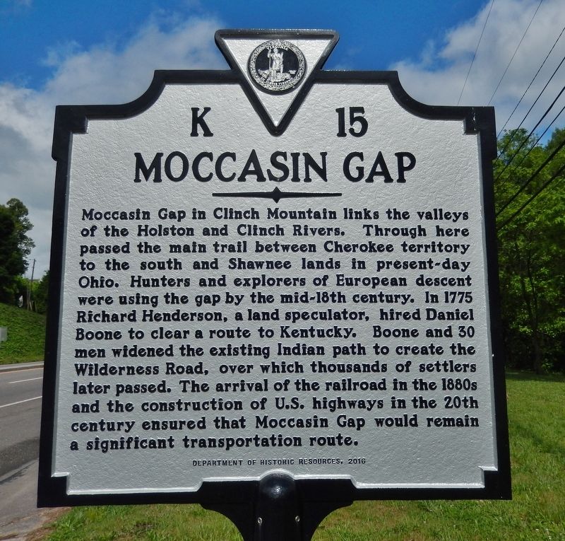
Moccasin Gap
Erected 2016 by Department of Historic Resources. (Marker Number K-15.)
Topics and series. This historical marker is listed in these topic lists: Exploration • Native Americans • Roads & Vehicles • Settlements & Settlers. In addition, it is included in the Virginia Department of Historic Resources (DHR) series list. A significant historical year for this entry is 1775.
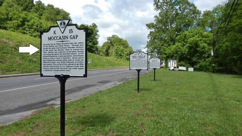
Location. 36° 38.27′ N, 82° 33.721′ W. Marker is in Gate City, Virginia, in Scott County. Marker is on U.S. 23/58, 0.3 miles east of Kane Street, on the right when traveling west. Marker is located in a small wayside park on the north side of the highway as you approach Gate City. This is third-from-the-west of five markers at this location. Touch for map. Marker is in this post office area: Gate City VA 24251, United States of America. Touch for directions.
Other nearby markers. At least 8 other markers are within walking distance of this marker. John P. McConnell (here, next to this marker); First Court of Scott County (a few steps from this marker); Prospect Public School (a few steps from this marker); Donelson's Indian Line (a few steps from this marker); Carter Musical Family (within shouting distance of this marker); Blackmore’s Fort (approx. 0.4 miles away); Gate City (approx. 0.4 miles away); a different marker also named Donelson's Indian Line (approx. 0.4 miles away). Touch for a list and map of all markers in Gate City.
Related markers. Click here for a list of markers that are related to this marker. Daniel Boone Trail, Gate City, Virginia
Credits. This page was last revised on July 9, 2021. It was originally submitted on June 21, 2019, by Cosmos Mariner of Cape Canaveral, Florida. This page has been viewed 720 times since then and 49 times this year. Photos: 1, 2. submitted on June 22, 2019, by Cosmos Mariner of Cape Canaveral, Florida.

