State College in Centre County, Pennsylvania — The American Northeast (Mid-Atlantic)
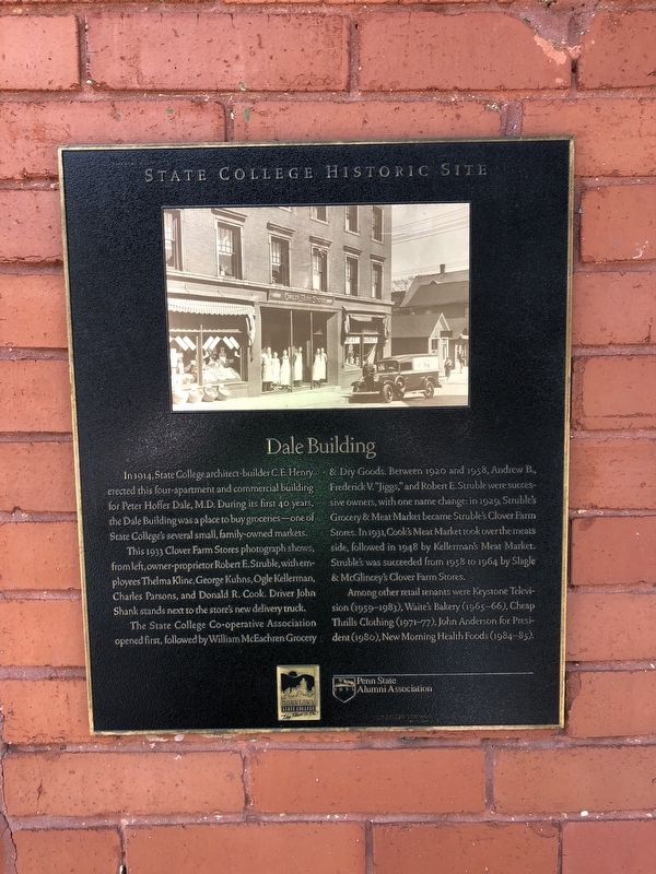
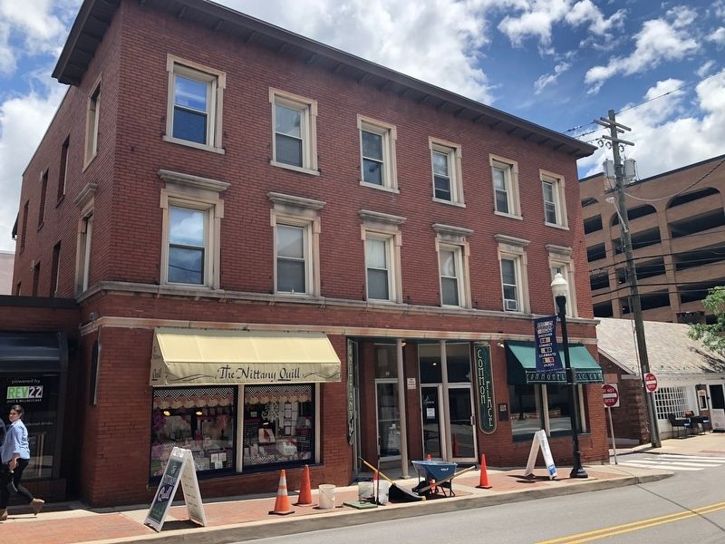
Dale Building
State College Historic Site
This 1933 Clover Farm Stores photograph shows, from left, owner-proprietor Robert E. Struble, with employees Thelma Kline, George Kuhns, Ogle Kellerman, Charles Parsons, and Donald R. Cook. Driver John Shank stands next to the store's new delivery truck.
The State College Co-operative Association opened first, followed by William McEachren Grocery & Dry Goods. Between 1920 and 1958, Andrew B., Frederick V. "Jiggs," and Robert E. Struble were successive owners, with one name change: in 1929, Struble's Grocery & Meat Market became Struble's Clover Farm Stores. In 1931, Cook's Meat Market took over the meats side, followed in 1948 by Kellerman's Meat Market. Struble's was succeeded from 1958 to 1964 by Slagle & McGlincey's Clover Farm Stores.
Among other retail tenants were Keystone Television (1959-1983), Waite's Bakery (1965-66), Cheap Thrills Clothing (1971-77), John Anderson for President (1980), New Morning Health Foods (1984-85).
Erected by Downtown State College; Penn State Alumni Association .
Topics and series. This historical marker is listed in these topic lists: Government & Politics • Industry & Commerce. In addition, it is included in the Pennsylvania State University series list. A significant historical year for this entry is 1914.
Location. 40° 47.602′ N, 77° 51.745′ W. Marker is in State College, Pennsylvania, in Centre County. Marker is on South Fraser Street south of West College Avenue (Pennsylvania Route 26), on the right when traveling north. Touch for map. Marker is at or near this postal address: 109 South Fraser Street, State College PA 16801, United States of America. Touch for directions.
Other nearby markers. At least 8 other markers are within walking distance of this marker. The State Theatre (within shouting distance of this marker); Heart-Assist Pump (within shouting distance of this marker); Diesel Engineering (within shouting distance of this marker); Wake Turbulence (about 300 feet away, measured in a direct line); Industry Research (about 300 feet away); Old Engineering (about 400 feet away); Hotel State College (about 400 feet away); The Bent of Tau Beta Pi (about 400 feet away). Touch for a list and map of all markers in State College.
Credits. This page was last revised on June 22, 2019. It was originally submitted on June 22, 2019, by Devry Becker Jones of Washington, District of Columbia. This page has been viewed 158 times since then and 17 times this year. Photos: 1, 2. submitted on June 22, 2019, by Devry Becker Jones of Washington, District of Columbia.

