Cumberland Township near Gettysburg in Adams County, Pennsylvania — The American Northeast (Mid-Atlantic)
Smith's Brigade
Early's Division - Ewell's Corps
— Army of Northern Virginia —
Army of Northern Virginia
Ewell's Corps Early's Division
Smith's Brigade
31st. 49th. 52nd. Virginia Infantry
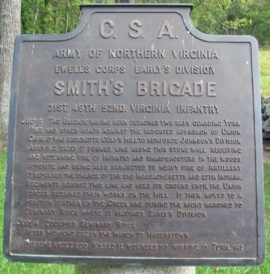
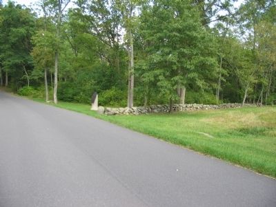
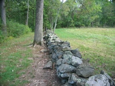
July 3 The Brigade having been detached two days guarding York Pike and other roads against the reported approach of Union Cavalry was ordered to Culp's Hill to reinforce Johnson's Division. Arriving early it formed line along this stone wall receiving and returning fire of Infantry and sharpshooters in the woods opposite and being also subjected to heavy fire of Artillery. It repulsed the charge of the 2nd Massachusetts and 27th Indiana Regiments against this line and held its ground until the Union forces regained their works on the Hill. It then moved to a position further up the Creek and during the night marched to Seminary Ridge where it rejoined Early's Division.
July 4 Occupied Seminary Ridge. After midnight began the march to Hagerstown.
Present about 800. Killed 12, wounded 113, missing 17. Total 142.
Erected 1910 by Gettysburg National Military Park Commission.
Topics. This historical marker is listed in this topic list: War, US Civil. A significant historical date for this entry is July 3, 1863.
Location. 39° 48.912′ N, 77° 12.952′ W. Marker is near Gettysburg, Pennsylvania, in Adams County . It is in Cumberland Township. Marker is at the intersection of East Confederate Avenue and Colgrove Avenue, on the left when traveling south on East Confederate Avenue. Located at stop 13 (Spangler's Spring) on the driving tour of Gettysburg National Military Park. Touch for map. Marker is in this post office area: Gettysburg PA 17325, United States of America. Touch for directions.
Other nearby markers. At least 8 other markers are within walking distance of this marker. Walker's Brigade (within shouting distance of this marker); 1st Maryland Regiment (about 300 feet away, measured in a direct line); 107th New York Infantry (about 300 feet away); 27th Indiana Infantry (about 300 feet away); 46th Pennsylvania Infantry (about 400 feet away); 145th New York Infantry (about 400 feet away); Myth, Memory, and Honor (about 400 feet away); The Fight at Spangler's Spring (about 400 feet away). Touch for a list and map of all markers in Gettysburg.
Also see . . .
1. Report of Col. John S. Hoffman, Thirty-first Virginia Infantry. Col. Hoffman filed the Brigade's report. Of the actions on July 3, Hoffman wrote:
On the morning of the 3d, the Forty-ninth and Fifty-second Virginia Regiments moved to the left and forward eastwardly, crossing the creek, and formed between the creek and the enemy's works near the left of General Johnson s division, and thence moved to the left, and formed nearly at right angles to the extreme left of that
division, when the Forty-ninth, supported by the Fifty-second Virginia Regiment, advanced upon a large body of the enemy near the left flank of that division, and dislodged it from its position. The Thirty-first Virginia Regiment having been relieved by General Stuart and joining the others about this time, the Forty-ninth Virginia Regiment was left, while the other two regiments recrossed the creek and moved down southeastwardly, and formed, and thence moved back up the creek and to the rear, and rested, when they were joined by the Forty-ninth Virginia Regiment. (Submitted on November 15, 2008, by Craig Swain of Leesburg, Virginia.)
2. General William "Extra Billy" Smith. Smith, who owed his position and rank more to political connections as former Governor of Virginia, was not considered reliable by many of his superiors. Following Gettysburg, he resigned on July 10 over perceived slights by Generals Early and Ewell, his commanders. (Submitted on November 15, 2008, by Craig Swain of Leesburg, Virginia.)
3. Smith's Brigade. Gettysburg Daily article. (Submitted on December 2, 2008, by Craig Swain of Leesburg, Virginia.)
Photographed By Craig Swain, September 17, 2008
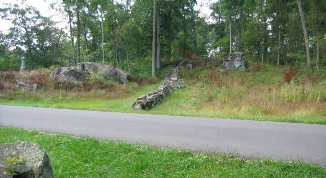
4. West Side of the Stone Wall
From the Smith Brigade tablet, looking at the west side of Confederate Avenue. The stone wall extended to the lower crest of Culp's Hill. During the evening phases of the fighting on July 2, Steuart's Brigade advanced a line outward and further up the hill into the Federal breastworks. Steuart's Brigade held a line extending to the north (right) of the wall at this point near the close of the fighting in this sector on July 3. Note the Federal regimental monuments on the hill crest. Visible are those for the 107th New York and 1st Maryland Potomac Home Guard.
Photographed By Craig Swain, September 17, 2008
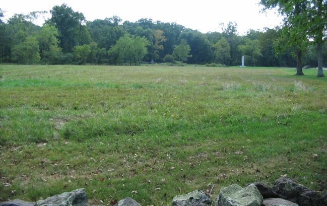
5. Smith's Brigade View of the Meadow
Looking from the stone wall. In the right center stands the Indiana State Memorial. A small marker stone indicates the advance position of the 27th Indiana Infantry. Smith's Brigade poured a devastating fire upon the advancing 27th Indiana and 2nd Massachusetts, which were exposed in the open ground in front of the wall. Following the repulse of the 27th Indiana, elements of Smith's Brigade advanced into the meadow and fired on the flank and rear of the 2nd Massachusetts.
Credits. This page was last revised on February 7, 2023. It was originally submitted on November 15, 2008, by Craig Swain of Leesburg, Virginia. This page has been viewed 1,237 times since then and 13 times this year. Photos: 1, 2, 3, 4, 5. submitted on November 15, 2008, by Craig Swain of Leesburg, Virginia.
