Near Santa Rosa Jáuregui in Querétaro, Mexico — The Central Highlands (North America)
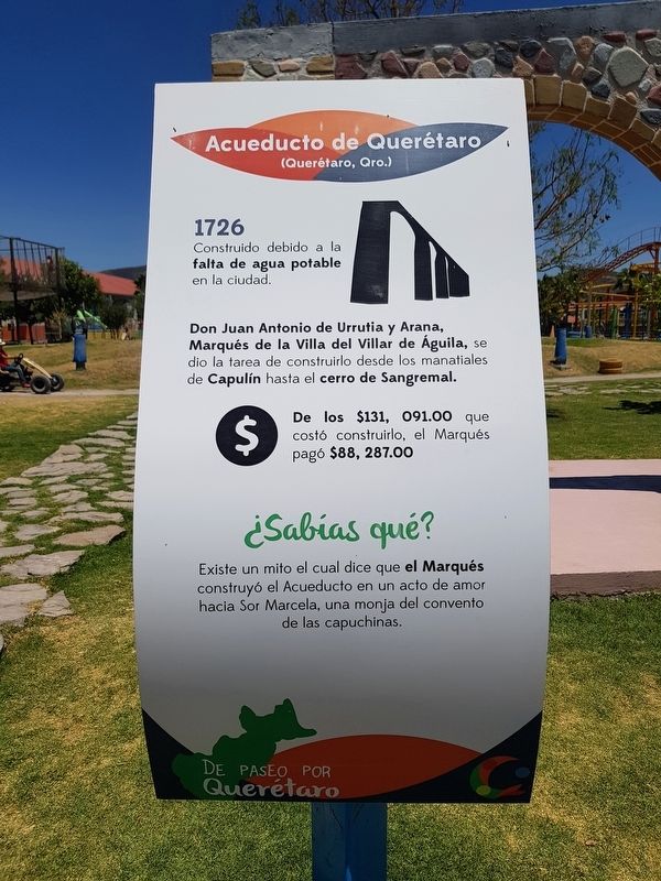
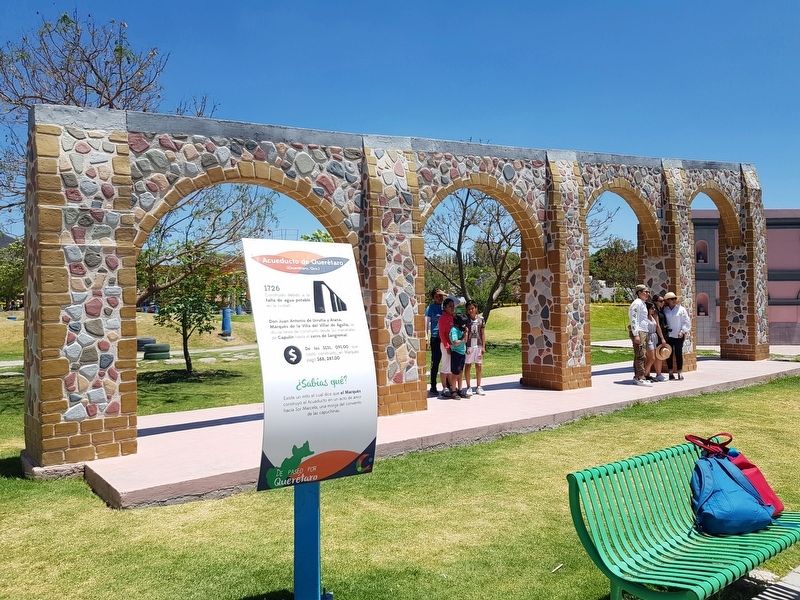
Aqueduct of Querétaro
De Paseo por Querétaro
(Querétaro, Qro.)
1726 ∙ Construido debido a la falta de agua potable en la ciudad.
Don Juan Antonio de Urrutia y Arana, Marqués de la Villa del Villar de Águila, se dio la tarea de construirlo desde los manatiales de Capulín hasta el cerro de Sangremal. De los $131,091.00 que costó construirlo, el Marqués pagó $88,287.00
¿Sabías qué? ∙ Existe un mito el cual dice que el Marqués construyó el Acueducto en un acto de amor hacia Sor Marcela, una monja del convento de las capuchinas.
Aqueduct of Querétaro
(Querétaro, Querétaro)
1726 ∙ Built due to the lack of drinking water in the city. Juan Antonio de Urrutia and Arana, Marquis of the Villa del Villar de Águila, was given the task of building it from the springs of El Capulín to the Sangremal Hill. Of the $131,091.00 that it cost to build it, the Marquis paid $88,287.00 himself.
Did you know? ∙ There is a myth that says that the Marquis built the aqueduct as an act of love towards Sister Marcela, a nun at the Convent of the Capuchins.
Topics. This historical marker is listed in these topic lists: Charity & Public Work • Colonial Era • Man-Made Features. A significant day of the year for for this entry is March 21.
Location. 20° 43.983′ N, 100° 27.058′ W. Marker is near Santa Rosa Jáuregui, Querétaro. Marker can be reached from Calle Melchor Ocampo just west of Independencia, on the left when traveling west. The marker is part of a series of markers near replicas of historic landmarks of Querétaro. The marker is along the northern shore of the large man-made lake at Parque Bicentenario. Touch for map. Marker is in this post office area: Santa Rosa Jáuregui QUE 76220, Mexico. Touch for directions.
Other nearby markers. At least 8 other markers are within walking distance of this marker. House of the Corregidora (a few steps from this marker); A Group of Revolutionaries (a few steps from this marker); Teatro de la República (a few steps from this marker); Temple of the Santa Cruz (about 90 meters away, measured in a direct line); Santa Rosa de Viterbo (about 90 meters away); The Mission at Tilaco (about 120 meters away); The Mission at Concá (about 150 meters away); Peña de Bernal (about 150 meters away). Touch for a list and map of all markers in Santa Rosa Jáuregui.
Credits. This page was last revised on October 9, 2020. It was originally submitted on June 28, 2019, by J. Makali Bruton of Accra, Ghana. This page has been viewed 118 times since then and 12 times this year. Photos: 1, 2. submitted on June 28, 2019, by J. Makali Bruton of Accra, Ghana.

