Rathvilly
Carlow Towns and Villages
— Ireland's Ancient East —
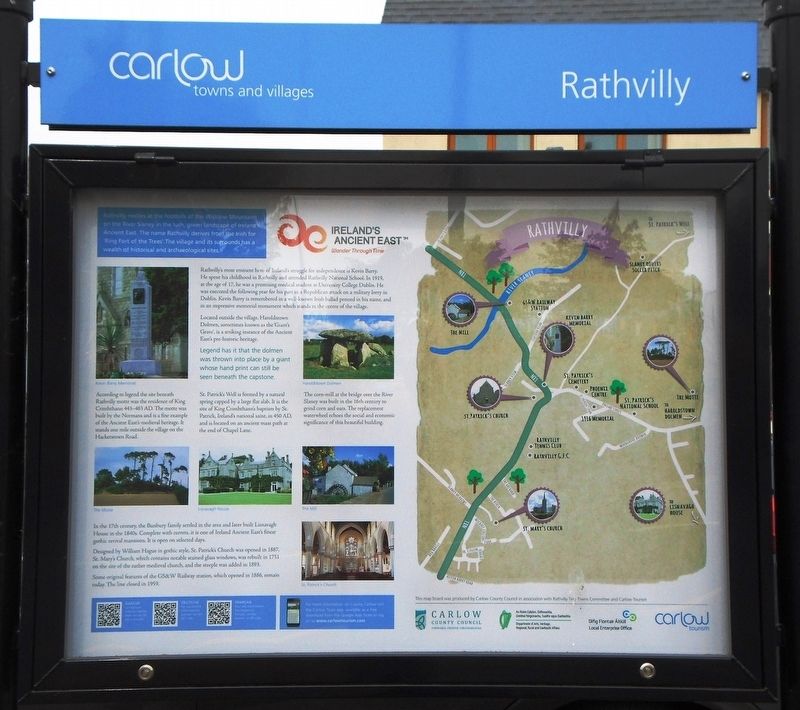
Rathvilly nestles at the foothills of the Wicklow Mountains on the River Staney in the lush, green landscape of Ireland's Ancient East. The name Rathvilly derives from the Irish for 'Ring Fort of the Trees'. The village and its surrounds has a wealth of historical and archaeological sites.
According to legend the site beneath Rathvilly motte was the residence of King Crimhthann 443-483 AD. The motte was built by the Normans and is a fine example of the Ancient East's medieval heritage. It stands one mile outside the village on the Hacketstown Road.
In the 17th century, the Bunbury family settled in the area and later built Lisnavagh House in the 1840s. Complete with turrets, it is one of Ireland Ancient East's finest gothic revival mansions. It is open on selected days.
St. Patrick's Well is formed by a natural spring capped by a large flat slab. It is the site of King Crimhthann's baptism by St. Patrick, Ireland's national saint, in 450 AD, and is located on an ancient mass path at the end of Chapel Lane.
Designed by William Hague in gothic style, St. Patrick's Church was opened in 1887. St. Mary's Church, which contains notable stained glass windows, was rebuilt in 1751 on the site of the earlier medieval church, and the steeple was added in 1893.
Some original features of the GS&W Railway station, which opened
in 1886, remain today. The line closed in 1959.Rathvilly's most eminent hero of Ireland's struggle for independence is Kevin Barry. He spent his childhood in Rathvilly and attended Rathvilly National School. In 1919, at the age of 17, he was a promising medical student at University College Dublin. He was executed the following year for his part in a Republican attack on a military lorry in Dublin. Kevin Barry is remembered in a well-known Irish ballad penned in his name, and in an impressive memorial monument which stands in the centre of the village.
Located outside of the village, Haroldstown Dolmen, sometimes known as the 'Giant's Grave', is a striking instance of the Ancient East's pre-historic heritage.
Legend has it that the dolmen was thrown into place by a giant whose hand print can still be seen beneath the capstone.
The corn-mill at the bridge over the River Slaney was built in the 16th century to grind corn and oats. The replacement waterwheel echoes the social and economic significance of this beautiful building.
Erected by Carlow County Council; Carlow Tourism; Dept of Arts, Heritage, Regional, Rural and Gaeltacht Affairs; and Local Enterprise Office.
Topics. This historical marker is listed in this topic list: Notable Places. A significant historical year for this entry is 1887.
Location. 52° 52.865′
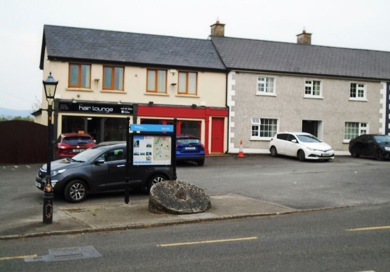
Other nearby markers. At least 8 other markers are within 13 kilometers of this marker, measured as the crow flies. Doyle Family Shoeing Stone (here, next to this marker); The Rathvilly Rose (a few steps from this marker); Kevin Gerard Barry (within shouting distance of this marker); Jennie Wyse Power (approx. 6.7 kilometers away); Michael Dwyer, Sam MacAllister, and the Insurrectionists (approx. 6.7 kilometers away); Private Michael McGuinn (approx. 6.7 kilometers away); Mainistir Bhealach Conglais / Baltinglass Abbey (approx. 7 kilometers away); Ciorcal Cloch le Claífort Chaisleán an Ridire (approx. 12.9 kilometers away). Touch for a list and map of all markers in Rathvilly.
Also see . . .
1. Rathvilly. Carlow Tourism (Submitted on January 25, 2021, by Larry Gertner of New York, New York.)
2. Rathvilly, Ireland. Wikipedia entry (Submitted on July 4, 2019, by William Fischer, Jr. of Scranton, Pennsylvania.)
Credits. This page was last revised on January 25, 2021. It was originally submitted on July 4, 2019, by William Fischer, Jr. of Scranton, Pennsylvania. This page has been viewed 344 times since then and 43 times this year. Photos: 1, 2. submitted on July 4, 2019, by William Fischer, Jr. of Scranton, Pennsylvania.

