Near Plymouth in Wayne County, Michigan — The American Midwest (Great Lakes)
Roadside Development
and the Haggerty Comfort Station
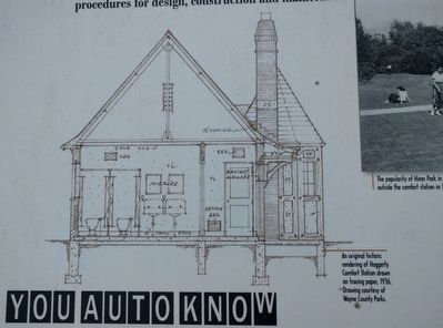
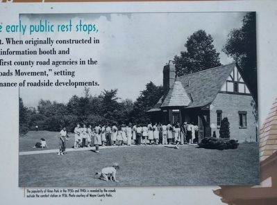
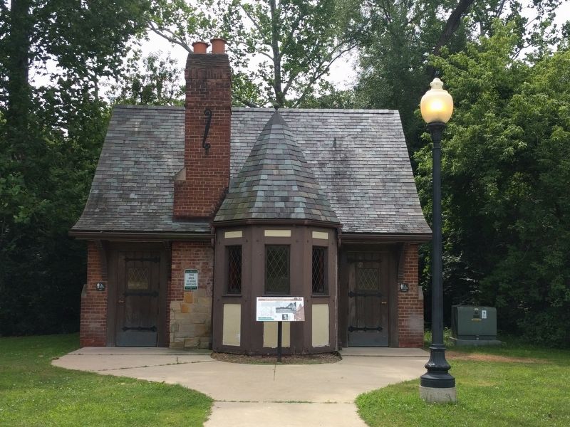
This comfort station was one of the early public rest stops,
and it was a prototype for roadside development. When originally constructed in 1937, this station had a full-time attendant, an information booth and concession stand. Wayne County was one of the first county road agencies in the United States to officially promote the "Good Roads Movement," setting procedures for design, construction and maintenance of roadside developments.
You Auto Know
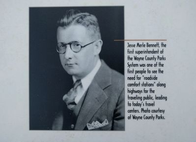
Jesse Merle Bennett established twenty-three roadside comfort stations in Wayne County Parks, and many others along state highways.
Erected by MotorCities National Heritage Area, National Park Service.
Topics and series. This historical marker is listed in this topic list: Roads & Vehicles. In addition, it is included in the MotorCities National Heritage Area series list. A significant historical year for this entry is 1937.
Location. 42° 22.162′ N, 83° 26.918′ W. Marker is near Plymouth, Michigan, in Wayne County. Marker is on Edward Hines Drive west of Haggerty Road, on the right when traveling east. Marker is in the Haggerty West unit of Hines Park. Touch for map. Marker is in this post office area: Plymouth MI 48170, United States of America. Touch for directions.
Other nearby markers. At least 8 other markers are within walking distance of this marker. Plymouth Township / Charter Township Of Plymouth (approx. 0.6 miles away); Gunsolly Carding Mill (approx. 0.7 miles away); Charles G. Curtiss House (approx. 0.9 miles away); Plymouth Railroads (approx. 0.9 miles away); Chessie Caboose 904151 (approx. 0.9 miles away); Fire Tower Bell (approx. 0.9 miles away); The Plymouth Plank Road (approx. one mile away); Plymouth Community Veterans Memorial Park (approx. one mile away). Touch for a list and map of all markers in Plymouth.
Also see . . .
1. Good Roads Movement. Wikipedia article (Submitted on July 19, 2019, by Joel Seewald of Madison Heights, Michigan.)
2. Roadsides: The Front Yard of the Nation. 1936 book by Jesse Merle Bennett in the Internet Archive. (Submitted on July 19, 2019, by Joel Seewald of Madison Heights, Michigan.)
3. Taking Comfort in Wayne County's Hines Park. Article from A Detroit Architect's Journal about comfort stations in Hines Park, a 15-mile long park that follows the Rouge River from Northville to Dearborn Heights. (Submitted on July 19, 2019, by Joel Seewald of Madison Heights, Michigan.)
Credits. This page was last revised on July 19, 2019. It was originally submitted on July 19, 2019, by Joel Seewald of Madison Heights, Michigan. This page has been viewed 229 times since then and 13 times this year. Photos: 1, 2, 3, 4, 5, 6. submitted on July 19, 2019, by Joel Seewald of Madison Heights, Michigan.


