Fort Recovery in Mercer County, Ohio — The American Midwest (Great Lakes)
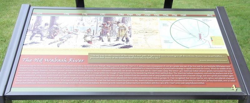
The Old Wabash River
"On my way to the center of the camp, I met pale, frightened men running in all directions. Numerous dead bodies …, proved that many of the Indians had been there before me."
--Kentucky Militiaman Robert Branshaw
You are facing the old Wabash River channel which played a key role in the Battle of the Wabash. Major General Arthur St. Clair's U.S. military main encampment of over 900 people was east of the river and the 300 Kentucky Militiamen were camped across the river to the west. Northwest of the Kentucky Militia, the American Indian alliance deliberately and silently assembled in a crescent formation, a proven battle strategy to rapidly surround the enemy. When the middle of the crescent (700 Miami, Shawnee, Delaware troops) attacked the Kentucky Militia, the 300 militiamen chaotically ran across the river back into St. Clair's main camp. The entire 1,400 American Indian alliance quickly surrounded the main encampment, using the landscape to their advantage, effectively pinning the U.S. troops within the triangle of land formed by the meandering Wabash River and Buck Run. The American Indians completely overtook the southern end of the main encampment, using trees, underbrush and firearm smoke as cover, and quickly moved into the center of camp. Soldiers from the northern end of camp pushed back the warriors with a bayonet charge, and were quickly surrounded again by the American Indian alliance. With almost all officers targeted and killed by the warriors, many soldiers abandoned their positions and formed random groups. St. Clair recognized that retreat was the only option and ordered a bayonet charge east through the American Indian lines. What was left of the army fled down the road that had been created the previous day. American Indian warriors pursued the remnants of the army for a few miles, as they fled south, over 20 miles back to Fort Jefferson. The battle was an overwhelming victory for the American Indians. Between 30 to 80 American Indian warriors were killed, with 800-900 of St. Clair's army and camp followers killed.
Erected by National Park Service American Battlefield Protection Program and the State of Ohio. (Marker Number 4.)
Topics. This historical marker is listed in these topic lists: Anthropology & Archaeology • Native Americans • Wars, US Indian • Waterways & Vessels.
Location. 40° 24.841′ N, 84° 46.864′ W. Marker is in Fort Recovery, Ohio, in Mercer County. Marker is on Fort Site Street south of West Boundary Street, on the right when traveling south. This
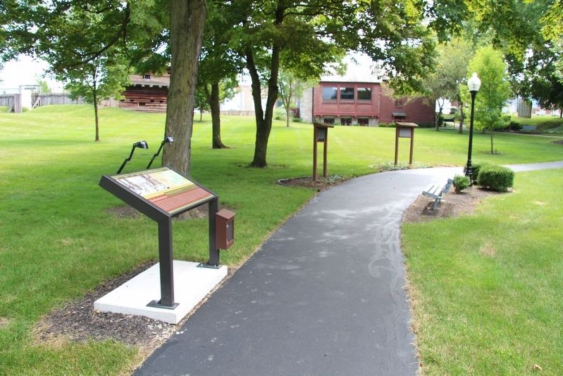
marker is located along the "Fort Recovery Battlefield Walking Tour." More specifically, it is situated along the walking path that is found behind the Fort Recovery Museum, in the park that is part of the state historic site. Touch for map. Marker is at or near this postal address: 1 Fort Site Street, Fort Recovery OH 45846, United States of America. Touch for directions.
Other nearby markers. At least 8 other markers are within walking distance of this marker. On This Triangle of Land (here, next to this marker); The Wabash (Ouabache) River (here, next to this marker); Native Cultures (here, next to this marker); The Battle of Fort Recovery (a few steps from this marker); On Christmas Day 1793 (a few steps from this marker); Battle of the Wabash (a few steps from this marker); The Greeneville Treaty Boundary Line (within shouting distance of this marker); Prologue to 1791 (within shouting distance of this marker). Touch for a list and map of all markers in Fort Recovery.
Credits. This page was last revised on January 28, 2021. It was originally submitted on August 2, 2019, by Dale K. Benington of Toledo, Ohio. This page has been viewed 172 times since then and 16 times this year. Photos: 1, 2. submitted on August 2, 2019, by Dale K. Benington of Toledo, Ohio.

