Near Millerton in Dutchess County, New York — The American Northeast (Mid-Atlantic)
Iron Mine Pond
Taconic State Park
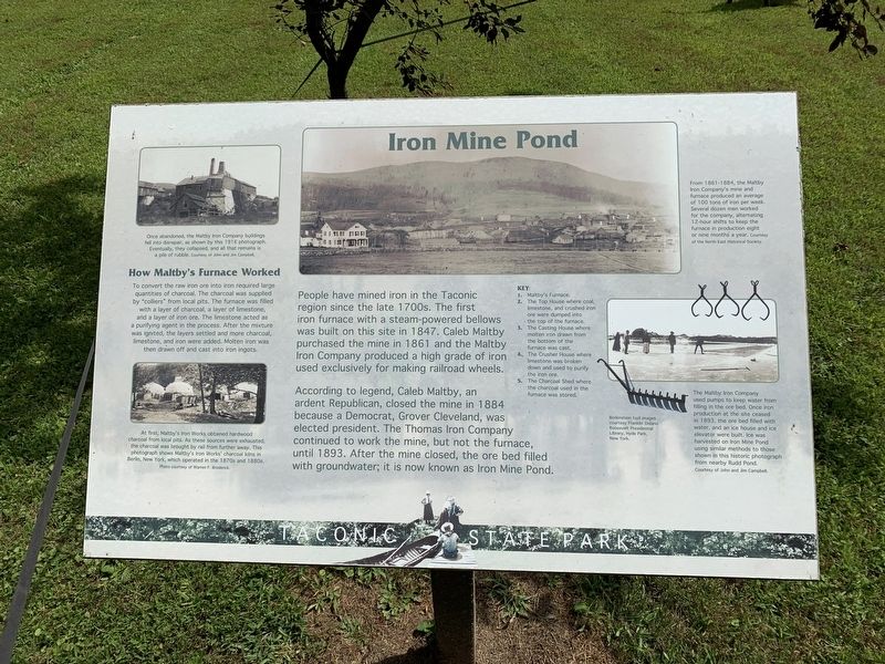
According to legend, Caleb Maltby, an ardent Republican, closed the mine in 1884 because a Democrat, Grover Cleveland, was elected president. The Thomas Iron Company continued to work the mine , but not the furnace, until 1893. After the mine closed, the ore bed filled with groundwater; it is now known as Iron Mine Pond.
How Maltby’s Mine Worked To convert the raw ore into iron required large quantities of charcoal. The charcoal was supplied by “colliers” from local pits. The furnace was filled with a layer of charcoal, a layer of limestone, and a layer of iron ore. The limestone acted as a purifying agent in the process. After the mixture was ignited, the layers settled and more charcoal limestone, and iron were added. Molten iron was then drawn off and cast into iron ingots.
Photo Captions:
Top left: Once abandoned, the Maltby Iron Company buildings fell into disrepair, as shown by the 1916 photograph. Eventually, they collapsed, and all that remains is a pile of rubble.
Bottom left: At first, Maltby’s Iron Works obtained hardwood charcoal from local pits. As these sources were exhausted, the charcoal was brought in by rail from further away. This photograph shows Maltby’s Iron Works charcoal kilns in Berlin, New York, which operated in the 1870s and 1880s.
Bottom right: The Maltby Iron Company used pumps to keep water from filling in the ore bed. Once iron production ceased in 1893, the ore bed filled with water, and an ice house and ice elevator were built. Ice was harvested on Iron Mine Pond using similar methods to those shown in this historic photograph from nearby Rudd Pond.
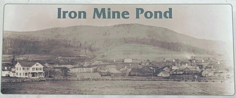
Iron Mine Pond Photo:
From 1861-1884, the Maltby Iron Company’s mine and furnace produced an average of 100 tons of iron per week. Several dozen men worked for the company, alternating 12-hour shifts to keep the furnace in producton eight or nine months a year.
Key:
1. Maltby’s Furnace
2. The Top House where coal. Limestone, and crushed iron ore were dumped into the top of the furnace.
3. The Casting House were molten iron drawn from the bottom of the furnace was cast.
4. The Crusher House were limestone was broken down and used to purify the iron ore.
5. The Charcoal Shed where the charcoal used in the furnace was stored.
Topics and series. This historical marker is listed in these topic lists: Industry & Commerce • Man-Made Features. In addition, it is included in the Former U.S. Presidents: #22 and #24 Grover Cleveland series list. A significant historical year for this entry is 1847.
Location. 41° 58.712′ N, 73° 30.219′ W. Marker is near Millerton, New York, in Dutchess County. Marker is on Rudd Pond Drive when traveling south. Marker is in Taconic State Park/Rudd Pond at the end of the road just before camping section. Touch for map. Marker is in this post office area: Millerton NY 12546, United States of America. Touch for directions.
Other nearby markers. At least 8 other markers are within 4 miles of this marker, measured as the crow flies. Rudd Pond (approx. 0.4 miles away); Spencer's Corners (approx. 1.1 miles away); Irondale School (approx. 1.1 miles away); a different marker also named Irondale School (approx. 1.1 miles away); Town of North East War Memorial (approx. 1.7 miles away); Irondale Cemetery (approx. 1.8 miles away); Pine Plains Northeast Line (approx. 2.8 miles away); North East Center Burying Ground (approx. 3.7 miles away). Touch for a list and map of all markers in Millerton.
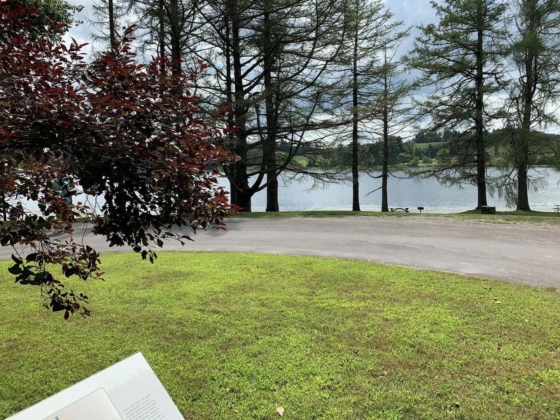
Regarding Iron Mine Pond. I am not exactly sure where Iron Mine Pond is. It isn't visible from the marker nor is it labeled on any maps (including the Spencer's Corners topo quadrant)
Credits. This page was last revised on August 20, 2019. It was originally submitted on August 20, 2019, by Steve Stoessel of Niskayuna, New York. This page has been viewed 946 times since then and 148 times this year. Photos: 1, 2, 3. submitted on August 20, 2019, by Steve Stoessel of Niskayuna, New York. • Bill Pfingsten was the editor who published this page.


