Westminster in Carroll County, Maryland — The American Northeast (Mid-Atlantic)
Divided Loyalties
A U.S. Flag Goes South
Inscription.
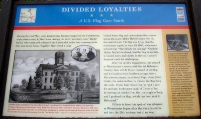
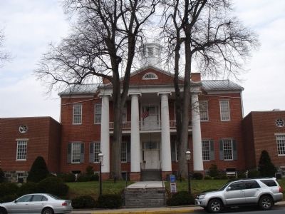
During the Civil War, some Westminster families supported the Confederacy while others stood by the Union. Among the latter was Mary Ann “Mollie” Huber, who organized a dozen other like minded ladies into a sewing circle that met at her house. Together, they sewed a large United States flag and embroidered their names across the stars (Mollie Huber’s name was on the central star). The flag was flying atop the courthouse cupola on June 29, 1863, when news arrived that “The Rebels are coming!” Abraham Huber, Mollie’s husband, had the flag immediately hauled down and hidden in the courthouse’s fireproof vault for safekeeping.
After the cavalry engagement that ensued in Westminster’s streets with the 1st Delaware Cavalry, Gen. J.E.B. Stuart learned of the flag and its location from Southern sympathizers. His interest piqued, he ordered Capt. John Esten Cooke, the noted author, to remove the flag from the vault. Cooke later wrote that he “got a candle and axe, broke open vault of Clerks office by hewing out bricks from the iron staple of lock, and I grabbed the flag…which has been sent to Richmond.”
Efforts to have this spoil of war returned to Westminster began after the war and continued into the 20th century, but to no avail.
(Sidebar): Among the shattered equipment from the Gettysburg battlefield that lined the street in front of you was a cannon that became famous as the “Gettysburg Gun.” On July 3rd, this piece from Battery B, 1st Regiment, Rhode Island Volunteer Light Artillery – stationed on Cemetery Ridge – sustained damage when a Confederate shell lodged in its barrel. Westminster residents vividly recalled seeing the gun on Court St. among the many that passed through Westminster on their way to repair shops. The Gettysburg Gun – with the shell still lodged in its barrel – is now at the Rhode Island statehouse.
Erected by Maryland Civil War Trails.
Topics and series. This historical marker is listed in this topic list: War, US Civil. In addition, it is included in the Maryland Civil War Trails series list. A significant historical date for this entry is June 29, 1863.
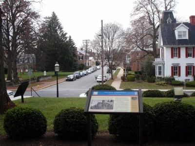
Location. 39° 34.262′ N, 76° 59.339′ W. Marker is in Westminster, Maryland, in Carroll County. Marker can be reached from North Court Street. Marker in on the grounds of the Old Carroll County Courthouse. Touch for map. Marker is in this post office area: Westminster MD 21157, United States of America. Touch for directions.
Other nearby markers. At least 8 other markers are within walking distance of this marker. Army of the Potomac (here, next to this marker); a different marker also named Army of the Potomac (a few steps from this marker); Aftermath of Battle (a few steps from this marker); A Final Tribute
(within shouting distance of this marker); Carroll County Vietnam Veterans Memorial (within shouting distance of this marker); Memorial Gateway (about 500 feet away, measured in a direct line); Corbit's Charge (about 600 feet away); Votes for Women (about 600 feet away). Touch for a list and map of all markers in Westminster.
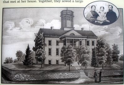
More about this marker. On the left side of the marker is a sketch and an inset photo captioned Carroll County Courthouse. The Greek Revival-style courthouse was designed about 1837 by Col. James M. Shellman, Westminster's first mayor. Inset: Mollie and Abraham Huber with their daughter, Margaret, 1865. Abraham Huber, Clerk of the Court for Carroll County, attempted to protect the Courthouse flag sewn by his wife, Mollie, and other local women, by securing it in the Courthouse vault.
On the upper right of the sidebar is a photo of the Gettysburg Gun referred to in the sidebar.
Credits. This page was last revised on July 9, 2022. It was originally submitted on November 25, 2008. This page has been viewed 1,644 times since then and 17 times this year. Last updated on July 8, 2022. Photos: 1, 2, 3, 4. submitted on November 25, 2008. • Bernard Fisher was the editor who published this page.


