Vischer Ferry in Saratoga County, New York — The American Northeast (Mid-Atlantic)
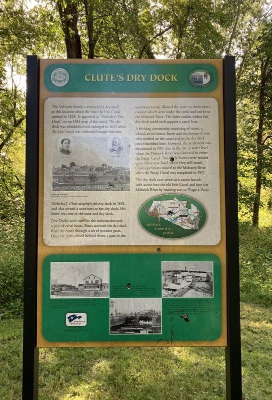
Clute’s Dry Dock
Nicholas J. Clute acquired the dry dock in 1852, and also owned a store next to the dry dock. His home was east of the store and dry dock.
Dry Docks were used for the construction and repair of canal boats. Boats accessed the dry dock from the canal through A set of wooden gates. Once the gates closed behind them, a gate in the southwest corner allowed the water to drain into a conduit which went under the canal and out in to the Mohawk River. The three cradles within the dry dock could each support a canal boat.
A thriving community consisting of stores, a school, an ice house, barns and the homes of men who worked on the canal and in the dry dock once flourished here. However, the settlement was abandoned in 1907 due to the rise in water level when the Mohawk River was dammed to create the Barge Canal. Two the homes were moved up to Riverview Road where they still stand. Canal operations moved to the Mohawk River when the Barge Canal was completed in 1917.
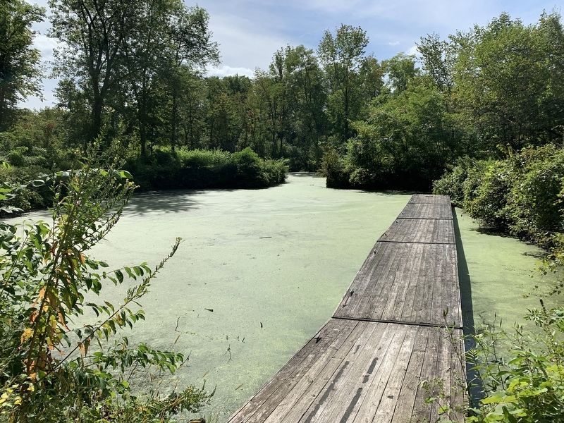
The dry dock now serves as a canoe launch with access into the old Erie Canal and into the Mohawk River by heading east to Wagar's Pond.
Erected by America’s Byways.
Topics and series. This historical marker is listed in these topic lists: Settlements & Settlers • Waterways & Vessels. In addition, it is included in the Erie Canal series list. A significant historical year for this entry is 1834.
Location. 42° 47.676′ N, 73° 46.599′ W. Marker is in Vischer Ferry, New York, in Saratoga County. Marker is at the intersection of Riverview Road, on the right when traveling east on Riverview Road. Touch for map. Marker is in this post office area: Rexford NY 12148, United States of America. Touch for directions.
Other nearby markers. At least 8 other markers are within one mile of this marker, measured as the crow flies. A different marker also named Clutes Dry Dock (about 300 feet away, measured in a direct line); Van Den Bergh (approx. 0.4 miles away); Vandenburgh Dunsbach Ferry (approx. 0.8 miles away); Fort's Ferry (approx. 0.9 miles away); Cast Iron Whipple Truss Bridge, 1869 (approx. one mile away); Vischer Ferry Nature and Historic Preserve (approx. one mile away); Whipple Iron Truss Bridge (approx. one mile away); Erie Canal (approx. one mile away). Touch for a list and map of all markers in Vischer Ferry.
Credits. This page was last revised on September 9, 2019. It was originally submitted on September 5, 2019, by Steve Stoessel of Niskayuna, New York. This page has been viewed 242 times since then and 22 times this year. Photos: 1, 2, 3. submitted on September 5, 2019, by Steve Stoessel of Niskayuna, New York. • Andrew Ruppenstein was the editor who published this page.


