Modern Automotive District
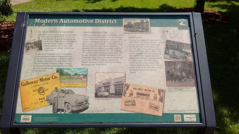
Automobile travel swept Bowling Green and the rest of the nation during the 1920s. Drivers enjoyed the freedom of traveling by car on the Dixie highway from Michigan to Florida. People stopped in Bowling Green along the way to shop, visit relatives, go to college, or tour Lost River Cave.
As auto travel continued to grow, businesses constructed specialized buildings to hold cars, trucks and farm equipment. In Bowling Green, the Modern Automotive District, listed on the National Register of historic Places, includes three automotive structures from the late 1940s that were located on the Dixie Highway.
Automobiles Come of Age
Galloway Motors is the yellow tile building with a long stretch of curved windows that was designed to show off the latest and fanciest new cars. Across the street, the same family sold farm equipment in the two story structure. Both buildings have highly reflective, glazed ceramic tile that caught the attention of drivers both day and night. Architect James Ingram designed both Galloway buildings. The concrete block structure across the street with an entry sheathed in enameled steel panels is the Hardcastle Filling Station, designed to sell gas and service cars. All three buildings represent the Modern Automotive District that commemorates auto
Circus Square
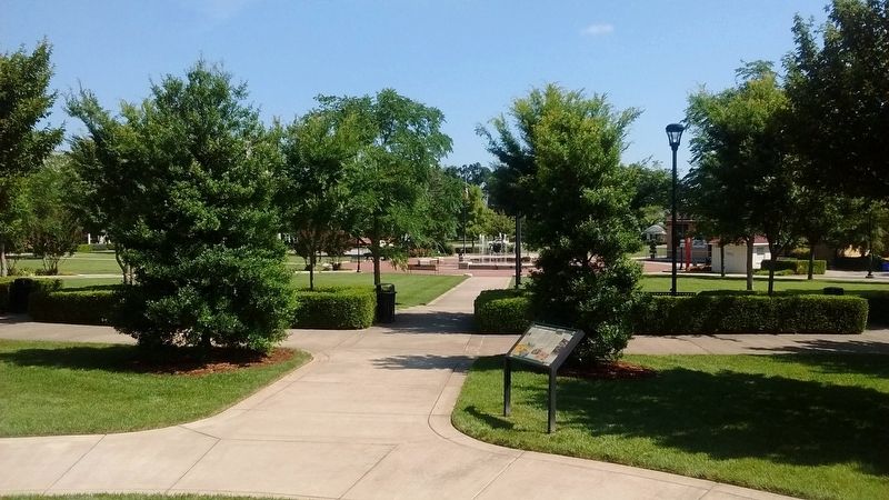
Bowling Green decided to rejuvenate this area in 2002. The creation of Circus Square
was part of a larger project that brought new business and entertainment to the city. The name “Circus Square” is based upon an 1877 map. When a circus came to town long ago, it was an exciting and memorable event; crowds watched as animals and performers paraded around Fountain Square. That same energy infects this area today, as bands play, children use the fountain to cool off and people picnic on the lawn, all in view of the Modern Automotive Historic District.
Topics. This historical marker is listed in these topic lists: Architecture • Industry & Commerce • Roads & Vehicles. A significant historical year for this entry is 2002.
Location. 36° 59.688′ N, 86° 26.281′ W. Marker is in Bowling Green, Kentucky, in Warren County. Marker is at the intersection of East 7th Street and State Street, on the right when traveling north on East 7th Street. Marker is located in Circus Square Park. Touch for map. Marker is in this post office area: Bowling Green KY 42101, United States of America. Touch for directions.
Other nearby markers. At least 8 other markers are within walking distance of this marker. Lower College Street (about 300 feet away, measured in a direct line); Standard Filling Station No. 1 (about 300 feet away); Cecelia Memorial Presbyterian Church (about 500 feet away); An African American Neighborhood (about 500 feet away); Residential Architecture (about 500 feet away); College Street Commercial Development (about 500 feet away); Presbyterian Church (about 700 feet away); 422 1/2 Main Street (approx. 0.2 miles away). Touch for a list and map of all markers in Bowling Green.
Credits. This page was last revised on September 11, 2019. It was originally submitted on September 11, 2019, by Tom Bosse of Jefferson City, Tennessee. This page has been viewed 174 times since then and 31 times this year. Photos: 1, 2. submitted on September 11, 2019, by Tom Bosse of Jefferson City, Tennessee. • Andrew Ruppenstein was the editor who published this page.

