Waterfront in Buffalo in Erie County, New York — The American Northeast (Mid-Atlantic)
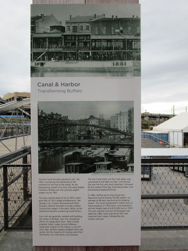
Canal and Harbor
Transforming Buffalo
Canal and Harbor
Transforming Buffalo
The Erie Canal formally opened on Oct. 26, 1825, connecting the heartlands of the continent to the rest of the world. As the engineering marvel of its time, the canal helped transform Buffalo into the country’s eighth largest city by 1901.
The story reaches back as far as 1814, when post-War of 1812 village entrepreneurs, like George Coit, Charles Townsend and Oliver Forward, had the foresight to build a harbor. Construction began in the early 1820s, as the waterfront became a booming Canal District.
Four men are generally credited with building the harbor at Buffalo, over the competitive efforts of nearby Black Rock. After a hired engineer failed, Judge Wilkeson supervised creation of the harbor in just 221 work days. Buffalo villagers pledged work and goods, but the majority of the funding came from merchants Coit, Townsend, and Forward.
The Erie Canal itself, just four feet deep, was connected to the lakes via slips. Commercial Slip was the first and most important, followed by the nearby Prime Slip, financed by New York Businessman Nathaniel Prime.
In 1862, Buffalo set its ship arrival and departures record hosting 16,390 vessels – an average of 68 each day during the shipping season. The canal transported 2 million tons of forest products in 1870 alone, and reached an all-time freight high of 6,670,000 tons in 1872. The port was the country’s third-largest coal depot by 1885. Grain was by far the most important port cargo, followed by ore, lumber and coal.
Topics and series. This historical marker is listed in this topic list: Waterways & Vessels. In addition, it is included in the Erie Canal series list. A significant historical year for this entry is 1825.
Location. 42° 52.674′ N, 78° 52.664′ W. Marker is in Buffalo, New York, in Erie County. It is in Waterfront. Marker can be reached from Marine Drive, 0.1 miles north of Lloyd Street, on the right when traveling west. Touch for map. Marker is in this post office area: Buffalo NY 14202, United States of America. Touch for directions.
Other nearby markers. At least 8 other markers are within walking distance of this marker. America's Crossroads: The Spaulding Exchange (within shouting distance of this marker); Shark Girl (within shouting distance of this marker); Miles Gilbert "Tim" Horton (within shouting distance of this marker); The Immigrant Steps (within shouting distance of this marker); Buffalo's Birthplace (within shouting distance of this marker); Buffalo - A Network of Canals (about 300 feet away, measured in a direct line); Buffalo - An Industrial Powerhouse (about 300 feet away); Buffalo Riverfront Historical Eras to 1930 (about 300 feet away). Touch for a list and map of all markers in Buffalo.
Credits. This page was last revised on February 16, 2023. It was originally submitted on October 8, 2019, by Anton Schwarzmueller of Wilson, New York. This page has been viewed 197 times since then and 16 times this year. Photos: 1, 2. submitted on October 8, 2019, by Anton Schwarzmueller of Wilson, New York.

