Near Syringa in Idaho County, Idaho — The American West (Mountains)
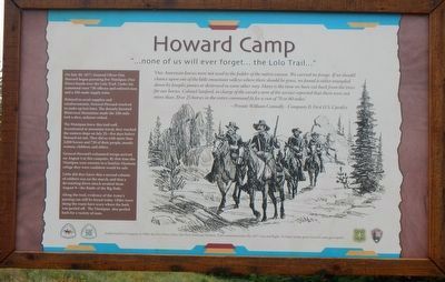
Howard Camp
"...none of us will ever forget... the Lolo Trail..."
(side bar on left)
On July 30, 1877, General Oliver Otis Howard began pursuing five Nímíípuu (Nez Perce) bands over the Lolo Trail. Under his command were 730 officers and enlisted men and a 350-mule supply train.
Delayed to await supplies and reinforcements, General Howard resolved to make up lost time. The densely forested Bitterroot Mountains made the 100-mile trek a slow, arduous ordeal.
The Nímíípuu knew this trail well. Accustomed to mountain travel, they reached the eastern slope on July 25 - five days before Howard set out. They did so with more than 2,000 horses and 750 of their people, mostly women, children, and elders.
General Howard's exhausted troops arrived on August 4 at this campsite. By that time the Nímíípuu were enroute to a familiar Montana refuge they were confident would be safe.
Little did they know that a second column of soldiers was on the march, and that a devastating dawn attack awaited them August 9 - the Battle of the Big Hole.
Along the trail, evidence of the Army's passing can still be found today. Older trees along the route have scars where the bark was peeled off. The Nímíípuu also peeled back for a variety of uses.
Authorized by Congress in 1986, the Nez Perce (Nee-Me-Poo) National Historic Trail commemorates the 1877 war and flight. To learn more, go to www.fs.usda.gov/npnht.
Erected by Forest Service, U.S. Department of Agriculture; National Park Service, U.S. Department of the Interior.
Topics and series. This historical marker is listed in these topic lists: Native Americans • Wars, US Indian. In addition, it is included in the The Nez Perce Trail series list. A significant historical date for this entry is July 30, 1877.
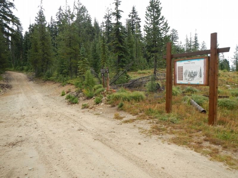
Location. 46° 31.817′ N, 115° 3.956′ W. Marker is near Syringa, Idaho, in Idaho County. Marker is on Lolo Motorway (Forest Road 500) near Horseshoe Lake Lookout Road, on the left when traveling south. Touch for map. Marker is in this post office area: Kooskia ID 83539, United States of America. Touch for directions.
Other nearby markers. At least 7 other markers are within 10 miles of this marker, measured as the crow flies. Nímíípuu and Selish (approx. 2.1 miles away); Indian Post Office (approx. 3.9 miles away); Smoking Place (approx. 5˝ miles away); My Name is K'useynisskit (approx. 5.6 miles away); Nimiipuum Wetes (approx. 5.6 miles away); Welcome to Colgate Licks (approx. 7˝ miles away); Green Swoard Camp (approx. 10 miles away).
More about this marker. The term motorway as applied to the Lolo Motorway should be understood as it was originally defined and not the expressway with think of today. The Lolo Motorway was built by the CCC in the 1930s over practically impassable terrain (for automobiles). In places the road is extremely rocky, steep and narrow with shear drop-offs. In short, the Lolo Motorway should only be driven by high clearance, 4WD vehicles and the like.
Credits. This page was last revised on June 15, 2020. It was originally submitted on October 9, 2019, by Barry Swackhamer of Brentwood, California. This page has been viewed 354 times since then and 37 times this year. Photos: 1, 2. submitted on October 9, 2019, by Barry Swackhamer of Brentwood, California.

