Portage des Sioux in St. Charles County, Missouri — The American Midwest (Upper Plains)
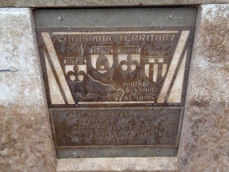
Louisiana Territory
1673 • 1763 • 1800 • 1803
— Portage des Sioux - St. Louis —
Ceded to Spain 1763
Ceded to Napoleon 1800
Sold to President Jefferson
1803
Topics and series. This historical marker is listed in these topic lists: Colonial Era • Political Subdivisions • Settlements & Settlers. In addition, it is included in the Former U.S. Presidents: #03 Thomas Jefferson series list. A significant historical year for this entry is 1673.
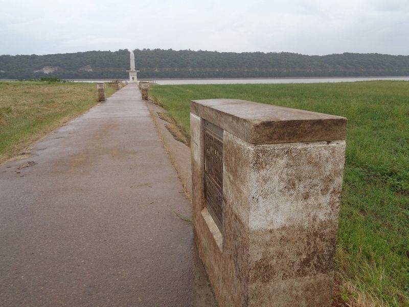
Location. 38° 55.788′ N, 90° 20.348′ W. Marker is in Portage des Sioux, Missouri, in St. Charles County. Marker is on River View Drive just north of Le Sieur Street, on the right when traveling north. Marker is located on a walkway towards the Our Lady of the Rivers Shrine statue. It is the first marker on the right. Touch for map. Marker is at or near this postal address: 1565 River View Drive, Portage des Sioux MO 63373, United States of America. Touch for directions.
Other nearby markers. At least 8 other markers are within walking distance of this marker. Pere Marquette & Joliet 1673 (here, next to this marker); Forts and Blockhouses (within shouting distance of this marker); Lewis & Clark 1804 (within shouting distance of this marker); Portage des Sioux 1798 (within shouting distance of this marker); 1815 Treaty (about 300 feet away, measured in a direct line); St Rose Philippine Duchesne (about 300 feet away); St. Francis of Assisi Church (about 300 feet away); Our Lady of the Rivers (about 500 feet away). Touch for a list and map of all markers in Portage des Sioux.
More about this marker. This is one of eight markers on the Our Lady of the Rivers Shrine walkway, which mostly cover Lewis & Clark and St. Charles County history.
Credits. This page was last revised on October 14, 2022. It was originally submitted on October 12, 2019, by Jason Voigt of Glen Carbon, Illinois. This page has been viewed 184 times since then and 24 times this year. Photos: 1, 2. submitted on October 12, 2019, by Jason Voigt of Glen Carbon, Illinois. • Devry Becker Jones was the editor who published this page.

